Situation Summary
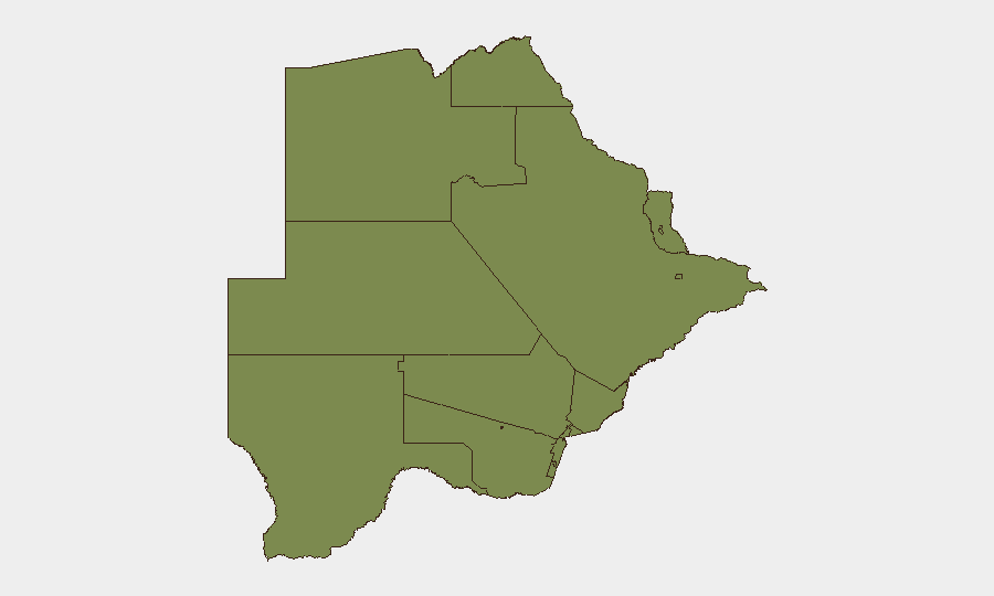
Botswana remains a stable, low-threat environment with a composite national risk score of 4 and no confirmed acute security incidents in the past 24–48 hours. Sub-national risk concentration is heavily skewed toward South-East District (score 31.3), while all other regions score uniformly at 1.3, indicating localized rather than systemic instability. The primary current operational concern is active wildfire activity across multiple districts rather than conflict, crime, or civil unrest. Overall security posture shows baseline-to-moderate risk with no trajectory toward deterioration.
Key Developments
- Wildfire Activity (multiple districts, ongoing) – Four separate wildfire events are currently tracked across Botswana, with cross-border fire in Namibia also affecting Botswana territory. Specific incident numbers 1029476, 1029477, 1029243, and 1029230 indicate sustained fire conditions; exact locations and impact on infrastructure or populated areas require follow-up analysis via satellite and spatial monitoring.
- Government Public Statement (Botswana, 2026-07-21) – An official government statement issued today; content not yet corroborated in open sources. Likely routine or policy-level communication unless subsequent reporting indicates otherwise.
- Citizen-State Dispute (Botswana, 2026-07-19) – A disapproval action between Botswana authorities and a citizen was recorded; lack of detail in available reporting prevents assessment of severity or scope.
- No acute crime, protest, or conflict incidents confirmed in the last 24–48 hours across tracked cities (Gaborone, Francistown, Selebi Phikwe) or major districts.
Note on emerging context (not a current incident): Botswana's Ministry of International Relations issued a warning on 18 July regarding recruitment of Botswana nationals into foreign military service (Russia–Ukraine), a strategic concern affecting overseas nationals rather than domestic security or travel risk within Botswana itself.
Highest-Risk Areas
South-East District dominates the risk profile, with a score of 31.3—approximately 24× the average of all other regions. This concentration suggests either concentrated historical incident data, cross-border volatility from South Africa, or localized crime/trafficking patterns; the underlying drivers require targeted intelligence sweep and entity mapping to clarify. All other regions (Chobe, North-West, Central, North-East, Kgalagadi, Kweneng, Southern, plus towns) cluster at 1.3, indicating either minimal threat or data sparsity. Wildfire risk is currently the most operationally material sub-national concern, affecting multiple districts simultaneously and potentially impacting supply routes and asset accessibility, particularly in northern and central areas.
How GeoBit Would Assist
- AOI Monitoring & Early Warning to track wildfire perimeter evolution, infrastructure exposure, and population displacement in real time via satellite and multi-source feeds.
- Intel Sweep + OSINT Fusion to corroborate the South-East District risk driver, identify specific crime categories, and surface any emerging protest or political instability signals before they escalate.
- Routing & Network Analysis to advise corporate teams and supply chains on alternative routes avoiding fire zones and South-East District friction points; satellite imagery to assess road/border crossing accessibility.
7-Day Outlook
Wildfire activity is expected to persist given typical July–August fire seasons in southern Africa; smoke, air quality, and logistics disruption will likely remain operational constraints. No indicators suggest imminent political, civil, or criminal escalation at the national level. South-East District remains the area requiring targeted intelligence refresh; personnel or asset movements into that region should be pre-cleared against current localized threat vectors.
Highest-Risk Areas — Ranked
| # | State / Region | Risk |
|---|---|---|
| 1 | South-East District | 31.3 |
| 2 | Chobe District | 1.3 |
| 3 | North-West District | 1.3 |
| 4 | Sowa Town | 1.3 |
| 5 | Central District | 1.3 |
| 6 | North-East District | 1.3 |
| 7 | Francistown | 1.3 |
| 8 | Ghanzi District | 1.3 |
| 9 | Selebi Phikwe | 1.3 |
| 10 | Kgalagadi District | 1.3 |
| 11 | Kweneng District | 1.3 |
| 12 | Southern District | 1.3 |
Sources
Previous Daily Briefs
A new Botswana brief is written every day — each with its own risk map and downloadable CSV. Here's the last week; use the calendar to go further back.
📅 Browse every day by calendar →
Highlighted days have a brief. Tap a day for that day's map & analysis, or “csv” for that day's dataset ($5).
Atlas — our AI intelligence desk — emails them this snapshot personally. Nothing else, no list.