Situation Summary
Cambodia remains a low-threat environment globally (#181 composite ranking) with no major acute security incidents reported in the past 24–48 hours. However, a border-area explosion on 5 July injuring Cambodian troops, combined with ongoing Thai–Cambodian military friction over disputed territory and barbed-wire installation, has elevated political-security risk in the northwestern border zones (Oddar Meanchey, Preah Vihear, Banteay Meanchey). Humanitarian strain from heat, drought, and military occupation of border villages adds indirect pressure to rural stability, though no wider unrest has materialized.
Key Developments
- Oddar Meanchey province (Thma Don village, Banteay Ampil district) – Explosion injuring soldiers – 5 July 2026
Four Cambodian soldiers were injured by an explosive device detonating behind their patrol in a cashew plantation near the Thailand–Cambodia border. Both Cambodian and Thai officials have stated the blast occurred on Cambodian-controlled territory and opened separate investigations; no evidence of Thai involvement has been confirmed, but the incident has triggered diplomatic protest and heightened regional concern.
- Preah Vihear and Oddar Meanchey provinces (Mom Bei and Chob Ruan areas) – Thai barbed-wire fence installation and Cambodian protest – 2 July 2026 (ongoing, referenced in last 48 hours)
Cambodia's Ministry of Foreign Affairs lodged a formal protest to Thailand over installation of barbed-wire fencing in disputed border areas, citing violation of de-escalation measures agreed in December 2025. Official and media reporting in the past 48 hours has relinked this incident to the 5 July explosion, indicating sustained military-political friction in these specific zones.
- Banteay Meanchey province (Slakram commune, Svay Chek district) – Humanitarian response to border occupation – Last week, cited in current coverage
Cambodia's Interior Ministry has authorized establishment of six "Rong Cham" villages to accommodate over 20,900 residents displaced by Thai military occupation of border settlements. This decision, while slightly older than 48 hours, is being referenced in current reporting as part of ongoing humanitarian and infrastructure strain linked to the border standoff.
- Nationwide rural and agricultural regions – Heat and drought conditions – 7 July 2026 (ongoing)
Cambodian authorities have issued warnings of intensifying El Niño-linked heat and drought through mid-July, with potential impacts on rural water supplies and crop yields. No civil unrest has been reported in connection with these conditions, but they may amplify indirect vulnerabilities in rural communities.
- Thailand–Cambodia maritime zone – Ongoing boundary friction – 7 July 2026 (referenced in current outlook)
Continued diplomatic friction has been noted over overlapping maritime boundaries and offshore hydrocarbon resources in the Gulf of Thailand. ASEAN-level concern has been raised, though no new discrete maritime incidents have been confirmed inside Cambodian waters in the last 48 hours.
Highest-Risk Areas
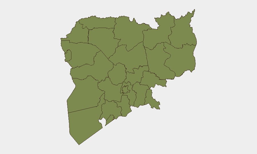
Kampong Cham dominates GeoBit's sub-national ranking (risk 31.5), though recent event signals do not indicate acute incidents in that province; the spike likely reflects longer-term criminality or instability patterns. The northwestern border provinces—Oddar Meanchey and Preah Vihear—now represent the most acute 24–48-hour risk zone due to the 5 July explosion and ongoing Thai–Cambodian military and diplomatic tension. All other provinces cluster at baseline risk (1.5), indicating the border dispute is geographically concentrated.
How GeoBit Would Assist
Security teams should deploy AOI Monitoring & Early Warning on Oddar Meanchey, Preah Vihear, and Banteay Meanchey provinces to detect escalation in military activity or new incidents. Intel Sweep and multi-language OSINT (X/Twitter, Telegram, local Khmer media) will track diplomatic statements and military movements; Routing & Network Analysis can identify safe alternative cross-border corridors if travel or logistics to/from Thailand are required. Conflict & Military force-structure tracking and satellite imagery will provide early indication of troop repositioning or fortification work in disputed zones.
7-Day Outlook
The border standoff is likely to remain tense but non-escalatory over the next 7 days, with diplomatic activity (protests, statements) continuing but no major new fighting expected. Heat and drought stress in rural areas may prompt localized resource disputes, though no organized unrest is anticipated. Continued monitoring of Thai military activity and bilateral diplomatic channels is essential to detect any shift toward armed confrontation.
Highest-Risk Areas — Ranked
| # | State / Region | Risk |
|---|---|---|
| 1 | Kampong Cham | 31.5 |
| 2 | Koh Kong | 1.5 |
| 3 | Kampong Speu | 1.5 |
| 4 | Kandal | 1.5 |
| 5 | Prey Veng | 1.5 |
| 6 | Khaet Preah Sihanouk | 1.5 |
| 7 | Kampot | 1.5 |
| 8 | Kep | 1.5 |
| 9 | Takeo | 1.5 |
| 10 | Svay Rieng | 1.5 |
| 11 | Oddar Meanchey | 1.5 |
| 12 | Pailin | 1.5 |
Sources
Previous Daily Briefs
A new Cambodia brief is written every day — each with its own risk map and downloadable CSV. Here's the last week; use the calendar to go further back.
📅 Browse every day by calendar →
Highlighted days have a brief. Tap a day for that day's map & analysis, or “csv” for that day's dataset ($5).
Atlas — our AI intelligence desk — emails them this snapshot personally. Nothing else, no list.