Situation Summary
Cuba is experiencing a compound crisis of energy, fuel, and economic supply shortages that has triggered visible public unrest in major urban centers over the past 48 hours. Rolling blackouts reaching 20 hours daily and severe fuel scarcity have prompted cacerolazo protests in Havana and disrupted interprovincial transport, while the government responded on June 19 with an emergency economic reform package aimed at containing social discontent. The threat environment remains below critical threshold (global rank #94, composite score 18) but shows acute operational risk to corporate personnel and supply chains, particularly in affected provinces and transportation corridors.
Key Developments
- Havana, June 18–19: Neighborhood cacerolazo protests (pot-banging demonstrations) documented across central and eastern districts, with residents citing 48-hour blackout periods. Posts geotagged to affected barrios show street gatherings in darkened conditions and vocal dissent; timing coincides with Communist Party's emergency economic package announcement.
- Santiago de Cuba & Holguín, June 18–19: Rolling blackouts documented at 20 hours per day; residents posting outage schedules and street-darkness photos on social platforms, consistent with island-wide thermoelectric plant failures.
- Island-wide transport corridors (Havana, Varadero, Viñales), June 18–19: Fuel shortages creating operational gridlock—long gas-station queues, canceled interprovincial buses, and stranded rental-car tourists. Canada's updated travel advisory now formally recommends avoiding non-essential travel due to fuel scarcity making transport "extremely challenging."
- Havana (national power grid), June 18–19: Approximately 1,400 megawatts of generating capacity offline; secondary impacts now visible in hospital disruptions (dialysis schedule delays, surgery postponements).
- Havana, June 19: Communist Party approved unprecedented emergency economic package (expanded private enterprise, foreign investment measures) in response to crisis; framed internationally as political containment measure.
- Nationwide, June 18–19: All Canadian airlines suspended service to Cuba; Canadian Embassy in Havana experiencing operational constraints and may further limit consular services.
- Multiple urban centers, June 18–19: Intermittent mobile-data loss and social-media blocking reported during evening protest hours in Havana and one provincial city, consistent with pattern of targeted telecom restrictions during unrest.
Highest-Risk Areas
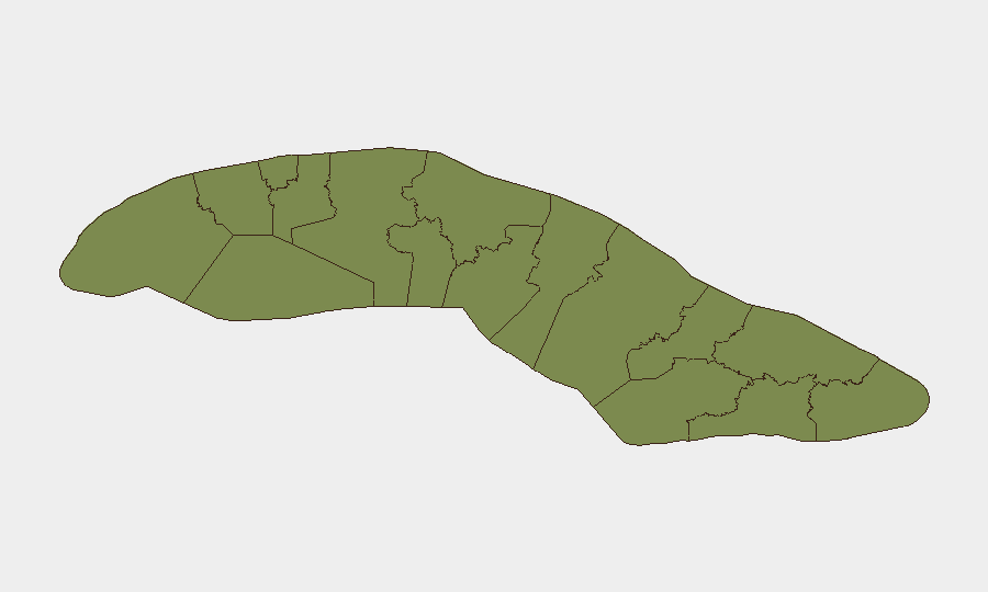
Sancti Spiritus (risk 32.7) is the outlier and requires direct investigation—its composite score is substantially higher than all other provinces and warrants intelligence clarification on underlying drivers. Havana (14.5) represents the second concentration of risk, anchored by documented cacerolazo activity, capital-city visibility, and critical transport/energy infrastructure. Santiago de Cuba and Holguín (both 3.8) show emerging pressure from extended blackouts and social-media documented grievances. Regional risk is being driven by energy supply collapse and visible public protest, with Havana's size and role in national administration amplifying escalation potential.
How GeoBit Would Assist
AOI Monitoring & Early Warning capabilities would enable persistent watch on Havana neighborhoods, provincial capitals, and fuel-distribution nodes to detect escalation or new protest formations before they spread. OSINT fusion (X/Telegram, geotagged posts, sentiment analysis) combined with telecommunications intelligence would provide real-time visibility into internet/social-media blockage patterns and allow teams to plan alternate communication protocols. Routing & Network Analysis would identify safe interprovincial and intra-city corridors given fuel scarcity and transport disruption, and support duty-of-care planning for personnel evacuation or supply-chain rerouting.
7-Day Outlook
The combination of ongoing blackouts, fuel shortages, and visible public discontent suggests continued low-level cacerolazo activity and transport disruption through late June. Government reforms may ease investor sentiment but are unlikely to resolve energy supply within 7 days, keeping operational friction high for corporate transport and logistics. Watch for either escalation in protest size/frequency or signs of increased telecom restrictions as early indicators of regime concern over stability.
Highest-Risk Areas — Ranked
| # | State / Region | Risk |
|---|---|---|
| 1 | Sancti Spiritus | 32.7 |
| 2 | Havana | 14.5 |
| 3 | Camagüey | 4.4 |
| 4 | Villa Clara | 3.8 |
| 5 | Santiago de Cuba | 3.8 |
| 6 | Holguín | 3.8 |
| 7 | Pinar del Rio | 3 |
| 8 | Matanzas | 3 |
| 9 | Artemisa | 2.7 |
| 10 | Mayabeque | 2.7 |
| 11 | Cienfuegos | 2.7 |
| 12 | Isle of Youth | 2.7 |
Sources
Previous Daily Briefs
A new Cuba brief is written every day — each with its own risk map and downloadable CSV. Here's the last week; use the calendar to go further back.
📅 Browse every day by calendar →
Highlighted days have a brief. Tap a day for that day's map & analysis, or “csv” for that day's dataset ($5).