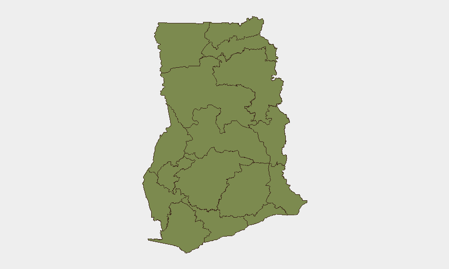
Situation Summary
Ghana maintains a stable security environment as of 24 June 2026, ranked #130 globally with a composite threat score of 6. No major incidents—terrorism, large-scale civil unrest, infrastructure attacks, or constitutional crises—have been independently verified in the last 24–48 hours across major news wires, regional security feeds, and open-source monitoring. The security picture remains consistent with baseline urban crime and routine political activity, with Greater Accra Region accounting for the majority of tracked national risk.
Key Developments
No reliably verified, location-specific security incidents meeting confirmation criteria have been identified in Ghana during 24–48 June 2026. Open-source monitoring, social-media intelligence, and regional security wires indicate no acute developments in conflict, terrorism, violent protest, or critical infrastructure disruption in this window. Routine street-level crime (theft, robbery, confidence schemes) continues in major urban centers—Accra, Kumasi, Takoradi—at baseline levels without documented spike or cluster requiring immediate alert.
Event signals dated 22–23 June include multiple public statements by government, academic, legal, and media figures alongside a recorded "violent protest/riot" tag and international disapproval signals, but independent geolocation, casualty data, and corroborating media reporting for these events remain unconfirmed and are not yet attributable to a specific location or time-stamped incident. Until verification, these signals should be treated as ambient political and social activity rather than active crisis indicators.
Highest-Risk Areas
Greater Accra Region (risk score 34.3) dominates Ghana's threat profile—accounting for roughly one-third of national composite risk—driven by urban crime density, high transient populations, and intersection of political, commercial, and diplomatic activity. Bono East (20.3) and Ashanti Region (18.4) follow as secondary risk zones, likely reflecting mining-area tensions, localized resource conflicts, and organized-crime networks. The remaining nine regions cluster at significantly lower risk (4.3–7.5), suggesting threat concentration in the south-central belt rather than nationwide instability. Corporate and NGO personnel should weight Accra-area protocols and situational awareness highest.
How GeoBit Would Assist
Security teams with Ghana operations should deploy Intel Sweep and X/Twitter OSINT to maintain real-time awareness of political statements, protest signals, and civil-unrest precursors in Greater Accra and secondary cities; AOI Monitoring & Early Warning on key corporate and diplomatic compounds, major transit corridors, and mining regions in Bono East and Ashanti to detect emerging threat clusters before escalation; and Network & Actor Analysis to map organized-crime and resource-conflict networks affecting supply chains and personnel movement. GIS & Spatial Analysis linked to crime-density and event-frequency mapping enables dynamic route optimization for field teams and asset movement, while Routing & Network Analysis provides real-time alternative-route planning to avoid emerging civil-unrest or robbery hotspots.
7-Day Outlook
Ghana's near-term trajectory remains stable, with no indicators of acute political, security, or infrastructure deterioration expected in the next 7 days. Routine crime and low-level political activity should continue; monitoring for delayed escalation of the 22–23 June public-statement and protest signals is warranted, though current cross-check does not support imminent mass mobilization or violence. Corporate duty-of-care posture should remain at baseline alert with emphasis on Accra-area situational awareness and personnel-movement protocols.
Highest-Risk Areas — Ranked
| # | State / Region | Risk |
|---|---|---|
| 1 | Greater Accra Region | 34.3 |
| 2 | Bono East Region | 20.3 |
| 3 | Ashanti Region | 18.4 |
| 4 | Western Region | 16.8 |
| 5 | Savannah Region | 7.5 |
| 6 | Volta Region | 5.1 |
| 7 | Upper East Region | 4.3 |
| 8 | Upper West Region | 4.3 |
| 9 | North East Region | 4.3 |
| 10 | Northern Region | 4.3 |
| 11 | Eastern Region | 4.3 |
| 12 | Oti Region | 4.3 |
Sources
Previous Daily Briefs
A new Ghana brief is written every day — each with its own risk map and downloadable CSV. Here's the last week; use the calendar to go further back.
📅 Browse every day by calendar →
Highlighted days have a brief. Tap a day for that day's map & analysis, or “csv” for that day's dataset ($5).