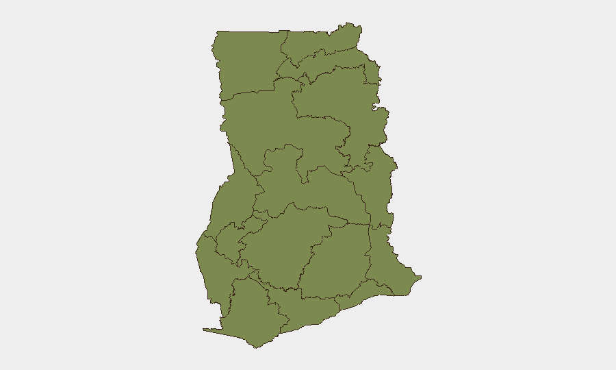
Situation Summary
Ghana remains a stable outlier in West Africa (rank #136 globally, composite threat 6/100) but faces persistent subnational violence concentrated in chieftaincy and resource disputes. The most severe recent escalation occurred in Nkwanta South (Oti Region) on 24–25 June, where armed clashes killed three and injured nine, prompting a nationwide curfew and military reinforcement. Current trajectory indicates localized but acute conflict risk in a handful of municipalities rather than systemic state fragility.
Key Developments
- Nkwanta South (Oti Region), 24 June 2026, ~16:30–17:00 local time: Unknown gunmen attacked residents in Odomi/Odumase, killing three and wounding nine; victims transferred to St. Joseph Hospital and Nkwanta Municipal Government Hospital. Sustained gunfire linked to renewed chieftaincy-related conflict; no immediate arrests reported.
- Nkwanta South (Oti Region), early hours 26 June 2026: An attempted libation ceremony triggered armed confrontations between rival groups; Interior Minister imposed a curfew (22:00–05:00/06:00) across multiple Nkwanta South communities in response.
- Nkwanta South (Oti Region), 24–25 June 2026: Joint police–military operations arrested eight persons suspected of involvement in the latest shootings and wider unrest; security agency deployments and checkpoint activity increased sharply following the Odomi/Odumase attack.
- National level, 24–25 June 2026: Interior Ministry and conflict bodies reaffirmed that 33 of Ghana's top 37 active conflict hotspots are chieftaincy-linked disputes; Nkwanta clashes cited as exemplar of this pattern, signaling continued structural risk in identified municipalities.
- Nkwanta South (Oti Region), 24–25 June 2026: Reports of community displacement, resident avoidance of nighttime movement, and public protests over insecurity following the killings; short-notice movement restrictions and unpredictable security environment reported in municipality.
Highest-Risk Areas
Bono East Region (34.3) and Western Region (28) drive the composite threat score, substantially ahead of Greater Accra (24.9) and Ashanti (17). Bono East's elevated ranking reflects ongoing resource and land disputes; Western Region concentrates mining-related tensions and cross-border trafficking concerns. Greater Accra's risk centers on urban crime and occasional political demonstrations rather than armed conflict. Oti Region's Nkwanta South municipality, though not listed separately, has emerged as the immediate flashpoint and warrants heightened monitoring despite the region's lower baseline score.
How GeoBit Would Assist
Conflict & Military mapping and AOI (Area-of-Interest) Monitoring & Early Warning with alerting would enable real-time tracking of curfew enforcement, security deployments, and renewed clashes in Nkwanta and other hotspots. Network & Actor Analysis combined with OSINT (X/Twitter, local media, Telegram feeds) would identify emerging factions, grievances, and mobilization signals ahead of escalation. Routing & Network Analysis would provide duty-of-care teams alternative journey planning to avoid Nkwanta South and other chieftaincy-dispute zones during volatile periods.
7-Day Outlook
Curfew enforcement and military presence will likely suppress immediate violence in Nkwanta South over the next 3–5 days, but underlying chieftaincy and land disputes remain unresolved. Sporadic incidents (clashes, arrests, community tension) are probable as rival groups test boundaries or attempt to circumvent curfew hours. Risk of secondary escalation across other identified hotspots (Bono East, Western Region) remains moderate if local actors perceive broader impunity or if national political developments amplify local grievances.
Highest-Risk Areas — Ranked
| # | State / Region | Risk |
|---|---|---|
| 1 | Bono East Region | 34.3 |
| 2 | Western Region | 28 |
| 3 | Greater Accra Region | 24.9 |
| 4 | Ashanti Region | 17 |
| 5 | Upper East Region | 4.3 |
| 6 | Upper West Region | 4.3 |
| 7 | Savannah Region | 4.3 |
| 8 | North East Region | 4.3 |
| 9 | Northern Region | 4.3 |
| 10 | Eastern Region | 4.3 |
| 11 | Oti Region | 4.3 |
| 12 | Volta Region | 4.3 |
Sources
Previous Daily Briefs
A new Ghana brief is written every day — each with its own risk map and downloadable CSV. Here's the last week; use the calendar to go further back.
📅 Browse every day by calendar →
Highlighted days have a brief. Tap a day for that day's map & analysis, or “csv” for that day's dataset ($5).