Situation Summary
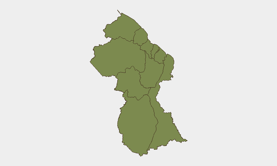
Guyana's overall security posture remains stable, with a national composite threat score of 5 and minimal tracked security incidents in the past 48 hours. All ten administrative regions show uniform risk scoring (1.3 each), indicating distributed low-level baseline vulnerability rather than acute concentration of threat. No major security, civil-unrest, conflict, or infrastructure events have been reliably documented within the last 24–48 hours across open sources; the security environment reflects routine criminality and governance issues rather than systemic instability.
Key Developments
No verified security incidents documented in the last 24–48 hours (as of 2026-07-30). Available Guyanese news feeds, crime reports, and social-media intelligence show no new conflict, civil unrest, major crime, infrastructure failure, or travel-safety events with reliable timestamps of 2026-07-29 or 2026-07-30. Incidents currently in circulation (maritime accidents, multiple murders, firearms seizures, fires, and political disputes) are dated 2026-06-23 through 2026-07-28 and thus predate the current 48-hour window.
Highest-Risk Areas
All ten administrative regions are scored identically at 1.3 composite risk, reflecting an absence of geographic hotspots and suggesting that threat is distributed across the country rather than concentrated in border, urban, or resource-extraction zones. This uniform rating may indicate either that baseline security conditions are comparable nationwide or that intelligence granularity at the regional level is insufficient to differentiate threat. Corporate security teams should not interpret the ranking as evidence of equal safety everywhere; rather, they should apply sector-specific risk assessment (e.g., maritime risk in coastal and island regions, cross-border smuggling in Cuyuni-Mazaruni and Potaro-Siparuni, urban crime in Demerara-Mahaica) independent of the composite scores.
How GeoBit Would Assist
Security teams operating in Guyana would benefit from AOI Monitoring & Early Warning (persistent watch on facilities, ports, border crossings, and transit routes with automated alerting on incident or threat escalation); Intel Sweep and OSINT fusion (continuous scanning of Guyanese news, social media, and government sources to detect emerging crime, political instability, or maritime incidents before they affect operations); and Routing & Network Analysis (generation of alternative travel and supply-chain routes to circumvent high-risk areas or corridors as conditions change). These tools reduce dwell-time on manual news review and enable rapid duty-of-care response if threat conditions shift.
7-Day Outlook
Near-term trajectory is expected to remain stable absent new major incidents or political escalation. Routine crime and maritime-safety issues are likely to persist; corporate teams should maintain standard operating security protocols and monitor regional news feeds for any sudden uptick in organized crime, labor unrest, or cross-border activity. No systemic security collapse or mass-casualty events are currently forecast.
Highest-Risk Areas — Ranked
| # | State / Region | Risk |
|---|---|---|
| 1 | Barima-Waini | 1.3 |
| 2 | Cuyuni-Mazaruni | 1.3 |
| 3 | Pomeroon-Supenaam | 1.3 |
| 4 | Essequibo Islands | 1.3 |
| 5 | Demerara-Mahaica | 1.3 |
| 6 | Mahaica-Berbice | 1.3 |
| 7 | Potaro-Siparuni | 1.3 |
| 8 | Upper Demerara-Berbice | 1.3 |
| 9 | East Berbice-Corentyne | 1.3 |
| 10 | Upper Takutu-Upper Essequibo | 1.3 |
Sources
Previous Daily Briefs
A new Guyana brief is written every day — each with its own risk map and downloadable CSV. Here's the last week; use the calendar to go further back.
📅 Browse every day by calendar →
Highlighted days have a brief. Tap a day for that day's map & analysis, or “csv” for that day's dataset ($5).
Atlas — our AI intelligence desk — emails them this snapshot personally. Nothing else, no list.