Situation Summary
Honduras remains a mid-tier regional security concern (global rank #59) with a composite threat score of 21 across 67 tracked events. The security environment is dominated by localized organized-crime and border-trafficking dynamics rather than acute nationwide unrest. No discrete security incidents were confirmed in the last 24–48 hours; the most recent policy development is a 22 June border-interdiction initiative by President Nasry Asfura.
Key Developments
- National borders (Guatemala, El Salvador, Nicaragua) — 22 June 2026: President Nasry Asfura announced a procurement plan for Ukrainian drones to enhance surveillance and interdiction capabilities, explicitly targeting organized-crime networks and trafficking operations along three international borders. This signals continued executive focus on cross-border criminal activity and reflects recent diplomatic sourcing from Eastern Europe for security hardware.
- No confirmed discrete incidents (nationwide) — 24–48 hours: GeoBit's live web research identified no cross-sourced reports of civil unrest, armed clashes, infrastructure disruption, kidnappings, or significant crime spikes in the past two days. The security baseline remains stable at the national level.
Highest-Risk Areas
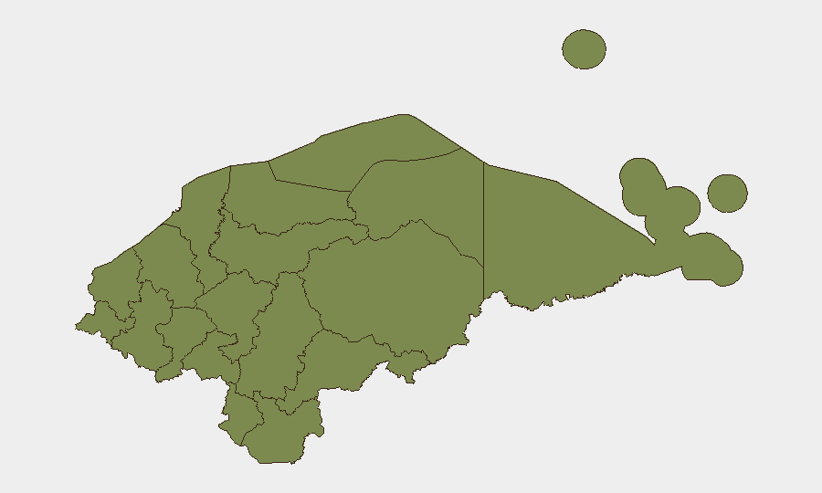
Francisco Morazán department (risk 16.8 points above the second-ranked region) is the clear epicenter of Honduras's security risk, driven primarily by organized-crime activity and gang presence in and around Tegucigalpa and suburban zones. Olancho, the second-highest-risk region (16.9), reflects trafficking-corridor dynamics along eastern borders with Nicaragua and El Salvador. The remaining ten departments cluster at baseline risk (1.9 each), indicating that Honduras's threat profile is highly concentrated geographically rather than dispersed. Corporate and NGO operations should weight security posture and monitoring intensity according to this disparity: Francisco Morazán and Olancho warrant heightened vigilance, while activity in other regions can operate under standard Central American protocols.
How GeoBit Would Assist
Duty-of-care teams with personnel or assets in Francisco Morazán or border zones should employ AOI Monitoring & Early Warning on high-traffic areas (Tegucigalpa, San Pedro Sula, Guatemala/El Salvador crossing points) to detect changes in gang activity, checkpoint locations, or trafficking patterns in near real time. Intel Sweep and multi-language OSINT (Twitter, Telegram, local radio SIGINT) would track both official border-security policy changes and criminal-network communications to anticipate route shifts or interdiction operations. GIS & Spatial Analysis combined with Routing & Network Analysis enables corporate security to model alternative transport corridors and identify safe transit windows, particularly critical for supply-chain and personnel-movement planning in high-risk departments.
7-Day Outlook
The announcement of drone procurement suggests the Asfura administration will increase border interdiction activity over the next 1–2 weeks as equipment is sourced and deployed. No immediate escalation in violence or unrest is anticipated, but heightened police and military presence along Guatemala, El Salvador, and Nicaragua borders may disrupt trafficking logistics and trigger temporary criminal-network repositioning. Organizations operating in Francisco Morazán should maintain situational awareness of checkpoint activity and adjust transit schedules accordingly.
Highest-Risk Areas — Ranked
| # | State / Region | Risk |
|---|---|---|
| 1 | Francisco Morazán | 31.9 |
| 2 | Olancho | 16.9 |
| 3 | El Paraíso | 1.9 |
| 4 | Copán | 1.9 |
| 5 | Ocotepeque | 1.9 |
| 6 | Cortés | 1.9 |
| 7 | Yoro | 1.9 |
| 8 | Santa Bárbara | 1.9 |
| 9 | Lempira | 1.9 |
| 10 | Intibucá | 1.9 |
| 11 | Comayagua | 1.9 |
| 12 | La Paz | 1.9 |
Sources
Previous Daily Briefs
A new Honduras brief is written every day — each with its own risk map and downloadable CSV. Here's the last week; use the calendar to go further back.
📅 Browse every day by calendar →
Highlighted days have a brief. Tap a day for that day's map & analysis, or “csv” for that day's dataset ($5).