Situation Summary
Indonesia remains at moderate global risk (rank #43, composite score 50) with 1,222 tracked security events. The national threat picture is dominated by concentrated urban volatility in Jakarta, coupled with persistent separatist and communal violence in peripheral regions—particularly Papua and North Sumatra. Recent 24–48-hour event signals indicate friction across government, law enforcement, and civilian institutions, though open-source incident confirmation remains limited. Trajectory suggests sustained baseline tension with localized flare risks in high-conflict zones.
Key Developments
- Yahukimo Regency, Papua Highlands (2026-07-04): Indonesian security forces recovered the body of American pilot Nicholas F. Goselin, shot dead after armed separatists attacked and burned a small aircraft at Ipdeheik airstrip, Balinggama village. Seven Papuan civilians aboard were unharmed; incident underscores ongoing separatist capability and targeting of aviation infrastructure in remote highlands.
- Jakarta (2026-07-08): Military Alert signal triggered between Police and Jakarta authorities; Public Statement issued by Jakarta officials to community, and by Ministry to civilians—nature and substance unconfirmed in available open sources but consistent with law-enforcement or administrative coordination event.
- National Level (2026-07-08): Multiple public statements and threat signals issued at national level by government, diplomatic, and judicial actors; Police-Government Military Alert also flagged. Pattern suggests either policy announcement, administrative friction, or response to security incident; underlying trigger requires corroboration.
- School (2026-07-08): Disapproval signal tied to educational institution; insufficient open-source detail to assess scope, location, or nature (administrative, safety, or civil-unrest related).
*Note: Open-source verification of last 24–48-hour incidents remains incomplete. Only the Papua pilot incident carries independent corroboration. Remaining signals reflect GeoBit event-feed data; operational context awaits fresh media or official confirmation.*
Highest-Risk Areas
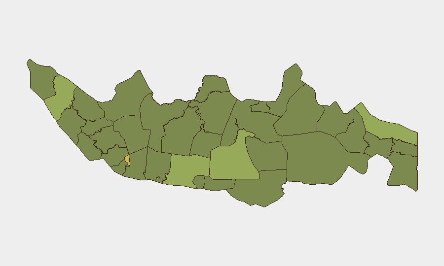
Jakarta dominates the sub-national ranking (64.9), reflecting capital-city concentration of institutional friction, protest activity, and petty/organized crime. North Sumatra (46.4) and Papua (42.9) form a secondary tier; Papua's ranking reflects separatist armed activity (as evidenced by the Goselin incident) and resource-conflict dynamics, while North Sumatra shows communal and labor-related volatility. East Java, South Sulawesi, and West Java (42.9–39.8) indicate dispersed lower-level criminality and civil unrest. Peripheral regions (East Nusa Tenggara, South Kalimantan, South Papua) remain elevated but stable. Risk concentration in Jakarta and Papua suggests corporate/expatriate security teams should prioritize capital-region situational awareness and Papua operations should assume elevated kinetic and political risk.
How GeoBit Would Assist
Security teams should deploy AOI Monitoring & Early Warning on Jakarta, North Sumatra, and Papua to catch protest escalation, armed-group activity, and official policy shifts in real time. OSINT Fusion & Corroboration (X/Twitter, Telegram, local media, radio SIGINT) would isolate confirmed incidents from noise in the current 24–48-hour signal pile. Conflict & Military force-structure tracking and Network & Actor Analysis are essential for understanding separatist capabilities and reach in Papua—critical for aviation, remote-site, and logistics security.
7-Day Outlook
No major destabilizing events are indicated for the immediate week, but Jakarta's institutional volatility and Papua's standing armed-separatist presence suggest elevated minor-incident frequency. International diplomatic or policy announcements may drive secondary civic friction. Teams should maintain heightened monitoring of Papua aviation routes and Jakarta transit nodes.
Highest-Risk Areas — Ranked
| # | State / Region | Risk |
|---|---|---|
| 1 | Special capital Region of Jakarta | 64.9 |
| 2 | North Sumatra | 46.4 |
| 3 | Papua | 42.9 |
| 4 | East Java | 42.9 |
| 5 | South Sulawesi | 40.9 |
| 6 | West Java | 39.8 |
| 7 | East Nusa Tenggara | 38.3 |
| 8 | South Kalimantan | 38.3 |
| 9 | Central Java | 37.5 |
| 10 | Riau | 36.3 |
| 11 | Banten | 36.3 |
| 12 | South Papua | 35.7 |
Sources
Previous Daily Briefs
A new Indonesia brief is written every day — each with its own risk map and downloadable CSV. Here's the last week; use the calendar to go further back.
📅 Browse every day by calendar →
Highlighted days have a brief. Tap a day for that day's map & analysis, or “csv” for that day's dataset ($5).
Atlas — our AI intelligence desk — emails them this snapshot personally. Nothing else, no list.