Situation Summary
Ivory Coast remains broadly stable with no major active conflict or civil unrest reported. The country's composite threat score of 21 places it in the lower-risk band globally, and no discrete security events have been confirmed in the current 24–48-hour window. Risk is concentrated in the northern and northeastern districts, driven by cross-border dynamics, smuggling networks, and localized intercommunal tension rather than organized insurgency or state collapse. The security environment is characterized by chronic rather than acute threats.
Key Developments
No verified security, conflict, civil-unrest, or infrastructure incidents in Ivory Coast have been confirmed for 24–48 June 2026 from available sources. Web research and event feeds have returned economic reporting (IMF funding, cotton production forecasts) and sporting coverage, but no dated, location-specific incident data meeting incident-level threshold. Regional developments in Burkina Faso and Mali (post-Mali military operations) provide border context but do not constitute current Ivorian events.
Highest-Risk Areas
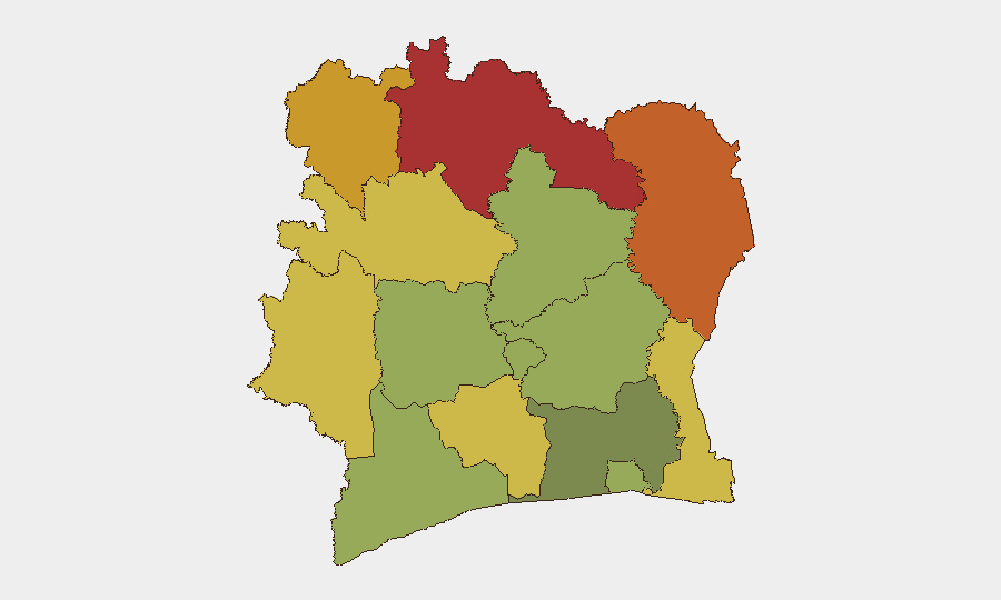
Northern and northeastern districts—Savanes, Zanzan, and Denguélé—drive the country's composite risk profile, each scoring 72–78. These areas share porous borders with Burkina Faso and Mali, enabling cross-border smuggling, trafficking, and occasional militant movement. Montagnes and Comoé districts (risk 68–70) face similar pressures. Risk in these zones is driven by weak state presence, smuggling corridors, and intercommunal grazing and resource disputes rather than organized armed-group control. Abidjan and southern coastal districts remain significantly lower-risk, though petty crime and port-area theft remain routine concerns for corporate operations.
How GeoBit Would Assist
Security teams should deploy AOI Monitoring & Early Warning on Savanes and Zanzan districts to detect cross-border movement and trafficking indicators in real time. Border & Disputed-Territory Search and Network & Actor Analysis would map smuggling and militant-affiliate networks active in the tri-border zone (Ivory Coast–Burkina Faso–Mali). For duty-of-care coverage in high-risk areas, Routing & Network Analysis enables alternative-route planning for personnel and supply convoys, while Satellite & Imagery Analysis supports site security assessments and perimeter monitoring at remote installations.
7-Day Outlook
No escalation is anticipated in the near term. Northern district risk levels are expected to remain elevated but stable, tracking seasonal migration, smuggling cycles, and cross-border militia activity rather than acute conflict triggers. Continued monitoring of Burkina Faso's military operations and Mali's political instability remains essential, as secondary spillover effects (refugee flow, weapons leakage, or militant repositioning) could gradually increase pressure on Ivory Coast's northern border; however, no such migration or event cascade is currently signaled.
Highest-Risk Areas — Ranked
| # | State / Region | Risk |
|---|---|---|
| 1 | Savanes District | 78 |
| 2 | Zanzan District | 75 |
| 3 | Denguélé District | 72 |
| 4 | Comoé District | 70 |
| 5 | Montagnes District | 68 |
| 6 | Woroba District | 65 |
| 7 | Gôh-Djiboua District | 60 |
| 8 | Sassandra-Marahoué District | 58 |
| 9 | Vallée du Bandama District | 55 |
| 10 | Bas-Sassandra District | 52 |
| 11 | Lacs District | 48 |
| 12 | Abidjan | 45 |
Sources
Previous Daily Briefs
A new Ivory Coast brief is written every day — each with its own risk map and downloadable CSV. Here's the last week; use the calendar to go further back.
📅 Browse every day by calendar →
Highlighted days have a brief. Tap a day for that day's map & analysis, or “csv” for that day's dataset ($5).