Situation Summary
Liberia remains a lower-tier global security concern (rank #88, composite threat score 11) with 50 tracked events, but sub-national risk is highly concentrated in eastern border zones. Signal activity spiked on July 8–9, 2026, involving police statements, presidential and government demands, and official investigations into unspecified conduct; a Costa Rican public statement on July 10 suggests potential diplomatic dimensions. The underlying security posture is characterized by fragmented institutional capacity and localized criminal or border-related pressure rather than national instability.
Key Developments
- July 8, Monrovia (likely). Police issued a public statement; contemporaneously, the President and Government issued formal demands and opened investigation(s) against unspecified Liberian entities and the Inspector General. Nature and outcome remain unclear from available signals.
- July 9. Citizen and Government public statements followed; a resident-media disapproval signal suggests local frustration or accusation related to media coverage.
- July 10. Costa Rica issued an unspecified public statement on Liberia, potentially related to diplomatic, trade, or judicial cooperation; context requires corroboration.
- Operational note: The arrest/detention of a named individual (listed only as "KING") on July 8 was flagged but lacks corroborating detail on location, charges, or identity confirmation.
Note: No verifiably recent (24–48 hour) security incidents—armed robbery, civil unrest, trafficking, or conflict—are visible in available open-source data. The signal above reflects political and institutional activity, not armed or criminal events. Background context includes a cocaine seizure at Roberts International Airport in early June and ongoing institutional scrutiny of security and customs operations, but these predate the current reporting window.
Highest-Risk Areas
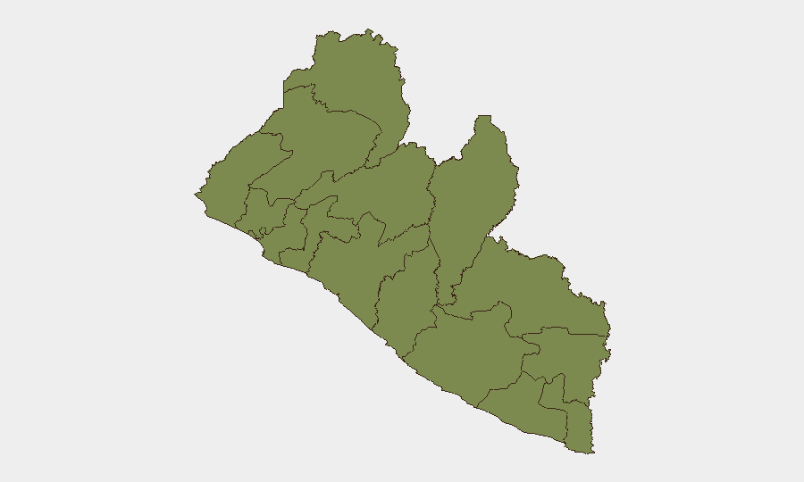
River Gee County (risk score 31.5) and Grand Bassa County (15.7) dominate the risk landscape, driven by proximity to the Sierra Leone and Guinea borders, limited state presence, and historical trafficking and cross-border movement corridors. Margibi County (12.1), home to Monrovia's port and airport, presents urban security and institutional-capacity concerns. Nimba County (8.6) remains a secondary eastern concern. These four counties account for approximately 68% of national tracked risk; Montserrado (Monrovia), despite capital status, scores only 1.5, reflecting institutional concentration rather than widespread metropolitan instability.
How GeoBit Would Assist
- AOI Monitoring & Early Warning on River Gee, Grand Bassa, and Margibi counties to detect cross-border trafficking, smuggling, or organized-crime activity before escalation.
- Network & Actor Analysis to map relationships among security officials, customs, and known trafficking networks exposed by the June airport seizure and subsequent investigations.
- Intel Sweep & OSINT Fusion (X, Telegram, local news outlets with validated timestamps) to corroborate the July 8–10 political signals and assess whether they presage institutional reform, corruption exposure, or personnel changes affecting duty-of-care risk for corporate or expatriate teams.
7-Day Outlook
The political activity of July 8–9 suggests internal institutional scrutiny, possibly corruption-related, with potential for personnel changes or policy shifts in security and customs operations. Unless accompanied by escalation in armed activity or civil unrest, this dynamic is unlikely to sharply elevate national risk; however, teams in River Gee and Grand Bassa should maintain heightened situational awareness of border-zone activity. Confirmation of Costa Rican diplomatic engagement will clarify whether extradition, sanctions, or enforcement cooperation is underway.
Highest-Risk Areas — Ranked
| # | State / Region | Risk |
|---|---|---|
| 1 | River Gee County | 31.5 |
| 2 | Grand Bassa County | 15.7 |
| 3 | Margibi County | 12.1 |
| 4 | Nimba County | 8.6 |
| 5 | Bong County | 5.1 |
| 6 | Maryland County | 5.1 |
| 7 | Gbarpolu County | 3.3 |
| 8 | Grand Gedeh County | 3.3 |
| 9 | Grand Cape Mount County | 1.5 |
| 10 | Lofa County | 1.5 |
| 11 | Bomi County | 1.5 |
| 12 | Montserrado County | 1.5 |
Sources
Previous Daily Briefs
A new Liberia brief is written every day — each with its own risk map and downloadable CSV. Here's the last week; use the calendar to go further back.
📅 Browse every day by calendar →
Highlighted days have a brief. Tap a day for that day's map & analysis, or “csv” for that day's dataset ($5).
Atlas — our AI intelligence desk — emails them this snapshot personally. Nothing else, no list.