Situation Summary
Maldives remains a low-threat environment globally (composite score 2), but localized civil-unrest and public-order risks have intensified in Malé over the past 48 hours. Police have escalated enforcement of protest regulations following back-to-back journalist-rights demonstrations, while youth violence, vandalism, and expatriate altercations continue across secondary urban centers. The security posture reflects managed but elevated tension rather than systemic instability.
Key Developments
- Malé City – Police enforcement escalation (evening, 23 July): Maldives Police Service issued a public warning that unauthorized rallies or demonstrations outside designated protest areas will be dispersed and organizers prosecuted; announcement followed consecutive evenings of journalist-rights demonstrations at Chaandhanee Magu–Majeedhee Magu junction demanding release of two detained Adhadhu reporters (Mohamed Shahuzan and Leevan Naseer).
- Hulhumalé – Repeat mosque vandalism incident (Wednesday night, 22 July): Police opened investigation after a man allegedly damaged the glass door of Azeeza Mosque for a second time in one week; first incident occurred Monday; no injuries reported. Pattern suggests deliberate targeting rather than random crime.
- Kaafu Atoll, Himmafushi – Expatriate deportations (incident 19 July; decision announced this week): Two Egyptian nationals arrested after a fight on 19 July were deported following police investigation and banned from re-entry; reflects ongoing low-level altercations involving migrant workers.
- Hulhumalé Phase II – Youth gang violence (night of 19 July, reported 20 July): Police responded to violent altercation between rival groups of minors (aged 16–17) near Hiyaa Park; one 16-year-old arrested; investigation ongoing with no serious injuries reported.
- Nationwide MNDF incident report (12–18 July, released 24–48 hours ago): Maldives National Defence Force logged 23 incidents across all commands, including 12 fire incidents, 5 rescues, 4 medical evacuations, and 1 hazardous-materials response; no major disaster incidents; Malé Area Command accounted for 16 of 23 responses, indicating elevated operational tempo in the capital region.
Highest-Risk Areas
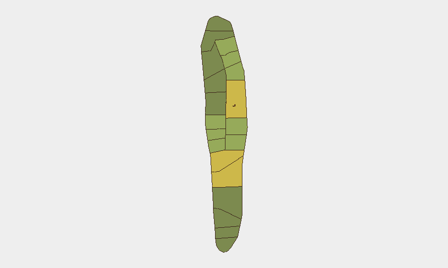
Malé City (risk 85) and Malé Atoll (68) dominate the threat landscape, driven by police enforcement activity, protest gatherings, and concentrated populations. Secondary urban zones—Hadhdhunmathi (65) and Hulhumalé (reflected in Kolhumadulu, risk 60)—show elevation due to youth violence, vandalism, and expatriate altercations over the past week. The risk gradient reflects density and law-enforcement presence rather than organized violence or extremist activity; peripheral atolls remain substantially lower-risk.
How GeoBit Would Assist
Security teams with personnel or assets in Maldives should deploy AOI Monitoring & Early Warning on Malé City protest zones and Hulhumalé neighborhoods to detect escalation patterns before police action occurs. OSINT fusion (X/Twitter, local news feeds, police statements) and sentiment & temporal analysis will track protest rhetoric and police messaging to forecast further enforcement actions. Network & Actor Analysis on youth-violence clusters and expatriate populations provides early signals of potential flashpoints in secondary urban centers.
7-Day Outlook
Police enforcement of protest regulations is likely to remain strict but reactive; no indication of imminent crackdown beyond dispersal of unauthorized gatherings. Youth and expatriate-related incidents will probably continue at current low-level frequency. Travel and duty-of-care protocols should maintain heightened alertness in Malé during daylight hours and restrict non-essential personnel from demonstration zones.
Highest-Risk Areas — Ranked
| # | State / Region | Risk |
|---|---|---|
| 1 | Malé | 85 |
| 2 | Malé Atoll | 68 |
| 3 | Hadhdhunmathi | 65 |
| 4 | Kolhumadulu | 60 |
| 5 | Felidhu Atoll | 58 |
| 6 | Mulaku Atoll | 55 |
| 7 | Faadhippolhu | 52 |
| 8 | South Miladhunmadulu | 48 |
| 9 | North Miladhunmadulu | 45 |
| 10 | South Nilandhe Atoll | 44 |
| 11 | North Nilandhe Atoll | 42 |
| 12 | South Ari Atoll | 40 |
Sources
Previous Daily Briefs
A new Maldives brief is written every day — each with its own risk map and downloadable CSV. Here's the last week; use the calendar to go further back.
📅 Browse every day by calendar →
Highlighted days have a brief. Tap a day for that day's map & analysis, or “csv” for that day's dataset ($5).
Atlas — our AI intelligence desk — emails them this snapshot personally. Nothing else, no list.