Situation Summary
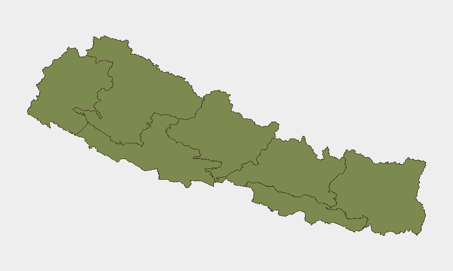
Nepal faces elevated localized security tensions stemming from a Nepal–India border confrontation in the Susta sector (West Nawalparasi) on 17–18 June, where Indian Sashastra Seema Bal (SSB) personnel allegedly crossed into Nepali territory and subsequently installed or reinforced barbed-wire fencing disputed as encroaching on Nepali land. Concurrent political activism in Kathmandu around transitional justice and enforced disappearances reflects ongoing internal governance friction. Overall, Nepal remains at composite threat level 14 globally, but the Bagamati Province (risk 31.3)—which encompasses Kathmandu and surrounding districts—and border-adjacent areas require heightened monitoring.
Key Developments
- Susta sector, West Nawalparasi (Nepal–India border), 17–18 June 2026: Indian SSB personnel allegedly crossed into Nepali territory, triggering a tense face-off with Nepali security and local residents before withdrawing across the border. This marks the most acute bilateral incident in the current reporting window.
- Susta sector, West Nawalparasi, 17–18 June 2026: Local reports indicate Indian authorities installing or reinforcing barbed-wire fencing along disputed sections of the Nepal–India border. Nepali locals contend the works encroach on Nepali agricultural and riverine territory, escalating existing boundary tensions.
- Susta sector, West Nawalparasi, 18 June 2026: Heightened security presence and continued civilian unrest reported; residents gathering to protest alleged encroachment and demanding stronger action from Nepali authorities to protect local land rights and freedom of movement.
- Kathmandu, 18 June 2026: Rights-focused public event drew victims' families and activists protesting lack of accountability for conflict-era enforced disappearances, reflecting sustained political and social tension around post-conflict justice mechanisms.
- Nepal–India border (nationwide coverage), 17–18 June 2026: National security briefing reports no nationwide curfews or large-scale violent unrest, but flags Susta border tensions and Kathmandu political activism as primary near-term security risks.
Highest-Risk Areas
Bagamati Province (risk 31.3) dominates Nepal's sub-national threat profile, driven by political activism and institutional friction centered in Kathmandu. Gandaki Province (risk 10) likely reflects spillover concern from border-adjacent districts and regional unrest signals. The Nepal–India border corridor—particularly West Nawalparasi in the Susta sector—presents the most acute near-term operational risk for organizations with personnel or logistics routes in that zone. Remaining provinces (Lumbini, Koshi, Sudurpashchim, Karnali, Madhesh) show minimal composite scores but warrant passive monitoring given historical patterns of cross-border and inter-provincial friction.
How GeoBit Would Assist
Area-of-Interest (AOI) Monitoring & Early Warning on the Susta sector and Kathmandu would provide persistent alert capability for fence-line activity, security force movement, and protest gathering. Border & Disputed-Territory Search functionality enables tracking of Nepal–India demarcation disputes, fencing operations, and bilateral posture shifts in real time. GIS & Spatial Analysis and Satellite & Imagery Analysis can corroborate on-the-ground reports of infrastructure changes and force concentration along sensitive border segments, supporting duty-of-care assessments for travel and asset positioning in West Nawalparasi and adjacent regions.
7-Day Outlook
The Susta confrontation is likely to remain localized unless Indian and Nepali authorities escalate through formal statements or large-force mobilization—both currently absent. Kathmandu's political activism around transitional justice will probably continue at low intensity but poses intermittent protest and traffic disruption risk. Border communities may sustain civilian-led opposition to fencing, with sporadic gatherings; recommend maintaining current monitoring cadence in West Nawalparasi and Bagamati Province and alerting on any bilateral formal response or additional cross-border incidents.
Highest-Risk Areas — Ranked
| # | State / Region | Risk |
|---|---|---|
| 1 | Bagamati Province | 31.3 |
| 2 | Gandaki Province | 10 |
| 3 | Lumbini Province | 2.9 |
| 4 | Koshi Province | 1.8 |
| 5 | Sudurpashchim Province | 1.3 |
| 6 | Karnali Province | 1.3 |
| 7 | Madhesh Province | 1.3 |
Sources
Previous Daily Briefs
A new Nepal brief is written every day — each with its own risk map and downloadable CSV. Here's the last week; use the calendar to go further back.
📅 Browse every day by calendar →
Highlighted days have a brief. Tap a day for that day's map & analysis, or “csv” for that day's dataset ($5).