Situation Summary
Panama's composite threat score of 14 places it at rank #76 globally, with 29 tracked events indicating a moderate security environment. The country faces concentrated risk in Colón province (score 31.4), which accounts for a significant share of national threat activity, while the capital region and remaining provinces show substantially lower individual risk profiles. Recent event signals spanning 2026-07-07 to 2026-07-08 suggest multi-domain tensions—including investigative actions involving Peru and the presidency, police-civilian friction, and public statements from Chinese and Japanese entities—though available open-source confirmation of specific incidents within the last 48 hours remains limited.
Key Developments
Live web research has not yielded time-stamped, multi-source confirmations of specific security incidents occurring within Panama in the last 24–48 hours. Recent signals flagged by GeoBit's event feed include:
- 2026-07-08 · Peru–Panama Investigation: A bilateral investigative action has been initiated; specific location and underlying cause remain unclear from available public sources.
- 2026-07-08 · Police–Civilian Confrontation: Conventional military force deployed in response to civil action; geographic location and casualty/injury status unconfirmed from independent sources.
- 2026-07-07 · Presidential Investigation: An investigative action directed at the Panamanian executive has been logged; scope and subject matter not yet detailed in accessible reporting.
- 2026-07-07 · Police Blockade: A blockade action by law enforcement suggests transport or movement restriction; specific route, duration, and reason not yet clarified.
- Prison & Detention Infrastructure: Open-source reporting indicates recent maximum-security prison construction following a historical jailbreak event; timeframe of announcement unclear but suggests ongoing penal-system strain.
Note: Confirmation of these signals' operational details, locations, and civilian impact requires corroboration through closed-source intelligence, regional police bulletins, or on-the-ground reporting not yet available in this cycle.
Highest-Risk Areas
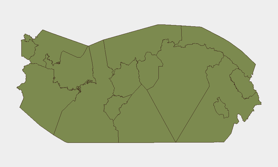
Colón province dominates the national risk profile at 31.4—more than double the capital region's 15.8 score—and accounts for the primary security concern. Colón's elevated risk reflects persistent challenges in port security, organized-crime transit routes, and police resource constraints in the Caribbean coastal corridor. Panamá Province (15.8) encompasses Panama City and the Canal Zone periphery, where administrative friction, labor disputes, and migrant-route vulnerabilities create secondary but significant risk. All other provinces fall to 1.4, indicating that risk concentration is acute and geographically bounded; duty-of-care planning should prioritize Colón and the capital region while maintaining baseline awareness of border areas (Darién) and indigenous territories.
How GeoBit Would Assist
Security teams should employ AOI Monitoring & Early Warning to establish persistent watch on Colón province and the Panama City–Canal Zone nexus, with automated alerting on police deployments, protest activity, and transnational investigative actions. OSINT Fusion & Corroboration across X/Twitter, regional news feeds, and Telegram channels will clarify the operational intent behind current event signals (Peru border investigation, police blockades, presidential inquiries). Routing & Network Analysis will support contingency planning for personnel and supply movements in Colón, identifying alternative transport corridors should primary ports or highways become congested or unsafe.
7-Day Outlook
No force-multiplier events (institutional collapse, major criminal act, external military intervention) are currently forecast for the next seven days. Colón-based port and transit friction will likely persist, and bilateral Peru–Panama investigative activity bears monitoring for escalation. Risk trajectory remains stable unless the presidential investigation or police actions trigger broader civil unrest or cross-border incident escalation.
Highest-Risk Areas — Ranked
| # | State / Region | Risk |
|---|---|---|
| 1 | Colón | 31.4 |
| 2 | Panamá Province | 15.8 |
| 3 | Guna Yala | 1.4 |
| 4 | Darién | 1.4 |
| 5 | Emberá-Wounaan | 1.4 |
| 6 | Naso Tjër Di | 1.4 |
| 7 | Bocas del Toro | 1.4 |
| 8 | Ngäbe-Buglé | 1.4 |
| 9 | Chiriquí | 1.4 |
| 10 | Coclé | 1.4 |
| 11 | Panamá Oeste | 1.4 |
| 12 | Veraguas | 1.4 |
Sources
Previous Daily Briefs
A new Panama brief is written every day — each with its own risk map and downloadable CSV. Here's the last week; use the calendar to go further back.
📅 Browse every day by calendar →
Highlighted days have a brief. Tap a day for that day's map & analysis, or “csv” for that day's dataset ($5).
Atlas — our AI intelligence desk — emails them this snapshot personally. Nothing else, no list.