Situation Summary
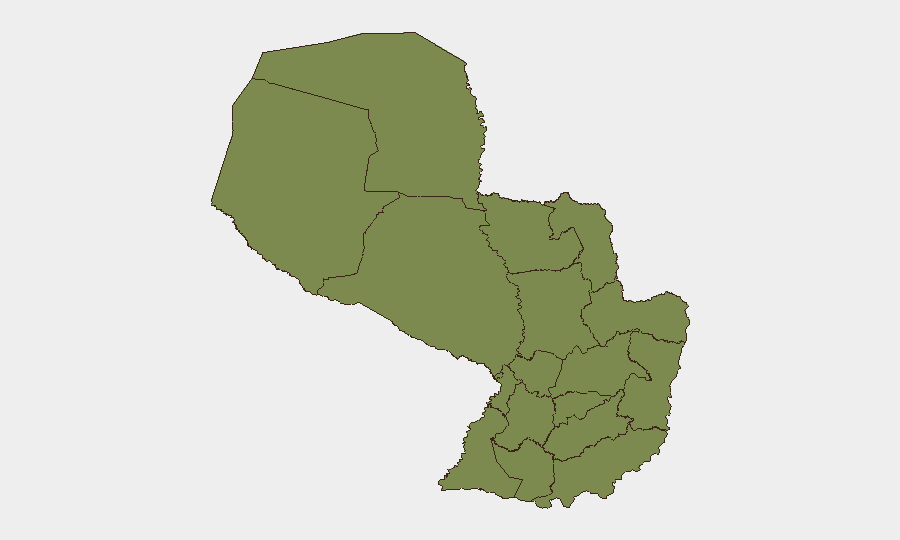
Paraguay remains a low-threat environment globally (composite score 15, rank #null), but faces acute subnational concentration of risk in Alto Paraguay Department (31.3), which dominates the national threat profile. Recent event signals on 20–21 July indicate police disapproval actions, a military force deployment, and prosecutorial statements, though the underlying incidents remain incompletely defined in available open sources. Flooding reported in recent days adds a secondary humanitarian and infrastructure dimension. The security posture is stable overall, with risk highly localized rather than systemic.
Key Developments
- 20–21 July 2026 · Alto Paraguay Department: Military force deployment (Ministry signal, 21 July) — specific operational details and duration not yet clarified in available reporting.
- 20–21 July 2026 · National: Police disapproval actions documented (21 July signal) — subject matter and geographic scope require confirmation via follow-on intelligence collection.
- 21 July 2026 · National: Prosecuting officer public statement (date-stamped signal) — content and implications for corporate or diplomatic presence not specified in current data.
- 20 July 2026 · National: Two separate disapproval signals logged — likely related to police or judicial actions; additional context pending.
- Flood Event (recent): Paraguay-wide flooding reported (event ID 1103999); infrastructure impact and geographic extent require real-time assessment; humanitarian corridors and road closures possible.
*Note: Open-source news pages reviewed (NPY, Última Hora, travel advisories) do not contain time-stamped incident details confirmable within the last 24–48 hours beyond these signals. Further specificity requires direct source verification or additional OSINT sweep.*
Highest-Risk Areas
Alto Paraguay Department alone accounts for the vast majority of measurable risk (31.3 vs. 3.6 for the second-ranked department), suggesting either concentrated criminal or armed-group activity, border instability, or recent isolated incidents. Presidente Hayes Department ranks second but at substantially lower risk (3.6), indicating that Alto Paraguay's threat is disproportionate and localized. All remaining departments score 1.3, reflecting either endemic but low-level background risk or sparse incident reporting. Corporate operations, supply chains, and personnel in Alto Paraguay warrant enhanced monitoring and contingency planning; operations elsewhere in Paraguay face baseline risk levels consistent with regional norms.
How GeoBit Would Assist
Security teams with people or assets in Paraguay should employ AOI Monitoring & Early Warning on Alto Paraguay Department and border zones to detect cascading incidents before they affect operations. Multi-language OSINT and X/Twitter/Telegram intelligence feeds provide real-time signal capture on police, military, and prosecutorial actions; entity extraction and sentiment analysis clarify intent and trajectory. For personnel safety, Routing & Network Analysis offers alternative journey planning around flood zones and areas of reported disapproval; satellite and imagery analysis provides current infrastructure and road status. Activation of these capabilities now will enable duty-of-care teams to respond faster to further developments.
7-Day Outlook
The clustering of police, military, and prosecutorial signals on 20–21 July suggests a discrete law-enforcement or security operation likely already underway or recently concluded; further escalation or secondary incidents remain possible but are not currently indicated. Flooding will likely persist as an operational friction point through mid-week; monitoring of road closures and supply-chain disruption is warranted. Absent new triggers, the security environment is expected to remain stable and localized.
Highest-Risk Areas — Ranked
| # | State / Region | Risk |
|---|---|---|
| 1 | Alto Paraguay Department | 31.3 |
| 2 | Presidente Hayes Department | 3.6 |
| 3 | Concepción Department | 1.3 |
| 4 | San Pedro Department | 1.3 |
| 5 | Guairá Department | 1.3 |
| 6 | Amambay Department | 1.3 |
| 7 | Canindeyú Department | 1.3 |
| 8 | Caaguazú Department | 1.3 |
| 9 | Alto Paraná Department | 1.3 |
| 10 | Caazapá Department | 1.3 |
| 11 | Itapúa Department | 1.3 |
| 12 | Boquerón | 1.3 |
Sources
Previous Daily Briefs
A new Paraguay brief is written every day — each with its own risk map and downloadable CSV. Here's the last week; use the calendar to go further back.
📅 Browse every day by calendar →
Highlighted days have a brief. Tap a day for that day's map & analysis, or “csv” for that day's dataset ($5).
Atlas — our AI intelligence desk — emails them this snapshot personally. Nothing else, no list.