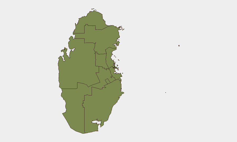
Situation Summary
Qatar faces an acute but currently contained security escalation following Iranian missile and drone strikes against US facilities and Qatari shipping on 22–24 July 2026. Air defenses successfully intercepted incoming fire over Doha on the night of 23 July, with the government declaring the immediate threat neutralized and civil order restored; however, maritime traffic in the Strait of Hormuz remains under direct threat, and regional tensions remain elevated. The composite national threat score of 30 reflects this spike, driven primarily by Doha's elevated risk profile (31.3) and diplomatic friction across multiple state relationships. No sustained internal instability or breakdown of government control is evident, but duty-of-care teams should expect operational friction and travel delays.
Key Developments
- Doha airspace, night of 23 July 2026 (03:00–06:00 local): Multiple explosions recorded as Qatar's air defenses intercepted incoming Iranian missiles and drones targeting US installations; mobile emergency alerts issued and situation declared stabilized by dawn.
- Al Udeid Air Base vicinity, late 22–early 23 July 2026: Coordinated Iranian missile and drone barrage struck US facilities in Qatar as part of regional campaign; air defenses engaged with no confirmed major structural damage or mass casualties reported.
- Strait of Hormuz, 24 July 2026: Three commercial tankers, including Qatari LNG vessel *Al Rekayyat*, struck by drone and unknown projectile within hours; Qatar's Foreign Ministry characterized attacks as "unacceptable Iranian escalation" and grave violation of international maritime law.
- Doha diplomatic response, 24 July 2026: Qatar condemned renewed Iranian attacks on its territory and shipping, signaling heightened concern over regional security while assessing domestic stability as maintained.
- Bahrain, Qatar, UAE missile alerts, 24 July 2026: Air-defense activations sounded across Gulf states; three people reportedly wounded by shrapnel; alerts triggered revised travel advisories from US and Australian governments warning of unpredictable conditions and flight disruption risk.
Highest-Risk Areas
Doha dominates the sub-national ranking (31.3) reflecting the capital's concentration of government, diplomatic, and US military infrastructure—all recent Iranian targeting priorities. Surrounding emirates (Ash Shamal, Al Rayyan, Al Khor and Al Thakhira, Al-Daayen, Umm Salal, Al Wakrah) show baseline risk (1.3 each), indicating geographically dispersed but lower-intensity exposure. Risk is driven by proximity to Doha's strategic assets and maritime chokepoint vulnerability rather than internal instability or crime. Qatari government capacity and security force presence remain intact; threat is external (Iranian action) and maritime-focused (Strait of Hormuz).
How GeoBit Would Assist
Security teams should deploy AOI Monitoring & Early Warning on Doha, Al Udeid vicinity, and Strait of Hormuz transit corridors to detect resumption of Iranian missile activity or maritime attacks in real time. Maritime & Aviation tracking paired with Routing & Network Analysis enables rerouting of cargo and personnel away from high-risk shipping lanes and identification of safe corridors. Multi-language OSINT fusion (X/Twitter, Telegram, regional outlets) and sentiment analysis will track both Iranian signaling and Qatari diplomatic posture to detect de-escalation or further escalatory intent 24–48 hours ahead.
7-Day Outlook
Regional de-escalation is possible if diplomatic channels between Iran and Gulf states activate, but maritime risk in the Strait will persist for at least 7–10 days given Iran's demonstrated capability and intent. Flight operations from Doha may experience minor delays or route changes, but no wholesale closure is forecast. Personnel in Qatar should expect normal operations with heightened security protocols; those transiting the Strait of Hormuz or dependent on LNG/tanker supply should plan for volatility.
Highest-Risk Areas — Ranked
| # | State / Region | Risk |
|---|---|---|
| 1 | Doha | 31.3 |
| 2 | Ash Shamal | 1.3 |
| 3 | Al Shahaniya | 1.3 |
| 4 | Al Rayyan | 1.3 |
| 5 | Al Khor and Al Thakhira | 1.3 |
| 6 | Al-Daayen | 1.3 |
| 7 | Umm Salal | 1.3 |
| 8 | Al Wakrah | 1.3 |
Sources
Previous Daily Briefs
A new Qatar brief is written every day — each with its own risk map and downloadable CSV. Here's the last week; use the calendar to go further back.
📅 Browse every day by calendar →
Highlighted days have a brief. Tap a day for that day's map & analysis, or “csv” for that day's dataset ($5).
Atlas — our AI intelligence desk — emails them this snapshot personally. Nothing else, no list.