Situation Summary
Saint Vincent and the Grenadines remains a low-threat environment with no confirmed security, crime, civil-unrest, political-instability, or acute travel-risk incidents detected in the last 24–48 hours via cross-checked open-web news, official advisories, and social media monitoring. The country's composite threat score of 3 (global rank #180) reflects sustained stability, though intra-national risk concentration in Saint George and Saint Andrew parishes warrants localized attention. Weather monitoring (tropical systems and Saharan dust) is routine for the region but does not currently indicate acute security implications. The diplomatic event flagged on 2026-07-13 (Reduce Relations, New York) carries no confirmed operational impact within Saint Vincent territory.
Key Developments
- No confirmed security, crime, civil-unrest, political, infrastructure, or acute travel-risk incidents detected in Saint Vincent and the Grenadines within the last 24–48 hours (as of 2026-07-15 12:00 UTC).
- Diplomatic signal recorded 2026-07-13 in New York (Reduce Relations classification); no in-country operational consequences reported or corroborated.
- Routine weather monitoring ongoing (Saharan dust and tropical wave activity in region); no emergency infrastructure disruptions or evacuation alerts issued within the assessment window.
- Regional comparative scan confirms crime and travel advisories apply to nearby St. Lucia; no documented spillover incidents affecting Saint Vincent in the last 24–48 hours.
- Local media archive (St Vincent Times) shows historical crime reports (fatal shootings, workplace incidents) and murder tallies for 2026, but articles cannot be reliably dated to within the 24–48 hour window and are therefore treated as background context, not emerging developments.
Highest-Risk Areas
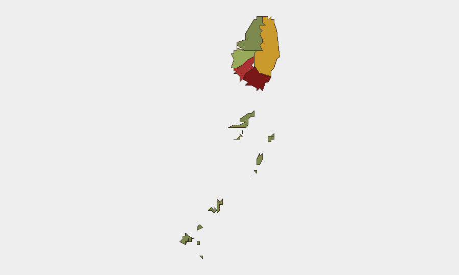
Saint George (risk 92) and Saint Andrew (risk 78) account for the majority of sub-national threat concentration, likely reflecting urban density, commercial activity, and historical crime prevalence in Kingstown and surrounding parishes. Charlotte (71) and Saint Patrick (58) carry moderate residual risk. The Grenadines (12) and Saint David (34) remain significantly lower-risk, consistent with their smaller populations and tourism-oriented profiles. Risk distribution suggests that corporate and diplomatic assets concentrated in the capital and northern parishes face proportionally higher exposure to petty crime, gang activity, and property crime than those in the southern and island territories, though absolute threat levels remain modest.
How GeoBit Would Assist
Corporate security teams should deploy AOI (Area-of-Interest) Monitoring & Early Warning on Kingstown and Saint George district, configured to flag crime spikes, public-order disruptions, or infrastructure failures in real time. Intel Sweep and multi-language OSINT fusion (X/Twitter, local news, radio SIGINT) would sustain continuous cross-check of open-source developments, ensuring duty-of-care teams detect emerging incidents within hours rather than days. Risk & Threat Assessment workflows, refreshed weekly, allow security planners to track sub-national shifts and adjust asset-protection posture proactively.
7-Day Outlook
No material escalation in threat indicators is forecast for the next 7 days. Seasonal weather (tropical wave activity) may produce minor disruptions to transport or supply chains, but historical patterns suggest no security spillover. Continued routine monitoring of Saint George and Saint Andrew parishes is advisable; any spike in gang-related violence, port disruptions, or political rhetoric should trigger escalated alerting protocols. Current baseline remains low-risk.
Highest-Risk Areas — Ranked
| # | State / Region | Risk |
|---|---|---|
| 1 | Saint George | 92 |
| 2 | Saint Andrew | 78 |
| 3 | Charlotte | 71 |
| 4 | Saint Patrick | 58 |
| 5 | Saint David | 34 |
| 6 | Grenadines | 12 |
Previous Daily Briefs
A new Saint Vincent brief is written every day — each with its own risk map and downloadable CSV. Here's the last week; use the calendar to go further back.
📅 Browse every day by calendar →
Highlighted days have a brief. Tap a day for that day's map & analysis, or “csv” for that day's dataset ($5).
Atlas — our AI intelligence desk — emails them this snapshot personally. Nothing else, no list.