Situation Summary
Senegal remains a low–to–moderate security environment (global rank #104, composite threat score 9) with no acute incidents reported in the past 24–48 hours across major population centers or transport corridors. Constitutional reform tensions and parliamentary debate documented last week have not escalated into fresh civil unrest, and routine crime and infrastructure challenges remain within historical baselines. The country's security posture is dominated by long-standing structural risks in Tambacounda Region—linked to cross-border pressures and resource constraints—while the capital and other administrative centers exhibit minimal acute threat activity.
Key Developments
- No acute incidents confirmed (24–48h window): Multi-source open-web and regional threat monitoring show no time-stamped reports of riots, armed clashes, major crime events, infrastructure failures, or travel disruptions in Senegal within the last 1–2 days.
- Constitutional tensions remain non-violent (historical context): Parliamentary confrontations and civil-society protests regarding constitutional reform were documented last week (pre–11 July) but have not generated new security incidents or force deployments in the current 48-hour window.
- Rift Valley fever activity (Mauritania–Senegal border): Zoonotic disease monitoring indicates ongoing animal-health concerns in cross-border zones; no mass-casualty or acute public-health emergency declared in Senegal proper, but livestock and regional trade warrant routine epidemiological attention.
- No corroborated large protests or civil unrest: Regional monitoring of West African unrest does not flag Senegal-specific demonstrations, riots, or security-force mobilizations in the last 24–48 hours.
- Infrastructure and debt pressures (structural, not acute): Senegal's documented fiscal and transport challenges remain chronic; no new outages, transport shutdowns, or accident events clearly dated to the past 48 hours.
Highest-Risk Areas
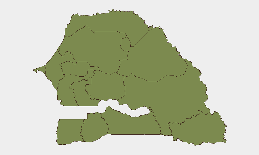
Tambacounda Region (composite risk 31.5) is the clear outlier, driven by cross-border proximity to Mauritania, resource scarcity, pastoral-community tensions, and limited state capacity. All other tracked regions—including Dakar, the capital and largest commercial hub—register uniform, significantly lower risk (1.5 each), reflecting concentrated urbanization, government presence, and functional security apparatus in the western coastal corridor. For corporate operations, Tambacounda warrants heightened due diligence and restricted-movement protocols; Dakar and secondary cities (Thiès, Saint-Louis, Kaolack) present routine baseline risk consistent with lower-income West African urban environments.
How GeoBit Would Assist
Security teams operating in Senegal should deploy Area-of-Interest (AOI) Monitoring & Early Warning on Tambacounda Region, Dakar parliamentary districts, and cross-border zones to detect renewed constitutional unrest, resource-conflict escalation, or health emergencies before they disrupt operations. OSINT Fusion & Corroboration across X/Twitter, Telegram, local media, and radio SIGINT would provide real-time detection of protest mobilization or political instability, while Entity Extraction & Sentiment Analysis would flag shifting elite rhetoric presaging policy or security shifts. Routing & Network Analysis and GIS-based alternative planning enable rapid contingency routing around any emerging unrest or infrastructure failures.
7-Day Outlook
No imminent acute security deterioration is forecast for Senegal's major population centers over the coming week. Tambacounda Region requires sustained baseline monitoring for cross-border spillover and resource-driven tensions, but the absence of current escalation signals suggests status-quo conditions. Watch for renewed parliamentary/constitutional debate and public statements (flagged in the signal feed) that could presage fresh civil unrest, particularly if tied to governance crises or electoral-cycle pressure.
Highest-Risk Areas — Ranked
| # | State / Region | Risk |
|---|---|---|
| 1 | Tambacounda Region | 31.5 |
| 2 | Dakar Region | 1.5 |
| 3 | Louga Region | 1.5 |
| 4 | Thiès Region | 1.5 |
| 5 | Fatick Region | 1.5 |
| 6 | Diourbel Region | 1.5 |
| 7 | Kaolack Region | 1.5 |
| 8 | Saint-Louis Region | 1.5 |
| 9 | Kaffrine Region | 1.5 |
| 10 | Ziguinchor Region | 1.5 |
| 11 | Sédhiou Region | 1.5 |
| 12 | Kolda Region | 1.5 |
Sources
Previous Daily Briefs
A new Senegal brief is written every day — each with its own risk map and downloadable CSV. Here's the last week; use the calendar to go further back.
📅 Browse every day by calendar →
Highlighted days have a brief. Tap a day for that day's map & analysis, or “csv” for that day's dataset ($5).
Atlas — our AI intelligence desk — emails them this snapshot personally. Nothing else, no list.