Situation Summary
South Sudan remains a complex operating environment with moderate composite threat intensity (rank #52 globally, score 40). The security picture is characterized by fragmented armed-group activity concentrated in oil-rich northern states, coupled with a sharp escalation in attacks on humanitarian personnel and supply convoys over the past 48 hours. The trajectory reflects deteriorating protection standards for aid operations and rising criminality along key transport corridors, despite nominal ceasefire frameworks in place since 2018.
Key Developments
- Duk County, Jonglei State – 30 June 2026: A clearly marked UN-affiliated humanitarian convoy operated by the John Dau Foundation was ambushed by armed gunmen while returning from a World Food Programme/Action Against Hunger training mission. Five humanitarian workers were killed, four injured, and approximately 17 total fatalities reported including civilians; the convoy was also looted. The UN has called for investigation.
- Jonglei State – 30 June 2026: UN spokesperson issued statement that attacks on humanitarian workers are becoming more frequent across South Sudan, characterizing them as violations of international humanitarian law and citing inadequate protection and accountability mechanisms for aid operations.
- South Sudan aid operations – 30 June 2026: UN signaled operational risk escalation for humanitarian convoys and staff security in Jonglei and other high-risk areas, with concern that deteriorating safety may constrain food and assistance delivery capacity.
- National context: U.S. legal alert (late June 2026) notes that Temporary Protected Status work authorization for South Sudan nationals remains valid but faces legal risk following Supreme Court Mullin decision, reflecting continued international concern about instability and protection needs in-country.
Highest-Risk Areas
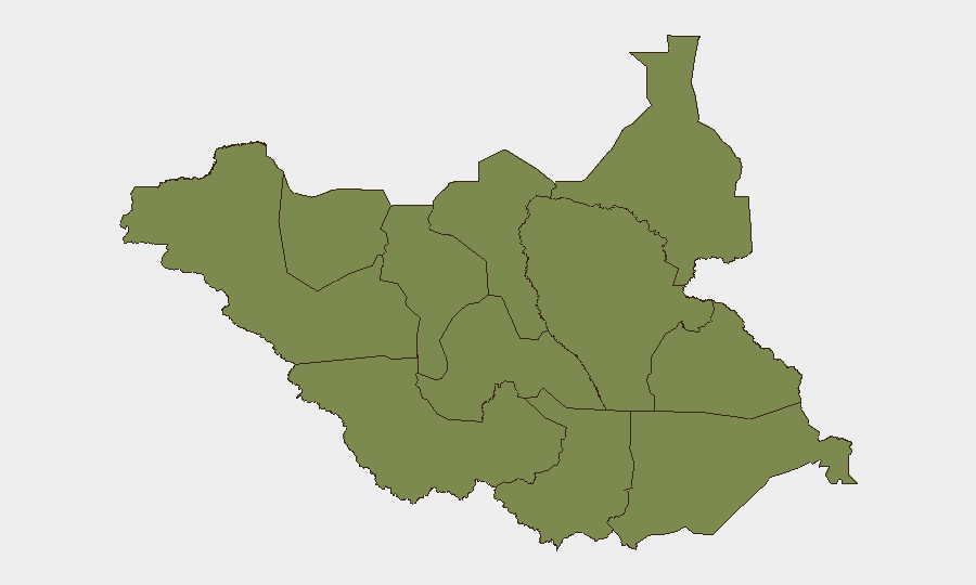
Unity State dominates the threat landscape with a composite risk score of 36.1—nearly six times higher than all other regions. This concentration reflects ongoing oil-sector competition, militia activity, and weapons proliferation in a remote, poorly governed zone. The remaining eleven tracked states/regions cluster at risk 6.1, indicating that while Jonglei (site of the 30 June convoy attack) and other equatorial and Bahr el Ghazal areas present genuine operational hazards—particularly for road travel and humanitarian supply routes—the disproportionate intensity and complexity of threats is concentrated in the north. Jonglei's recent incident underscores that even clearly marked, coordinated aid operations face lethal ambush risk on rural corridors.
How GeoBit Would Assist
Security teams with personnel or assets in South Sudan would benefit from GeoBit's AOI Monitoring & Early Warning capability to track Jonglei road corridors and Unity State flash-point zones with persistent alerting on armed-group activity, roadblock formation, and convoy interdiction patterns. Routing & Network Analysis would enable alternative route planning for humanitarian and staff movements, avoiding known ambush zones and identifying lower-risk transit windows. Conflict & Military mapping combined with Entity & Actor Network Analysis would provide near-real-time intelligence on militia force structure, weapons capability, and territorial control shifts driving the escalation in attacks on aid operations.
7-Day Outlook
The escalation in humanitarian-worker targeting over the past 48 hours signals hardening criminal or militia intent to interdict aid flows and extract value from supply chains. Expect continued high operational risk on Jonglei transport corridors and potential secondary attacks on aid facilities or warehousing. Any further attacks on marked convoys will likely trigger donor-agency security reviews and potential suspension of road-based operations, further constraining humanitarian access in northern zones.
Highest-Risk Areas — Ranked
| # | State / Region | Risk |
|---|---|---|
| 1 | Unity | 36.1 |
| 2 | Upper Nile | 6.1 |
| 3 | Northern Bahr el Ghazal | 6.1 |
| 4 | Western Bahr el Ghazal State | 6.1 |
| 5 | Ruweng Administrative Area | 6.1 |
| 6 | Warrap | 6.1 |
| 7 | Lakes | 6.1 |
| 8 | Jonglei | 6.1 |
| 9 | Greater Pibor Administrative Area | 6.1 |
| 10 | Western Equatoria | 6.1 |
| 11 | Central Equatoria | 6.1 |
| 12 | Eastern Equatoria | 6.1 |
Sources
Previous Daily Briefs
A new South Sudan brief is written every day — each with its own risk map and downloadable CSV. Here's the last week; use the calendar to go further back.
📅 Browse every day by calendar →
Highlighted days have a brief. Tap a day for that day's map & analysis, or “csv” for that day's dataset ($5).