Situation Summary
Sri Lanka remains a composite threat-level #132 globally, with localized instability concentrated in the Western Province and fragmented governance challenges. The past 48 hours reflect a confluence of public-health strain (dengue outbreak), political friction over digital-identity contracts, transnational organized crime enforcement activity, and nascent protest mobilization in the north—none individually severe, but collectively signaling institutional stress and elevated risk in urban centers. The threat trajectory is stable but deteriorating in health-system capacity and political polarization; no immediate indicators of large-scale violence or civil unrest, though protest risk and cyber-crime remain elevated.
Key Developments
- Dengue outbreak strain (nationwide, published June 19, 2026): Sri Lanka is managing its worst dengue fever outbreak in years, with over 44,000 cases and 28 deaths since January, concentrated in Colombo and the western region. Public hospitals are approaching capacity, and authorities have launched a nationwide cleanup campaign running through June 23. This creates elevated health-system strain and potential service disruptions affecting corporate operations and travel.
- E-NIC contract controversy (Colombo, June 19, 2026): Opposition actors and the Frontline Socialist Party publicly criticized the selection of Infosys as the front-runner for Sri Lanka's Electronic National Identity Card project (tender completed May 8), citing data-sovereignty concerns. Political opposition is mobilizing around the issue, with risk of legal challenges and protest activity.
- Chinese-led cyber-crime enforcement surge (Colombo and multi-site, mid-June 2026): Police conducted raids netting 18 Chinese nationals and one Laotian linked to online scam operations; broader enforcement data indicate over a dozen operations in 2026 and ~700 foreign national arrests and deportations. This reflects a shift of transnational organized crime bases from Myanmar/Cambodia to Sri Lanka, elevating cyber-fraud and organized-crime exposure in urban areas.
- Planned protest activity (Kilinochchi, June 19, 2026 announcement): Social-media calls circulated for protests in Kilinochchi supporting a former presidential secretary described as facing an unfair arrest. Timing and scale remain unconfirmed, but the activity signals localized political grievance and police presence risk in the northern region.
- Ongoing political-institutional tension: Multiple arrest/detain and disapproval events in the GEOBIT event feed (June 17–19) involving government actors, anti-corruption bodies, and international entities (UNESCO) reflect friction within Sri Lanka's institutional governance and potential legal/reputational risk for foreign entities.
Highest-Risk Areas
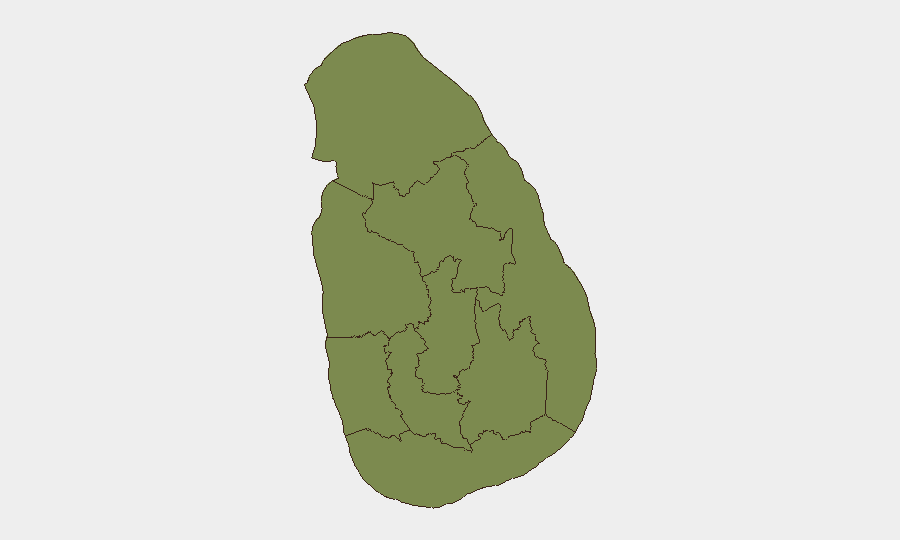
Western Province (risk score 35) dominates the national profile, driven by Colombo-centered political decision-making, urban density, health-system strain, and organized-crime concentration. Northern Province (risk 21) and Central Province (risk 17.6) show secondary but significant risk, with the north experiencing political mobilization and the central region facing dengue and infrastructure pressure. All other provinces remain below risk 17, indicating that acute risk is geographically concentrated in the west and north, where corporate presence and supply chains face tangible exposure to political friction, health disruption, and transnational crime.
How GeoBit Would Assist
Security and risk teams would employ Intel Sweep and OSINT fusion to track political statements, protest mobilization, and institutional actions in real time; AOI Monitoring & Early Warning on Colombo, Kilinochchi, and key hospital/infrastructure nodes to detect escalation; and Network & Actor Analysis to map relationships between political actors, anti-corruption bodies, and protest organizers. Environmental & Health tracking would provide early signals on dengue-system strain and disease spread. These capabilities enable duty-of-care teams to anticipate disruption, validate travel risk, and brief executive exposure.
7-Day Outlook
Over the next seven days, dengue-cleanup campaigns and hospital-capacity pressures will likely persist, with no immediate resolution expected. Protest activity in the north may materialize around Kilinochchi but is unlikely to escalate nationally absent major institutional trigger. Political controversy over the e-NIC contract will continue to generate opposition statements and possible legal filings, maintaining low-level institutional friction. No indicators suggest imminent large-scale violence or systemic breakdown.
Highest-Risk Areas — Ranked
| # | State / Region | Risk |
|---|---|---|
| 1 | Western Province | 35 |
| 2 | Northern Province | 21 |
| 3 | Central Province | 17.6 |
| 4 | Uva Province | 16.7 |
| 5 | Eastern Province | 10.8 |
| 6 | Southern Province | 10.8 |
| 7 | Sabaragamuwa Province | 10.4 |
| 8 | North Western Province | 9.4 |
| 9 | North Central Province | 5 |
Sources
Previous Daily Briefs
A new Sri Lanka brief is written every day — each with its own risk map and downloadable CSV. Here's the last week; use the calendar to go further back.
📅 Browse every day by calendar →
Highlighted days have a brief. Tap a day for that day's map & analysis, or “csv” for that day's dataset ($5).