Situation Summary
Sweden maintains a low-to-moderate threat profile (rank #127 globally, composite score 6) with 153 tracked security events. However, the last 24–48 hours have seen a concentration of serious incidents—violent crime, traffic collisions with casualties, and public-order arrests—concentrated primarily in Stockholm and Västra Götaland counties. The trajectory remains stable relative to historical baselines, but the clustering of high-severity incidents warrants monitoring of urban centres and transport corridors through the weekend.
Key Developments
- Rosersberg, Sigtuna (Stockholm County), night of 18–19 July 2026: Large police operation deployed after report of a seriously injured person; suspected violent crime or gross offence under investigation. Multiple patrols, helicopter, and ambulance response indicates severity; active crime scene until at least early morning 19 July.
- Stenungsund, Västra Götaland, 18–19 July 2026: Serious truck–bus collision hospitalised nine people (two with severe injuries). Male driver detained on probable cause for gross negligence in traffic and causing bodily harm; investigation ongoing.
- Östra Göinge, Skåne, afternoon of 18 July 2026: Suspected dangerous object at residential villa prompted bomb-technician response; item assessed as harmless by 14:39, cordons lifted, threat designation removed.
- Lidingö, Stockholm County, 18 July 2026: Dead body recovered in water; police concluded by 13:00 no suspicion of crime, reducing immediate security concern for the area.
- E4 Trafikplats Stora Wäsby (north of Stockholm), 18 July 2026: Multi-vehicle traffic accident in right lane; no injuries reported but caused temporary disruption on major transport corridor northbound.
- Resarö, Vaxholm (Stockholm archipelago), morning of 18 July 2026: Man in his 50s detained after boat became stuck under pier; positive breath alcohol test, suspected boating under influence (sjöfylleri).
- Borgholm, Öland (Kalmar County), evening of 17 July into 18 July 2026: Three males (approx. 20–25 years old) detained on suspicion of assault following brawl; criminal case opened for misshandel (assault).
Highest-Risk Areas
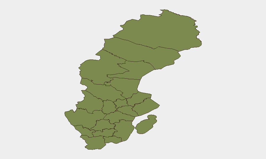
Jämtland County presents markedly elevated risk (31.8) relative to all other regions and warrants priority investigation to establish causation—current data do not isolate the specific drivers. Stockholm County (3.1) reflects the concentration of recent violent crime (Rosersberg), water-recovery operations (Lidingö), and traffic incidents (E4, Resarö), concentrating duty-of-care exposure for corporate and expatriate populations in the metropolitan area. Västra Götaland (1.9) and Skåne (2.8) show secondary elevations linked to the serious traffic collision and suspected dangerous object, respectively. Southern and northern counties remain within baseline risk bands.
How GeoBit Would Assist
Security teams should employ AOI Monitoring & Early Warning to establish persistent watch on Jämtland County and Stockholm's key transport corridors and urban centres to detect clustering of violent-crime or traffic-incident signals in real time. Intel Sweep and multi-language OSINT fusion across regional police bulletins, local media, and emergency-services feeds will triangulate emerging threats faster than reactive incident response. Routing & Network Analysis capabilities enable alternative-route planning for personnel and supply chains to avoid E4 and other high-incident corridors during peak-risk hours.
7-Day Outlook
No significant escalation in national threat indicators is forecast; however, the density of serious incidents in Stockholm and surrounding counties suggests elevated ambient risk in urban transport and recreational settings through the weekend. Continued monitoring of Jämtland County is essential to clarify the source of its elevated composite score. Routine security protocols for expatriates and corporate assets in Stockholm and Västra Götaland should remain in effect.
Highest-Risk Areas — Ranked
| # | State / Region | Risk |
|---|---|---|
| 1 | Jämtland County | 31.8 |
| 2 | Stockholm County | 3.1 |
| 3 | Skåne County | 2.8 |
| 4 | Örebro County | 2.8 |
| 5 | Västernorrland County | 1.9 |
| 6 | Västra Götaland County | 1.9 |
| 7 | Norrbotten County | 1.8 |
| 8 | Västerbotten County | 1.8 |
| 9 | Dalarna County | 1.8 |
| 10 | Gävleborg County | 1.8 |
| 11 | Blekinge County | 1.8 |
| 12 | Halland County | 1.8 |
Sources
Previous Daily Briefs
A new Sweden brief is written every day — each with its own risk map and downloadable CSV. Here's the last week; use the calendar to go further back.
📅 Browse every day by calendar →
Highlighted days have a brief. Tap a day for that day's map & analysis, or “csv” for that day's dataset ($5).
Atlas — our AI intelligence desk — emails them this snapshot personally. Nothing else, no list.