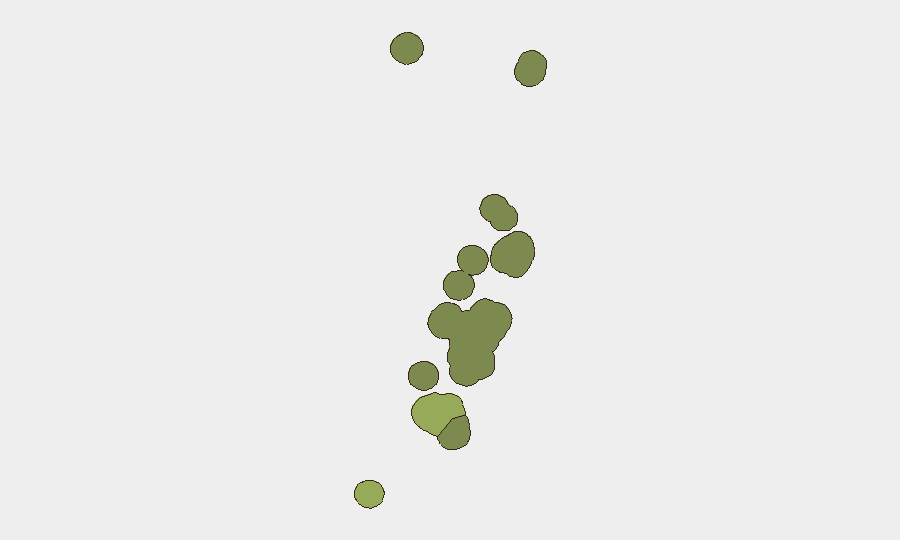
Situation Summary
Tonga remains a low-threat environment overall (composite threat score 14), with no major security incidents, civil unrest, infrastructure failures, or travel-advisory changes in the past 24–48 hours. A manhunt for two foreign nationals who escaped Central Police Station in Nuku'alofa on 19 July continues as the primary active security operation; one of three escapees (a 16-year-old Tongan) was recaptured on 21 July. Routine moderate seismic activity (M 4.3–5.1) offshore presents no immediate impact to population centers or travel.
Key Developments
- Nuku'alofa, Tongatapu – 24 July 2026: Police Commissioner Geoff Turner held a press conference reiterating that two foreign escapees—New Zealand national Liuaki Fungalei Kokohu Vi and Fijian national Adam Zabid Hussein—remain at large; rewards of TOP 5,000 per fugitive are available for information directly leading to arrest; public urged to contact emergency number 922 or 7401656.
- Regional Coordination – 21–24 July 2026: Tonga Police have escalated the manhunt to other Pacific jurisdictions; both fugitives are classified as "high-risk escapees" wanted for passport fraud and related serious offences, with warnings that harboring them carries a penalty of up to 10 years' imprisonment.
- Mataika, Tongatapu – 20–21 July 2026: One escapee, 16-year-old Angelico Fa'aoa (Tongan national), was recaptured in early hours of Tuesday; two foreign nationals remain outstanding as of 24 July.
- Offshore Seismic Activity – Past Week, Status Unchanged: Four moderate earthquakes (M 4.3–5.1) recorded 89–299 km from populated areas (Hihifo, Neiafu, ʻOhonua, Houma); no tsunami warnings, coastal impacts, or travel-advisory changes reported.
- National Security Assessment – Last 24–48 Hours: Open-source monitoring across news wires, Pacific regional outlets, and social-media feeds confirms no protests, civil unrest, major crime spikes, infrastructure failures, or new political-instability events; overall threat level assessed as low.
Highest-Risk Areas
Tongatapu (risk score 45) dominates the sub-national ranking and drives national risk, primarily due to the active manhunt centered in Nuku'alofa and routine port/urban vulnerability factors. Vavaʻu (28) and Haʻapai (22) maintain elevated scores likely reflecting maritime exposure and dispersed population control; ʻEua (18) and Ongo Niua (12) remain lower-risk. The concentration of law-enforcement activity and potential escapee movement in and around Tongatapu justifies heightened attention for organizations with personnel or assets in the capital and surrounding districts.
How GeoBit Would Assist
Organizations should deploy AOI Monitoring & Early Warning focused on Tongatapu (particularly Nuku'alofa and Mataika) to detect any escalation of the manhunt or associated civil/security incidents. Intel Sweep, OSINT fusion, and X/Twitter OSINT provide continuous tracking of police briefings, reward notices, and regional coordination updates, enabling rapid detection of fugitive sightings or law-enforcement status changes. Routing & Network Analysis can support contingency planning for personnel movement if the manhunt expands or security conditions deteriorate unexpectedly.
7-Day Outlook
The manhunt is expected to remain the dominant security event over the next week; regional police coordination and reward incentives may increase likelihood of capture without immediate escalation of broader security risk. Offshore seismic activity will likely continue at low-to-moderate levels with no anticipated impact on population centers or travel corridors. Absent new civil unrest, political instability, or infrastructure disruption, Tonga's threat profile is forecast to remain low, with routine conditions for corporate operations.
Highest-Risk Areas — Ranked
| # | State / Region | Risk |
|---|---|---|
| 1 | Tongatapu | 45 |
| 2 | Vavaʻu | 28 |
| 3 | Haʻapai | 22 |
| 4 | ʻEua | 18 |
| 5 | Ongo Niua | 12 |
Sources
Previous Daily Briefs
A new Tonga brief is written every day — each with its own risk map and downloadable CSV. Here's the last week; use the calendar to go further back.
📅 Browse every day by calendar →
Highlighted days have a brief. Tap a day for that day's map & analysis, or “csv” for that day's dataset ($5).
Atlas — our AI intelligence desk — emails them this snapshot personally. Nothing else, no list.