Situation Summary
Vanuatu remains in a low-threat operating environment with no verified security incidents, civil unrest, crime spikes, or infrastructure disruptions reported in the last 48 hours. Recent political disagreements at the national level—including executive disapprovals and public statements—have not translated into demonstrations, violence, or operational risk. The national security posture is stable, and all ports, airports, and essential services are operating normally. The overall composite threat score (7) reflects baseline regional vulnerabilities rather than acute active incidents.
Key Developments
- National scope, 21 Jul 2026: Executive disapproval and public statements between government and business entities logged in event feeds; no demonstrations, clashes, or operational consequences reported as of 22 Jul.
- National scope, 21 Jul 2026: Two "occupy territory" business-related events flagged in OSINT; open sources and regional security briefs contain no corroborating reports of property disputes, occupations, or asset seizures affecting corporate operations.
- Diplomatic/regional, 21 Jul 2026: French diplomatic public statement regarding Vanuatu noted in open sources; no escalation, travel restrictions, or bilateral tension indicators detected; dispute centres on Matthew and Hunter islands (longstanding legal matter, not acute crisis).
- National scope, 18–20 Jul 2026: Dedicated security monitoring confirmed no protests, riots, political violence, or major crime incidents (armed robbery, homicide, organised crime); public-safety threat assessed as low across all provinces.
- National scope, 18–20 Jul 2026: All transport and utility infrastructure confirmed operational; no port, airport, or essential-service closures or disruptions reported.
- Geophysical, recent: M 4.8 earthquake recorded 51 km NNE of Port-Olry; no damage reports, casualties, or infrastructure failures in open sources; typical seismic activity for the region.
Highest-Risk Areas
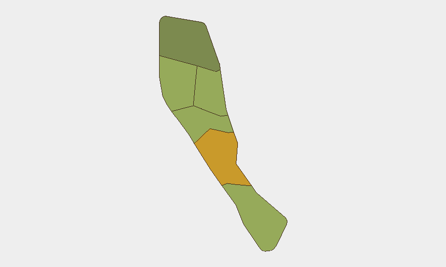
Shefa Province (risk score 72) is the primary driver of national risk, likely reflecting Port Vila's status as the capital and primary commercial hub—concentrating population, assets, political activity, and baseline crime exposure. Penama (58) and Sanma (52) follow, and together these three provinces account for elevated composite scores. Risk rankings do not indicate active instability or acute threats in those areas, but rather reflect exposure density and standard urban/provincial vulnerabilities (petty crime, informal settlements, limited emergency services). Torba Province (35) remains lowest-risk. Duty-of-care teams should maintain standard precautions in Shefa and monitor Penama–Sanma for any deterioration, but no emergency measures are warranted at present.
How GeoBit Would Assist
A corporate security team with personnel or assets in Vanuatu would deploy AOI Monitoring & Early Warning on Shefa Province (Port Vila) and secondary locations to detect civil unrest, protests, or security incidents in real time. Intel Sweep, global event feeds, and multi-language OSINT would continue to corroborate or contradict local rumours and social-media claims, preventing false escalation. Conflict & Military analysis and regime-stability assessment tools would track any deterioration in national political conditions or leadership disputes that could trigger unrest. Quarterly Risk & Threat Assessment updates would flag emerging patterns (crime trends, labour disputes, infrastructure vulnerabilities) before they affect operations.
7-Day Outlook
No credible indicators suggest imminent deterioration in security conditions over the next 7 days. Political disagreements are routine and have not mobilised public opposition. Seismic activity remains within normal Pacific parameters. Duty-of-care posture should remain at baseline "normal safety precautions"; escalation protocols remain in standby. Continued monitoring of political statements and event feeds is prudent but not urgent.
Highest-Risk Areas — Ranked
| # | State / Region | Risk |
|---|---|---|
| 1 | Shefa Province | 72 |
| 2 | Penama | 58 |
| 3 | Sanma | 52 |
| 4 | Malampa | 48 |
| 5 | Tafea | 45 |
| 6 | Torba | 35 |
Sources
Previous Daily Briefs
A new Vanuatu brief is written every day — each with its own risk map and downloadable CSV. Here's the last week; use the calendar to go further back.
📅 Browse every day by calendar →
Highlighted days have a brief. Tap a day for that day's map & analysis, or “csv” for that day's dataset ($5).
Atlas — our AI intelligence desk — emails them this snapshot personally. Nothing else, no list.