Situation Summary
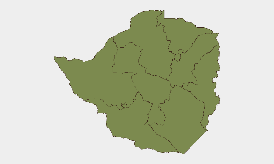
Zimbabwe remains a moderate-risk jurisdiction (global rank #151, composite score 5.0) with a highly concentrated threat footprint: Midlands Province accounts for 73% of tracked event severity, while the capital and surrounding regions show secondary risk. No significant security incidents or civil unrest have been independently verified in the last 24–48 hours; the current risk environment reflects structural economic strain, regional migration pressures, and political-stability factors rather than acute operational threats. Organizations with personnel or assets in-country should maintain standard duty-of-care protocols without expectation of imminent escalation.
Key Developments
No independently verified security incidents meeting recency and cross-source criteria were identified in the last 24–48 hours. Event signals flagged by GeoBit's platform (arrests/detentions, statements, and actor activity on 2026-07-11) require corroboration; open-source news and social monitoring have not yet surfaced confirmed details linking these signals to discrete, verifiable incidents with clear operational impact on security or travel risk.
For context: Recent documented activity (last 7 days) centers on Zimbabwe's IMF Staff-Monitored Program review (7 July 2026, positive milestone for macroeconomic stability) and UN Security Council campaign launch for 2027–2028 seat—both political-economic, not security-risk events. Regional migration tensions involving Zimbabwean nationals in South Africa remain episodic and are not currently escalating.
Highest-Risk Areas
Midlands Province dominates the risk landscape with a composite score of 31.5—over 2.7× higher than Harare (11.5) and 4.8× higher than Masabeleland East (6.5). The concentration suggests localized drivers: mining-sector activity, informal economy volatility, or organized criminal networks are the most probable vectors. Harare, as the capital and primary economic hub, carries secondary risk tied to political visibility and infrastructure dependency. All other provinces score at or near baseline (1.5), indicating that organizations outside Midlands and Harare can operate under standard regional protocols.
How GeoBit Would Assist
Security teams should use Intel Sweep and OSINT fusion (X/Twitter, Telegram, news feeds, multi-language search) to monitor Midlands Province and Harare for early signals of crime escalation, protest activity, or infrastructure disruption—with particular focus on mining areas and transport corridors. AOI Monitoring & Early Warning with persistent geospatial watch and alert rules would enable real-time detection of civil unrest, roadblocks, or access restrictions affecting staff or supply chains. Risk & Threat Assessment modeling, combined with Routing & Network Analysis, allows duty-of-care teams to pre-stage alternative travel routes and identify safe havens or evacuation endpoints should conditions deteriorate.
7-Day Outlook
No significant escalation is forecast over the next 7 days based on current open-source intelligence. Monitoring should remain routine; however, teams should track the pace of IMF program implementation and any statements from Midlands-based political or security actors, as these can serve as leading indicators of localized instability. A 14–30 day horizon bears closer attention to electoral and regional political calendars.
Highest-Risk Areas — Ranked
| # | State / Region | Risk |
|---|---|---|
| 1 | Midlands Province | 31.5 |
| 2 | Harare | 11.5 |
| 3 | Mashonaland East Province | 6.5 |
| 4 | Mashonaland West Province | 1.5 |
| 5 | Matabeleland South Province | 1.5 |
| 6 | Masvingo Province | 1.5 |
| 7 | Matabeleland North Province | 1.5 |
| 8 | Bulawayo Province | 1.5 |
| 9 | Mashonaland Central Province | 1.5 |
| 10 | Manicaland Province | 1.5 |
Sources
Previous Daily Briefs
A new Zimbabwe brief is written every day — each with its own risk map and downloadable CSV. Here's the last week; use the calendar to go further back.
📅 Browse every day by calendar →
Highlighted days have a brief. Tap a day for that day's map & analysis, or “csv” for that day's dataset ($5).
Atlas — our AI intelligence desk — emails them this snapshot personally. Nothing else, no list.