Situation Summary
Algeria faces a composite threat score of 16 globally, placing it in the lower–mid range of geopolitical and security risk. The country is currently experiencing a significant wildfire crisis, with civil defence recording 63 fires nationwide in the past 24 hours; concurrent with this environmental emergency, authorities have detained seven suspects in connection with five arson cases across multiple wilayas (Guelma, Constantine, Tipaza, Jijel, Bouira), with charges of sabotage and deliberate property destruction. Baseline security remains stable outside the Saharan counter-terrorism operations, though the arson wave and resulting fatalities (at least six deaths reported) represent an acute near-term threat to life and critical infrastructure.
Key Developments
- Nationwide wildfire and arson spike (multi-wilaya; 27 July): Civil defence recorded 63 fires across Algeria within the past 24 hours. Most were controlled or extinguished, but the surge is linked to deliberate arson activity.
- Arson suspects detained (Algiers court; timing: recent, likely within 48 hours): Seven individuals placed in pre-trial detention on charges of sabotage endangering lives and property, linked to five separate arson cases across Guelma, Constantine, Tipaza, Jijel, and Bouira. One case destroyed approximately 500 m² of olive trees, Aleppo pines, and scrubland.
- Fatalities from fire wave: At least six deaths confirmed since the onset of the recent wildfire and arson wave, though specific incident dates and locations are not yet fully disaggregated in available reporting.
- Civil defence response active: Fire suppression and emergency response operations remain operational nationwide; no reports of critical infrastructure collapse or mass evacuation orders as of 27 July.
Highest-Risk Areas
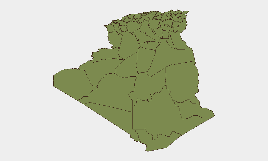
Algiers dominates the sub-national risk ranking at 31.3, driven by administrative concentration, population density, and institutional vulnerabilities to civil disturbance and crime. The remaining 11 tracked wilayas (Bechar, Beni Abbes, Adrar, Bordj Badji Mokhtar, El Bayadh, Ghardaia, Saïda, Boumerdes, Tizi Ouzou, Chlef, Relizane) cluster at 1.3 each, reflecting either low baseline conflict risk or sparse data. The current wildfire surge, however, is dispersed across multiple regions (Guelma, Constantine, Tipaza, Jijel, Bouira), suggesting that environmental/criminal arson risk currently exceeds traditional geopolitical or terrorism metrics in operational impact.
How GeoBit Would Assist
Corporate security teams with personnel or assets in Algeria should deploy Intel Sweep and multi-language OSINT to monitor Algerian civil-defence, Interior Ministry, and local media channels in real time for fire incident updates and suspect-tracking. AOI Monitoring & Early Warning on high-risk wilayas (especially Algiers and the central fire-affected regions) would provide persistent alerting on new arson incidents, protests, or security incidents before they escalate. GIS & Spatial Analysis can map active fire zones and population/asset exposure, enabling dynamic route planning and evacuation readiness.
7-Day Outlook
The wildfire and arson campaign is likely to persist or intensify over the next week, given seasonal conditions and apparent coordinated intent. Authorities are expected to continue detentions and criminal investigations; no major political or security escalation is forecast. Corporate teams should maintain elevated situational awareness in the central and northern wilayas and confirm continuity-of-operations plans for asset protection in fire-prone areas.
Highest-Risk Areas — Ranked
| # | State / Region | Risk |
|---|---|---|
| 1 | Algiers | 31.3 |
| 2 | Bechar | 1.3 |
| 3 | Beni Abbes | 1.3 |
| 4 | Adrar | 1.3 |
| 5 | Bordj Badji Mokhtar | 1.3 |
| 6 | El Bayadh | 1.3 |
| 7 | Ghardaia | 1.3 |
| 8 | Saïda | 1.3 |
| 9 | Boumerdes | 1.3 |
| 10 | Tizi Ouzou | 1.3 |
| 11 | Chlef | 1.3 |
| 12 | Relizane | 1.3 |
Sources
Previous Daily Briefs
A new Algeria brief is written every day — each with its own risk map and downloadable CSV. Here's the last week; use the calendar to go further back.
📅 Browse every day by calendar →
Highlighted days have a brief. Tap a day for that day's map & analysis, or “csv” for that day's dataset ($5).
Atlas — our AI intelligence desk — emails them this snapshot personally. Nothing else, no list.