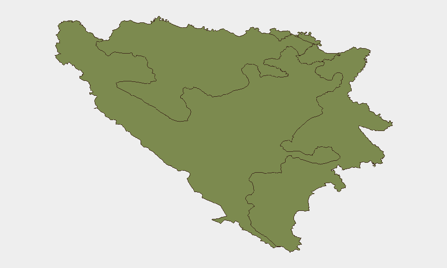
Situation Summary
Bosnia and Herzegovina remains at a low global threat rank (#116 globally; composite score 7/100) with no verifiable security incidents, civil unrest, or infrastructure disruption reported in the last 24–48 hours. Current conditions align with baseline security posture across all three administrative entities. The country's overall risk profile is stable, though significant sub-national variance exists between Republika Srpska and the Federation.
Key Developments
- No confirmed security incidents or acute threats reported in Bosnia and Herzegovina during 07–11 July 2026. Major news wires (AP, Reuters, AFP) and regional outlets show no new armed conflict, terror attacks, or large-scale security operations.
- No civil unrest, protests, or riots documented in major urban centers (Sarajevo, Banja Luka, Mostar, Tuzla) in the last 24–48 hours across mainstream or social media channels.
- No new travel advisories or alerts issued by foreign ministries or embassies for Bosnia and Herzegovina in the last 24–48 hours; existing travel guidance remains unchanged.
- No infrastructure disruptions reported: power systems, transportation networks, and critical services operating normally across the country.
- Social media and web traffic remain routine: World Cup-related content, tourism posts, and standard political commentary dominate X/Twitter discussions; no posts gaining traction on acute security or crime incidents.
- No indication of Bosnia and Herzegovina as a specific target in current cybersecurity reporting, despite global documentation of AI-driven ransomware campaigns against cloud infrastructure elsewhere.
Highest-Risk Areas
Republika Srpska (composite risk 31.5) represents the dominant sub-national threat driver, roughly eight times higher risk than the Federation of Bosnia and Herzegovina (3.9) and over 20 times higher than Brčko District (1.5). This disparity reflects longstanding ethnic tensions, legacy weapons proliferation, and weak governance in RS relative to other entities. The Federation, while carrying elevated risk relative to global baseline, remains substantially more stable; Brčko District presents minimal risk. Duty-of-care teams should prioritize monitoring and contingency planning for operations or personnel in RS, particularly in areas with high ethnic-Serb majorities and limited central-authority presence.
How GeoBit Would Assist
Security and risk teams should deploy AOI Monitoring & Early Warning against high-risk zones in Republika Srpska to detect emerging civil unrest, weapons activity, or cross-border incidents in real time. OSINT fusion across X/Twitter, Telegram, and multi-language web feeds, combined with sentiment & temporal analysis, provides early indication of localized grievance escalation before events reach mainstream reporting. For personnel routing and contingency planning, Routing & Network Analysis identifies safe corridors and alternative transit paths away from highest-risk municipalities in RS, while GIS & Spatial Analysis overlays infrastructure, population, and historical incident data to support site-specific risk assessment.
7-Day Outlook
No acute threat indicators suggest a shift in Bosnia and Herzegovina's current stable security posture over the next seven days. Routine monitoring should continue, with heightened sensitivity to any signals emanating from Republika Srpska, particularly around ethnic or political flashpoints. Standard duty-of-care protocols for personnel in RS remain appropriate; no emergency escalation is warranted at this time.
Highest-Risk Areas — Ranked
| # | State / Region | Risk |
|---|---|---|
| 1 | Republika Srpska | 31.5 |
| 2 | Federation of Bosnia and Herzegovina | 3.9 |
| 3 | Brčko District | 1.5 |
Sources
Previous Daily Briefs
A new Bosnia and Herzegovina brief is written every day — each with its own risk map and downloadable CSV. Here's the last week; use the calendar to go further back.
📅 Browse every day by calendar →
Highlighted days have a brief. Tap a day for that day's map & analysis, or “csv” for that day's dataset ($5).
Atlas — our AI intelligence desk — emails them this snapshot personally. Nothing else, no list.