Situation Summary
Botswana remains a stable, low-threat environment with a composite threat score of 5 (rank #132 globally) and no verifiable acute security incidents reported in the last 24–48 hours across open-source channels. The security landscape is dominated by chronic environmental hazards—multiple active wildfires across the country—rather than civil unrest, armed conflict, or organized crime spikes. The national risk baseline remains moderate (U.S. State Department Level 2: "exercise increased caution"), with all monitored districts at or near baseline threat levels.
Key Developments
- Wildfire Activity (Nationwide, ongoing July 2026): Multiple active wildfires reported across Botswana (events 1029528, 1029596, 1029476, 1029230, 1029243) and cross-border incident with Namibia (1029477). No specific location-specific containment updates or evacuations confirmed in the last 24 hours, but fire activity remains the dominant operational hazard for logistics, transportation, and air quality.
- Military Force Event (Botswana, 2026-07-23): A conventional military force signal was recorded on today's date (2026-07-23). Details remain limited in open sources; this may relate to routine exercises, border operations, or disaster-response mobilization in support of wildfire management. Clarification from official channels advised.
- Public Statement (Botswana, 2026-07-21): A government or official public statement was issued on 2026-07-21. Content and attribution not yet detailed in available open-source reporting. Context likely administrative or policy-related rather than crisis response.
- No Civil Unrest or Acute Crime Events (Last 48 hours): Cross-checked open-source security monitoring, government news portals, and social-media feeds confirm absence of recorded protests, armed incidents, major crime spikes, or infrastructure disruptions within the last 1–2 days. Threat environment remains consistent with monthly baseline.
Highest-Risk Areas
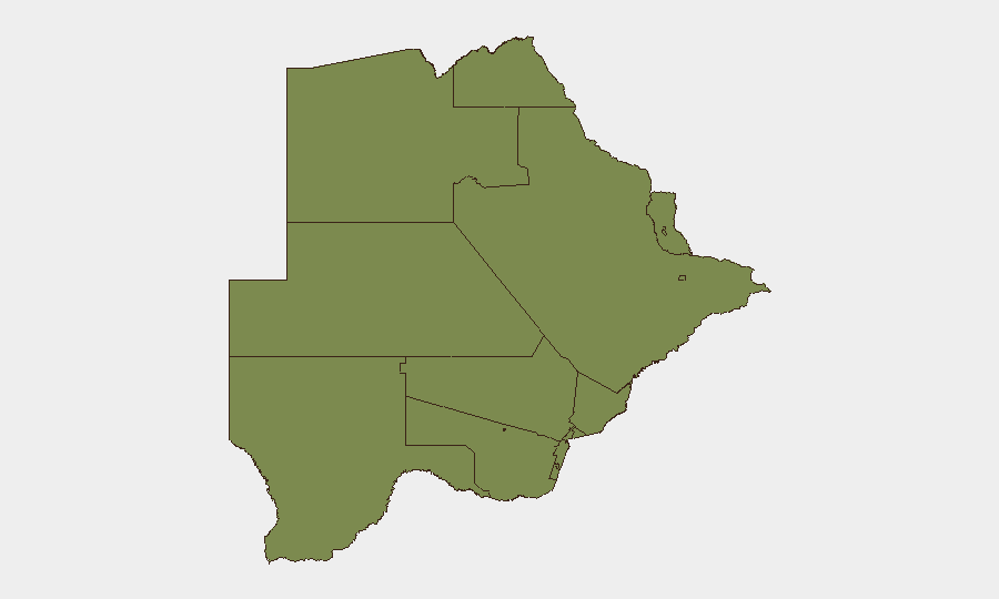
North-West District (composite risk 31.4) significantly outranks all other regions and warrants focused monitoring; the gap between North-West and South-East District (3.9) suggests localized drivers—potentially cross-border activity, resource competition, or environmental/livelihood stress—rather than nationwide instability. All other tracked districts cluster at or below risk 1.4, indicating risk is highly concentrated. Security teams with personnel or assets in North-West District should maintain heightened situational awareness and verify access routes; all other regions present minimal elevated risk above the national baseline.
How GeoBit Would Assist
Persistent AOI Monitoring & Early Warning coverage of North-West District and active wildfire zones would provide real-time alerts for any emergence of civil unrest, displacement, or resource-conflict incidents linked to fire activity. Intel Sweep and OSINT fusion (X/Twitter, local news, Telegram, radio SIGINT) would track whether the 2026-07-23 military force event signals routine operations or emergency response, enabling duty-of-care teams to adjust personnel movement and supply-chain routing. Satellite & Imagery analysis combined with Environmental & Health monitoring would map wildfire progression and air-quality impacts on business continuity and staff safety across the country.
7-Day Outlook
Wildfire activity is expected to remain the primary operational driver over the next 7 days, with potential for air-quality degradation and transport disruptions, particularly in central and northern zones. No new civil unrest or security incidents are anticipated absent a major shock (e.g., cross-border escalation or humanitarian crisis triggered by fires). The national stability outlook remains favorable; risk will remain concentrated in North-West District and managed through standard duty-of-care protocols.
Highest-Risk Areas — Ranked
| # | State / Region | Risk |
|---|---|---|
| 1 | North-West District | 31.4 |
| 2 | South-East District | 3.9 |
| 3 | Chobe District | 1.4 |
| 4 | Sowa Town | 1.4 |
| 5 | Central District | 1.4 |
| 6 | North-East District | 1.4 |
| 7 | Francistown | 1.4 |
| 8 | Ghanzi District | 1.4 |
| 9 | Selebi Phikwe | 1.4 |
| 10 | Kgalagadi District | 1.4 |
| 11 | Kweneng District | 1.4 |
| 12 | Southern District | 1.4 |
Sources
Previous Daily Briefs
A new Botswana brief is written every day — each with its own risk map and downloadable CSV. Here's the last week; use the calendar to go further back.
📅 Browse every day by calendar →
Highlighted days have a brief. Tap a day for that day's map & analysis, or “csv” for that day's dataset ($5).
Atlas — our AI intelligence desk — emails them this snapshot personally. Nothing else, no list.