Situation Summary
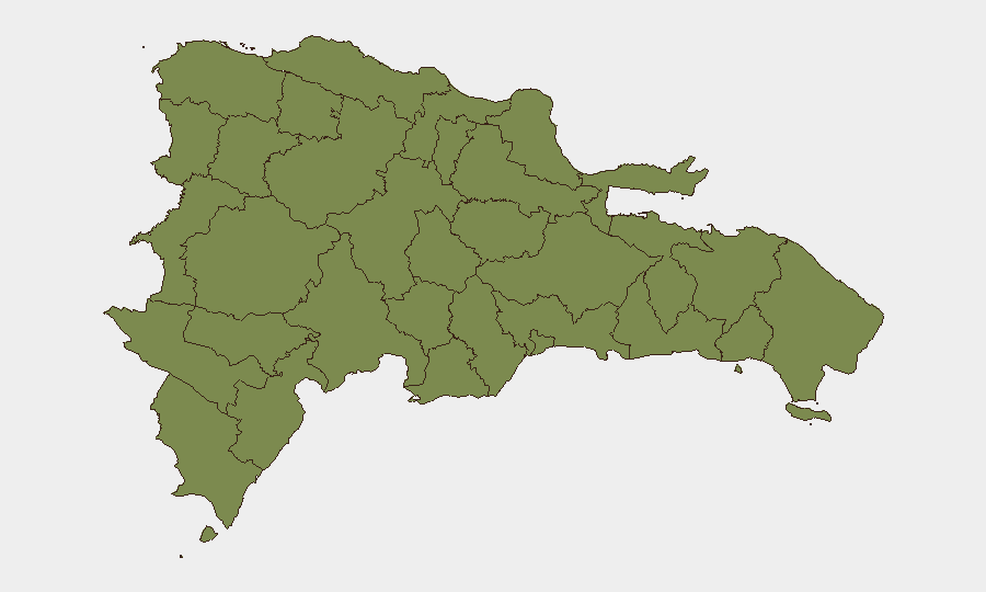
Dominican Republic remains a lower-tier global security concern (rank #88, composite score 13) with no verified security incidents reported in the last 24–48 hours. Recent event signals flagged in the GeoBit platform relate primarily to UK–US diplomatic tensions and military activity, with only tangential or unclear nexus to the Dominican Republic itself. The country's threat profile is heavily concentrated in La Vega province (risk score 31.8), which accounts for the majority of tracked instability; all other provinces show significantly lower and comparable risk levels. Overall security trajectory is stable in the near term, pending clarification of international actors' intentions.
Key Developments
No discrete, verifiable security, crime, unrest, or infrastructure incidents within the Dominican Republic have been confirmed in the last 24–48 hours from available open-source and social media channels. Live web research yielded no reliable, time-stamped events meeting the 24–48 hour requirement; content retrieved references either general safety discussion, older historical issues, or regional cooperation efforts without specific in-country incidents. GeoBit's event feed for the same period flags military and diplomatic signals (UK–US tensions, military mobilization, arrests/detention, sanction activity), but these do not clearly resolve to specific locations or incidents *within* Dominican territory. Corporate security teams should await additional confirmation from local law enforcement, Dominican media, or dedicated incident-tracking platforms before elevating threat posture. Recommendation: Request integration of local Dominican press feeds, police blotters, or embassy reporting to enable real-time incident correlation.
Highest-Risk Areas
La Vega province (risk 31.8) dominates the country's threat landscape, accounting for approximately 59% of GeoBit's composite risk score and representing the primary focus area for protective planning. San Cristóbal (14.8) is the second-ranked province but carries less than half of La Vega's risk score, indicating significant geographic concentration of instability. All remaining provinces cluster at risk scores of 1.8, suggesting diffuse, low-intensity activity or data-collection gaps outside the two primary hotspots. Security teams with personnel or assets in La Vega should maintain heightened situational awareness and contingency protocols; those in San Cristóbal should apply standard precautions; lower-risk provinces warrant baseline duty-of-care protocols only.
How GeoBit Would Assist
Security teams should deploy Area-of-Interest (AOI) Monitoring & Early Warning on La Vega and San Cristóbal to trigger alerts on emerging crime, civil unrest, or infrastructure disruption in real time. Intel Sweep and multi-language OSINT fusion (X/Telegram, local Dominican news sources, and radio SIGINT) would provide 24–48 hour event corroboration and context needed to distinguish isolated incidents from systematic threats. Risk & Threat Assessment combined with GIS & Spatial Analysis enables route planning and facility risk-profiling to reduce exposure of personnel and supply chains in high-risk zones.
7-Day Outlook
No significant escalation in Dominican Republic's internal security environment is forecast over the next seven days absent new triggering events. International diplomatic tensions (UK–US signals) pose indirect reputational or policy risks rather than direct operational threats. Security posture should remain on standard alert; teams should refresh contact trees, embassy reporting procedures, and contingency plans while monitoring for clarity on the nature and geographic scope of recent event signals.
Highest-Risk Areas — Ranked
| # | State / Region | Risk |
|---|---|---|
| 1 | La Vega | 31.8 |
| 2 | San Cristóbal | 14.8 |
| 3 | Monte Cristi | 1.8 |
| 4 | Dajabón | 1.8 |
| 5 | Santiago Rodríguez | 1.8 |
| 6 | Valverde | 1.8 |
| 7 | Puerto Plata | 1.8 |
| 8 | Santiago | 1.8 |
| 9 | Espaillat | 1.8 |
| 10 | Hermanas Mirabal | 1.8 |
| 11 | Elías Piña | 1.8 |
| 12 | San Juan | 1.8 |
Sources
Previous Daily Briefs
A new Dominican Republic brief is written every day — each with its own risk map and downloadable CSV. Here's the last week; use the calendar to go further back.
📅 Browse every day by calendar →
Highlighted days have a brief. Tap a day for that day's map & analysis, or “csv” for that day's dataset ($5).