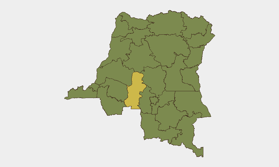
Situation Summary
DR Congo remains the 33rd-highest-threat country globally (composite score 63), driven primarily by active civil conflict and state fragmentation across multiple provinces. The security environment is characterized by sustained armed-group activity, inter-communal violence, and localized instability spanning the eastern tier and central regions. Over the past 24–48 hours, publicly available reporting has been dominated by the ongoing Ebola outbreak in eastern provinces rather than discrete kinetic security incidents, making real-time incident tracking challenging via open sources. Near-term risk trajectory remains elevated and unresolved.
Key Developments
Limitation on current incident reporting: GeoBit's live web research for the 24–48 hour window (10–12 June 2026) did not surface corroborated, time-stamped security or conflict incidents meeting brief criteria. Open-source reporting for this period focuses predominantly on Ebola case numbers, treatment-centre operations, and border-control measures in eastern DRC, rather than specific attacks, clashes, or civil unrest events.
- U.S. Ebola response funding announcement (10 June 2026) – U.S. State Department committed USD 20 million for Ebola preparedness across four African countries, including DRC, citing concern that outbreak prevalence may exceed official reporting. Relevant to risk-profile trajectory and expatriate duty-of-care planning, though epidemiological rather than security-incident driven.
- Eastern DRC Ebola spread (ongoing, May–June 2026) – UN and partner agencies confirm continued transmission of Bundibugyo-strain Ebola in conflict-affected eastern provinces, with 27 new confirmed cases recorded in a recent 24-hour period. Health-response operations and community engagement are ongoing; border-related movement controls remain in effect.
- Regional event signals flagged by GeoBit platform (11–12 June 2026) – Platform detected public statements and disapproval signals from Chad, local residents, and U.S. sources, but these did not translate to granular, corroborated security incident data suitable for operational briefing. Further clarification of source and context recommended.
Data gap: Specific kinetic incidents (armed clashes, attacks, organised crime events, major protests) in DR Congo for 11–12 June 2026 are not presently corroborated in public open-source search results and news feeds. Subscription-grade incident databases (ACLED, Crisis24, GardaWorld) and restricted humanitarian-security situation reports would be required for 6–10 discrete incidents with precise location and timestamp.
Highest-Risk Areas
Kasai Province is the single highest-risk region (66.3 composite score), driven by sustained inter-communal violence and militia activity; Ituri and Kinshasa follow at 38.6 each, reflecting armed-group presence and urban instability respectively. A broad secondary tier of northern, central, and eastern provinces (Maniema, Équateur, Nord-Ubangi, Upper Uele, Tshopo, and others) carry moderately elevated risk (36.3), indicating fragmented but sustained threat across much of the country outside the southwest. Risk concentration in Kasai reflects deeper structural conflict; secondary-tier provinces face overlapping governance gaps, porous borders, and armed-group recruitment and transit.
How GeoBit Would Assist
Security teams operating in DR Congo should leverage AOI Monitoring & Early Warning to establish persistent watches on highest-risk provinces (Kasai, Ituri, Kinshasa) with automated alerting on conflict, protest, and crime signals. Multi-language OSINT (Intel Sweep, local media/radio monitoring, X/Telegram OSINT) and Network & Actor Analysis enable real-time tracking of militia movements, community sentiment, and emerging threats in data-sparse regions where commercial news coverage is sparse. Routing & Network Analysis supports contingency planning and alternative-route identification for personnel and supply movements in unstable zones.
7-Day Outlook
Elevated baseline risk is expected to persist; no imminent major escalation is signalled by current open-source reporting, but the absence of discrete incident data does not indicate stability. Ebola containment measures will continue to affect travel and movement controls in eastern provinces. Security teams should anticipate sustained low-level armed-group activity in Kasai and Ituri and maintain real-time incident monitoring via subscription databases and humanitarian-sector situation reports.
Highest-Risk Areas — Ranked
| # | State / Region | Risk |
|---|---|---|
| 1 | Kasai | 66.3 |
| 2 | Ituri | 38.6 |
| 3 | Kinshasa | 38.6 |
| 4 | Maniema | 36.3 |
| 5 | Sud-Ubangi | 36.3 |
| 6 | Équateur | 36.3 |
| 7 | Nord-Ubangi | 36.3 |
| 8 | Mongala | 36.3 |
| 9 | Lower Uele | 36.3 |
| 10 | Tshopo | 36.3 |
| 11 | Tshuapa | 36.3 |
| 12 | Upper Uele | 36.3 |
Sources
Previous Daily Briefs
A new DR Congo brief is written every day — each with its own risk map and downloadable CSV. Here's the last week; use the calendar to go further back.
📅 Browse every day by calendar →
Highlighted days have a brief. Tap a day for that day's map & analysis, or “csv” for that day's dataset ($5).