Situation Summary
Eritrea remains a high-baseline, low-volatility threat environment for corporate and NGO operations. While no discrete security incidents have been reported in the last 24–48 hours, the country faces persistent structural risks: arbitrary detention of over 10,000 individuals across 300+ sites, ongoing political repression, and unresolved border tensions with neighbours. The threat landscape is stable but not improving; risk concentrates in western and southern regions rather than the capital.
Key Developments
- No verifiable new incidents in the last 24–48 hours. Open-source feeds, wire services, and regional reporting do not show newly timestamped security events, protests, arrests, or infrastructure disruptions in Eritrea between 12–13 July 2026.
- UN Human Rights Council renewed Special Rapporteur mandate (7 July 2026, Geneva). The Council reaffirmed oversight of Eritrea's detention and human-rights practices, citing over 10,000 persons in arbitrary detention and systematic torture. This signals continued international scrutiny but reflects a standing governance issue rather than a triggering incident.
- Australian Smartraveller advisory remains at "reconsider travel" level (ongoing). No new advisory update or incident-driven downgrade/upgrade has been documented in the last 48 hours; the advisory reflects persistent border-tension and consular-access concerns.
- No new cross-border military activity reported (last 24–48h). While Ethiopia and Sudan remain sources of low-level border friction, no fresh escalation or troop movements have been independently corroborated in the immediate window.
Highest-Risk Areas
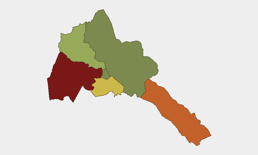
Gash-Barka region (risk score 92) and the Southern Red Sea Region (75) drive Eritrea's threat profile. Gash-Barka's western location and proximity to Sudanese border volatility elevates risk of spillover conflict, smuggling, and uncontrolled movement; Southern Red Sea faces similar cross-border exposure and limited state capacity. Debub Region (68) and Anseba (55) maintain elevated but secondary risk. By contrast, Maekel Region (18), which includes the capital Asmara, remains the safest zone, though still subject to internal-security controls and restricted movement. Regional risk is primarily structural (borders, state capacity, detention infrastructure) rather than event-driven.
How GeoBit Would Assist
Security teams operating in or near Eritrea should deploy AOI Monitoring & Early Warning on high-risk zones (Gash-Barka, Southern Red Sea) to detect cross-border incursions, smuggling, or protest activity before escalation. OSINT Fusion across X/Twitter, Telegram, and regional news feeds—combined with multi-language search and entity extraction—enables continuous detection of arrests, displacement, or militia activity not yet covered by mainstream wire services. Routing & Network Analysis supports duty-of-care planning for staff transit, identifying alternative routes and safe zones around detention sites and border flashpoints.
7-Day Outlook
No acute security catalyst is visible in the near term. Risk trajectory remains stable at current baseline: persistent detention and repression without imminent outbreak of mass unrest or border conflict. Teams should maintain standard vigilance protocols and monitor for any UN or diplomatic statements that might signal escalation in the governance environment.
Highest-Risk Areas — Ranked
| # | State / Region | Risk |
|---|---|---|
| 1 | Gash-Barka | 92 |
| 2 | Southern Red Sea Region | 75 |
| 3 | Debub Region | 68 |
| 4 | Anseba | 55 |
| 5 | Maekel Region | 18 |
| 6 | Northen Red Sea Region | 0 |
Sources
Previous Daily Briefs
A new Eritrea brief is written every day — each with its own risk map and downloadable CSV. Here's the last week; use the calendar to go further back.
📅 Browse every day by calendar →
Highlighted days have a brief. Tap a day for that day's map & analysis, or “csv” for that day's dataset ($5).
Atlas — our AI intelligence desk — emails them this snapshot personally. Nothing else, no list.