Situation Summary
Guatemala remains at moderate global risk (composite threat score 27, rank #53), with no major nationwide security incidents or civil unrest confirmed in the last 24–48 hours. The primary operational risks are localized violent crime in metropolitan areas and weather-driven infrastructure disruption from recent heavy rainfall and flooding. The country operates under a *estado de prevención* (preventive state) following earlier prison-security crises, which maintains elevated security-force presence and potential constraints on assembly.
Key Developments
- Guatemala City, Puente Olímpico area (15 July 2026): A targeted armed attack on a vehicle under the Olympic bridge resulted in one fatality and prompted police road closures and traffic disruption in Zone 5 and adjacent areas.
- Nationwide rainfall and flooding (14–15 July 2026): Heavy precipitation caused transport and logistics disruption across multiple departments, including coastal and highland zones, with blocked road segments and infrastructure strain identified as the principal operational risk over the reporting window.
- Pacific offshore seismic events (13 July 2026): Two minor earthquakes were recorded without reported damage, casualties, or significant infrastructure impact, though they briefly elevated concern about stability and tsunami risk in coastal regions.
- Petén Department (mid-July 2026): The president inaugurated the first dedicated police headquarters in Petén, a security-infrastructure development intended to expand formal state presence in the northern department, historically associated with cross-border crime and trafficking.
- Preventive state framework (ongoing): The *estado de prevención* remains in effect, maintaining heightened security-force deployment and potential limits on public assembly; authorities warn that demonstrations and roadblocks can occur with risk of clashes or vandalism, though no large verified protests were confirmed in the last 24–48 hours.
Highest-Risk Areas
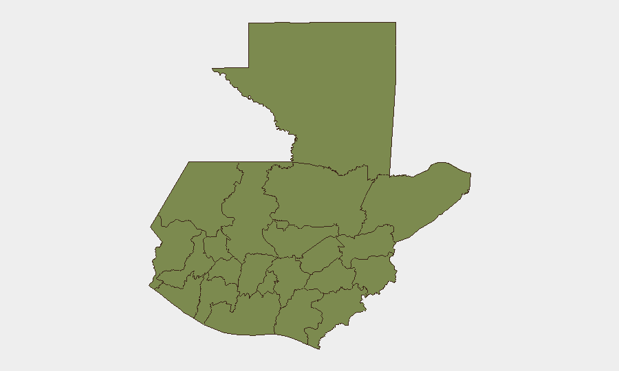
Alta Verapaz (composite risk 31.8) is significantly elevated above all other departments and merits priority attention, though the specific incident drivers are not detailed in current open-source reporting. Guatemala Department (risk 6.6), which includes the capital and its metropolitan zone, remains the second-highest-risk area due to localized armed crime clusters—particularly in Mixco (Zones 6–7) and near major transit corridors—and concentration of economic and political activity. The remaining ten departments cluster at risk scores below 2.2, indicating risk is heavily concentrated in the highlands (Alta Verapaz) and the capital region rather than dispersed nationwide.
How GeoBit Would Assist
A security team protecting personnel or assets in Guatemala would employ AOI (Area-of-Interest) Monitoring & Early Warning to track violent-crime hotspots in Mixco, Guatemala City, and Alta Verapaz in real time, with alerting for incidents near facilities or travel routes. Intel Sweep and OSINT Fusion (X/Twitter, local crime reporting, regional security briefs, multi-language search) would enable continuous tracking of *estado de prevención* enforcement, protest activity, and crime-cluster evolution. Routing & Network Analysis would support dynamic alternative-route planning to avoid road closures from weather, police operations, or demonstration sites.
7-Day Outlook
Weather-driven infrastructure disruption is likely to persist through the immediate near term as rainfall continues across multiple departments. Localized armed crime in metropolitan Guatemala will remain the principal threat to personnel movement and operations, with no indicators of nationwide escalation or large-scale civil unrest; the preventive-state framework suggests security-force presence will remain elevated but is not expected to trigger major policy shifts or restrictions within seven days.
Highest-Risk Areas — Ranked
| # | State / Region | Risk |
|---|---|---|
| 1 | Alta Verapaz | 31.8 |
| 2 | Guatemala Department | 6.6 |
| 3 | San Marcos | 2.2 |
| 4 | Petén | 1.8 |
| 5 | Huehuetenango | 1.8 |
| 6 | Quetzaltenango | 1.8 |
| 7 | Retalhuleu | 1.8 |
| 8 | Quiché | 1.8 |
| 9 | Totonicapán | 1.8 |
| 10 | Sololá | 1.8 |
| 11 | Chimaltenango | 1.8 |
| 12 | Suchitepéquez | 1.8 |
Sources
Previous Daily Briefs
A new Guatemala brief is written every day — each with its own risk map and downloadable CSV. Here's the last week; use the calendar to go further back.
📅 Browse every day by calendar →
Highlighted days have a brief. Tap a day for that day's map & analysis, or “csv” for that day's dataset ($5).
Atlas — our AI intelligence desk — emails them this snapshot personally. Nothing else, no list.