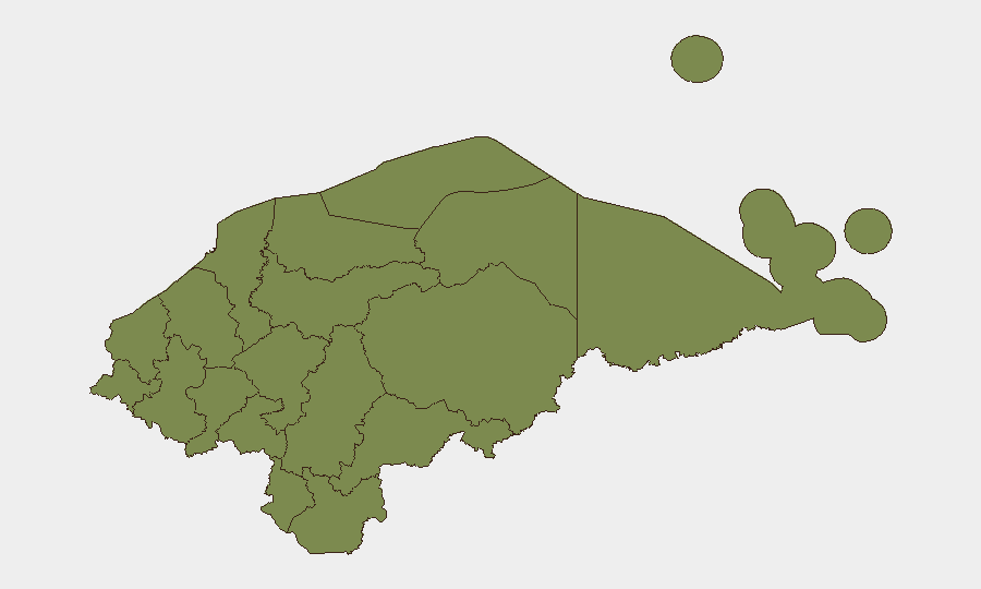
Situation Summary
Honduras remains at composite threat rank #61 globally, with a stable security posture over the past 48 hours marked by the absence of confirmed acute incidents. Structural risk is concentrated in organized crime, gang activity, and trafficking operations rather than active civil unrest or armed conflict. The country's security profile reflects chronic criminal pressure distributed across multiple departments, with Olancho Department emerging as the primary organized-crime hotspot, though no new specific incidents were reported during 26–28 June 2026.
Key Developments
- No confirmed discrete security incidents reported nationwide, 26–28 June 2026. Multi-source monitoring across major Honduran media outlets (La Prensa, El Heraldo, Proceso Digital), regional wires, and social media detected no verified roadblocks, armed clashes, infrastructure attacks, or major crime events with precise location and date markers during this 48-hour window.
- Olancho Department retains highest sub-national risk profile (31.4). Olancho's elevated composite score reflects persistent organized-crime and trafficking activity, but no newly reported clashes, blockades, or targeted attacks with specific dates were corroborated in recent reporting.
- Remaining 11 departments show near-parity baseline violence levels (all 1.4). El Paraíso, Copán, Cortés, Yoro, Santa Bárbara, and others maintain similar underlying criminal and gang-related risk, with no acute incidents cross-verified in 26–28 June reporting.
- No imminent escalation signals detected for next seven days. Current absence of acute incident activity and lack of triggering events in public reporting suggest no short-term acceleration of violence beyond endemic organized-crime operations.
Highest-Risk Areas
Olancho Department, located in eastern-central Honduras, stands as the dominant structural risk driver with a composite score of 31.4—substantially above all other departments. This elevation reflects its role as a primary corridor for organized-crime operations, trafficking networks, and gang activity. The remaining 11 departments cluster at near-equal baseline risk (1.4 each), indicating that while organized crime and criminal violence are distributed nationwide, Olancho's geography and weak state capacity have made it particularly attractive to criminal organizations. Security teams with operations in Olancho should assume elevated ambient risk; teams in other departments should maintain standard situational awareness without assuming proportional escalation.
How GeoBit Would Assist
Security teams monitoring Honduras should deploy AOI (Area-of-Interest) Monitoring & Early Warning to track Olancho and secondary departments for sudden incident clustering, combined with Intel Sweep and multi-language OSINT (social media, regional media feeds) to detect emergent roadblocks, clashes, or criminal activity shifts before they escalate. Network & Actor Analysis can map gang and trafficking-organization presence to refine risk models for specific routes and facilities. Routing & Network Analysis supports duty-of-care teams in identifying alternative transit corridors if primary routes are compromised.
7-Day Outlook
No acute escalation triggers are evident as of 28 June; the security environment is expected to remain stable at current baseline through early July barring unexpected external shocks or major criminal organization clashes. Structural risk from gangs and trafficking will persist, particularly in Olancho and transit corridors. Corporate teams should maintain standard operational security protocols without assuming imminent tactical incidents, while monitoring platforms remain active for sudden indicator changes.
Highest-Risk Areas — Ranked
| # | State / Region | Risk |
|---|---|---|
| 1 | Olancho | 31.4 |
| 2 | El Paraíso | 1.4 |
| 3 | Copán | 1.4 |
| 4 | Ocotepeque | 1.4 |
| 5 | Cortés | 1.4 |
| 6 | Yoro | 1.4 |
| 7 | Santa Bárbara | 1.4 |
| 8 | Lempira | 1.4 |
| 9 | Intibucá | 1.4 |
| 10 | Comayagua | 1.4 |
| 11 | La Paz | 1.4 |
| 12 | Valle | 1.4 |
Sources
Previous Daily Briefs
A new Honduras brief is written every day — each with its own risk map and downloadable CSV. Here's the last week; use the calendar to go further back.
📅 Browse every day by calendar →
Highlighted days have a brief. Tap a day for that day's map & analysis, or “csv” for that day's dataset ($5).