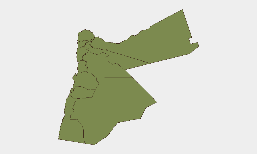
Situation Summary
Jordan faces elevated but contained regional security risk following Iranian missile activity in its airspace on July 10, 2026. A single confirmed incident—interception of eight Iranian missiles with no reported damage or casualties—has triggered official alerts and heightened vigilance across the country. While Jordan's global threat ranking remains moderate (#61), sub-national concentration of risk in Karak and Zarqa reflects localized instability; the broader security picture suggests reactive rather than imminent crisis conditions.
Key Developments
- Azraq / Jordanian airspace, 2026-07-10 — Jordanian military intercepted and shot down eight Iranian missiles that entered national airspace; no injuries or damage confirmed by official sources.
- Nationwide airspace, 2026-07-10 — U.S. Embassy in Jordan issued a security alert warning of potential missile, drone, or rocket activity in Jordanian airspace, escalating situational awareness across the country.
- Azraq region, 2026-07-10 — Iranian state-linked sources claimed missiles targeted a U.S.-linked military facility near Azraq; claims remain unverified by independent confirmation.
- Social/digital channels, 2026-07-10 — Multiple regional accounts (Smartraveller, local observers) reported sightings of missiles or drones in Jordanian airspace, consistent with official interception narrative.
- Media environment, 2026-07-11 — Iranian demands directed at media and Jordanian administrative sanctions on publications suggest information-environment tensions alongside kinetic activity.
- Domestic military activity, 2026-07-10 — Reports of conventional military force activity within Jordan (distinct from external threats) indicate possible heightened internal security posture or contingency operations.
Highest-Risk Areas
Karak (composite risk 31.5) and Zarqa (14.6) drive the national sub-national ranking, together accounting for the majority of tracked threat signals. Karak's significantly elevated score suggests either recent incident concentration, proximity to disputed or sensitive zones, or persistent instability drivers; Zarqa's secondary elevation may reflect industrial/urban density, refugee population dynamics, or logistical vulnerabilities. The remaining ten governorates cluster at baseline risk (1.5), indicating that security pressure is geographically concentrated rather than dispersed—a pattern consistent with regional rather than nationwide destabilization.
How GeoBit Would Assist
Teams managing personnel or assets in Jordan should leverage AOI Monitoring & Early Warning (persistent watch on Karak, Zarqa, and Azraq/Amman airspace with real-time alerting) and Conflict & Military tracking (force posture, weapons capability, and interception capacity monitoring) to maintain awareness of both kinetic threats and military response patterns. Intel Sweep and multi-language OSINT fusion enable rapid corroboration of unverified claims (e.g., Iranian targeting assertions) and detection of secondary threats in media or political messaging. Routing & Network Analysis supports contingency planning for alternative transportation corridors in high-risk governorates and around military zones.
7-Day Outlook
The immediate trajectory appears stabilizing: the July 10 missile interception was tactically contained, with no escalation or secondary strikes reported in the 24 hours following. However, Iranian public statements and Jordanian administrative responses suggest sustained political/information-environment tension; further verbal escalation or symbolic military activity is plausible but lower-probability than continued de-escalation. Karak and Zarqa require sustained monitoring for secondary incidents or spillover effects.
Highest-Risk Areas — Ranked
| # | State / Region | Risk |
|---|---|---|
| 1 | Karak | 31.5 |
| 2 | Zarqa | 14.6 |
| 3 | Irbid | 1.5 |
| 4 | Ajlun | 1.5 |
| 5 | Balqa | 1.5 |
| 6 | Jarash | 1.5 |
| 7 | Mafraq | 1.5 |
| 8 | Madaba | 1.5 |
| 9 | Amman | 1.5 |
| 10 | Tafilah | 1.5 |
| 11 | Aqaba | 1.5 |
| 12 | Maan | 1.5 |
Sources
Previous Daily Briefs
A new Jordan brief is written every day — each with its own risk map and downloadable CSV. Here's the last week; use the calendar to go further back.
📅 Browse every day by calendar →
Highlighted days have a brief. Tap a day for that day's map & analysis, or “csv” for that day's dataset ($5).
Atlas — our AI intelligence desk — emails them this snapshot personally. Nothing else, no list.