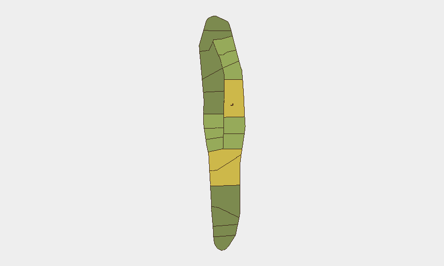
Situation Summary
Maldives remains a low-threat destination overall (composite score 2; no tracked discrete events at the national level), but localized security activity has intensified in the Malé–Hulhumalé corridor and at key transport nodes over the past 24–48 hours. Recent incidents span youth gang violence, religious-site vandalism, drug trafficking enforcement, and infrastructure fires, concentrated in urban and peri-urban zones. The incidents reflect operational enforcement and public-order management rather than systemic instability, though repetition of vandalism and youth altercations signals emerging micro-level volatility requiring close monitoring.
Key Developments
- Hulhumalé Phase II (Hiyaa Park), Sunday ~20:40 – A violent altercation between rival minor groups (ages 16–17) resulted in one arrest; police flagged the incident as part of a monitored pattern of youth group violence.
- Greater Malé area, Monday – Four Maldivian nationals arrested on suspicion of pre-planned group violence with sharp-edged weapons (knives); all remanded for 15 days with prior criminal records noted; two blades recovered at scene.
- Azeeza Mosque, Hulhumalé, Wednesday night – Second vandalism incident at the same location within days; glass-door damage reported; no injuries; separate investigation underway indicating persistence of targeting.
- Thilafushi waste site (near Malé), Sunday night–Monday morning – Fire at WAMCO facility extinguished by MNDF; temporary reduction in waste-acceptance capacity for Greater Malé region announced.
- Gan International Airport, Addu City, Saturday – Customs seized 5.5 kg of drugs (MVR 4.4 million) from two Indian passengers; trafficking from India cited as increasing trend, with concealment methods including shoe-sole insertion.
- Hanimaadhoo harbour, Haa Dhaalu Atoll, recent – Engine fire on a launch controlled by MNDF firefighters; no injuries; transport-infrastructure risk noted.
- Himmafushi (Kaafu), Sunday ~19:24 – Two Egyptian nationals arrested in an altercation; both deported and barred from re-entry following investigation completion.
Highest-Risk Areas
Malé (risk 85) and the Malé Atoll zone (68) dominate the sub-national ranking and are the primary loci of current incident activity, with Hulhumalé emerging as a secondary concentration point for youth violence and vandalism. The corridor's risk elevation reflects population density, tourism/expatriate presence, and police operational visibility; Hadhdhunmathi and Kolhumadulu (risks 65 and 60, respectively) remain flagged but have not generated recent incident reports in the current window. Outer atolls score lower, indicating geographic concentration of reportable security activity in the capital region and immediate surroundings.
How GeoBit Would Assist
Security teams operating in Maldives would benefit from AOI Monitoring & Early Warning capabilities focused on Malé, Hulhumalé, and Gan Airport to track emerging patterns of youth violence, vandalism, and drug-trafficking activity in near-real-time. OSINT fusion and multi-language web research (particularly Twitter/Telegram, local news, and police announcements) would corroborate incident timelines and identify secondary targets or coordinated activity. Network & Actor Analysis would map criminal group structures and expatriate-linked public-order risks to support duty-of-care protocols for staff mobility and premises security in high-risk zones.
7-Day Outlook
Youth gang activity and vandalism targeting religious sites are likely to remain elevated in the Malé–Hulhumalé zone through the near term absent significant police intervention or community intervention; drug trafficking enforcement at Gan Airport will persist. No indicators suggest escalation to organized violence or terrorism, but repetition of youth altercations and targeted vandalism warrant continued close surveillance to detect organized plotting or cross-atoll coordination.
Highest-Risk Areas — Ranked
| # | State / Region | Risk |
|---|---|---|
| 1 | Malé | 85 |
| 2 | Malé Atoll | 68 |
| 3 | Hadhdhunmathi | 65 |
| 4 | Kolhumadulu | 60 |
| 5 | Felidhu Atoll | 58 |
| 6 | Mulaku Atoll | 55 |
| 7 | Faadhippolhu | 52 |
| 8 | South Miladhunmadulu | 48 |
| 9 | North Miladhunmadulu | 45 |
| 10 | South Nilandhe Atoll | 44 |
| 11 | North Nilandhe Atoll | 42 |
| 12 | South Ari Atoll | 40 |
Sources
Previous Daily Briefs
A new Maldives brief is written every day — each with its own risk map and downloadable CSV. Here's the last week; use the calendar to go further back.
📅 Browse every day by calendar →
Highlighted days have a brief. Tap a day for that day's map & analysis, or “csv” for that day's dataset ($5).
Atlas — our AI intelligence desk — emails them this snapshot personally. Nothing else, no list.