Situation Summary
New Zealand remains a low-risk operating environment globally (rank #163, composite threat score 4.0) with limited confirmed security incidents in the past 48 hours. The principal disruption on 26 June is weather-driven rather than threat-actor-driven: a powerful storm has disabled Wellington's air transport hub and caused widespread regional travel delays. Underlying signals across the platform suggest labour tensions, localized civic friction, and routine government/media commentary, but none have crystallized into verifiable incidents with direct security or duty-of-care impact outside the storm event.
Key Developments
- Wellington region, 26 June 2026 – A severe storm brought air traffic to a standstill, resulting in hundreds of flight cancellations, downed trees, and significant disruption to travel through the capital. This is the only confirmed incident-level event with concrete operational risk in the last 48 hours.
- Union activity flagged (25 June) – GeoBit platform detected public statements involving unions and hospital sector; signals do not currently indicate escalation to disruption or work stoppages, but sentiment bears routine monitoring in Wellington and Auckland regions.
- Waikato regional disapproval signal (25 June) – A localized disapproval event was flagged in Waikato; open-source corroboration is limited and no verifiable disruption or security consequence has been confirmed.
- Cyber and strategic advisories (26 June) – Five Eyes and New Zealand National Cyber Security Centre joint statements on AI-linked cyber risk have circulated; these are strategic national-level warnings, not discrete operational incidents.
- Law enforcement activity (25 June) – An arrest/detain event was logged involving Parliament; insufficient open-source detail to assess scale or security implications at this time.
- No verifiable civil unrest, conflict, or critical infrastructure failure beyond the weather event has been confirmed in the last 48 hours through open-source monitoring.
Highest-Risk Areas
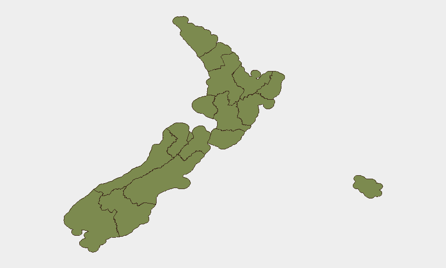
Canterbury carries the highest composite risk score (31.7) and warrants elevated monitoring; Wellington (17.7) is the second-highest risk area and is currently experiencing weather-related operational disruption that may compound pre-existing tensions. Auckland (7.2) shows moderate risk signals consistent with urban complexity and labour/civic activity. The remaining regions (Waikato through Taranaki) score materially lower and are considered lower-priority for acute incident watch, though Waikato's recent disapproval signal suggests a localized friction point to track. The concentration of risk in Canterbury and Wellington suggests that security and duty-of-care resources should be weighted toward those regions for the near term.
How GeoBit Would Assist
Security teams should employ AOI Monitoring & Early Warning (persistent watch on Canterbury, Wellington, and Auckland with alerting thresholds) to detect escalation of labour, civic, or political friction before disruption occurs. Intel Sweep, OSINT Fusion & Corroboration, and X/Twitter OSINT provide real-time signal cross-check to distinguish genuine security incidents from routine statements and to validate open-source reporting. Routing & Network Analysis and Maritime & Aviation tracking are operationally essential for supply-chain and personnel continuity planning around Wellington's current air-transport outage.
7-Day Outlook
Near-term risk is expected to remain low to moderate. The Wellington storm will likely clear within 1–2 days, though recovery of air services may take 2–3 days. Labour and civic signals in Canterbury and Wellington should be monitored for signs of escalation; if none materializes by early July, risk posture may ease. No indicators currently suggest imminent conflict, large-scale civil unrest, or critical infrastructure failure beyond weather effects.
Highest-Risk Areas — Ranked
| # | State / Region | Risk |
|---|---|---|
| 1 | Canterbury | 31.7 |
| 2 | Wellington | 17.7 |
| 3 | Auckland | 7.2 |
| 4 | Waikato | 3.7 |
| 5 | West Coast | 2.9 |
| 6 | Chatham Islands | 2.1 |
| 7 | Northland | 2.1 |
| 8 | Gisborne | 2.1 |
| 9 | Marlborough | 2.1 |
| 10 | Southland | 2.1 |
| 11 | Otago | 2.1 |
| 12 | Taranaki | 1.7 |
Sources
Previous Daily Briefs
A new New Zealand brief is written every day — each with its own risk map and downloadable CSV. Here's the last week; use the calendar to go further back.
📅 Browse every day by calendar →
Highlighted days have a brief. Tap a day for that day's map & analysis, or “csv” for that day's dataset ($5).