Situation Summary
Fiji remains a low-threat environment globally (rank #74, composite score 28), with no tracked security incidents in the reporting period. The country's risk profile is shaped primarily by localized drug and weapons trafficking rather than organized conflict or political instability. Recent government announcements on constitutional referendum timing and public-holiday rescheduling reflect routine administrative activity without immediate security implications.
Key Developments
- Suva, 5 October 2026: Prime Minister Sitiveni Rabuka announced a constitutional referendum scheduled for 9 December 2026 and suspended general-election campaigning. Civil-society groups objected that the referendum had not yet satisfied all legal requirements, signaling potential procedural tension ahead of the vote.
- Nationwide, announced in Suva, 9 October 2026: The government issued a revised Gazette reclassifying Monday, 12 October, as the observed Fiji Day public holiday, displacing the previous holiday arrangement and affecting government and commercial operating schedules across all regions.
Note on historical context: Prior to the 7-day window, Fiji Police and Republic of Fiji Military Forces conducted joint operations in Solovi (Nadi) and Lautoka on 1 October 2026, resulting in seizures of suspected illicit drugs and ammunition and multiple arrests. These operations reflect ongoing enforcement activity against trafficking networks but do not indicate a material escalation in regional threat levels.
Highest-Risk Areas
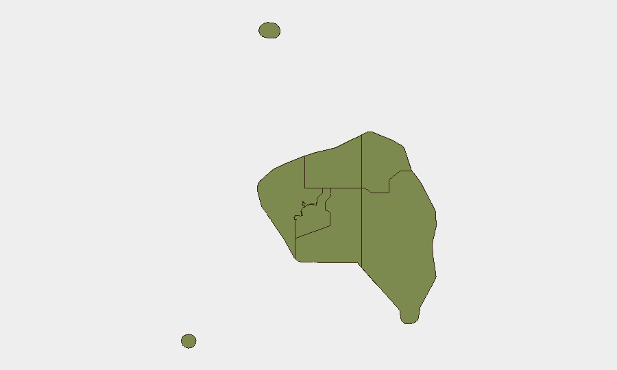
The Western region (composite risk score 85) dominates the sub-national threat landscape, driven by trafficking infrastructure and enforcement operations in Nadi and Lautoka—Fiji's principal commercial and port hubs. The Central region (risk 72) ranks second and likely reflects Port of Suva activity and urban crime in the capital. Eastern (45), Northern (38), and Rotuma (12) regions carry substantially lower scores, indicating that security management priorities should concentrate on the western and central corridors where transnational drug and weapons flows present the most persistent concern.
How GeoBit Would Assist
Intel Sweep and OSINT fusion would enable continuous monitoring of trafficking networks, arrest patterns, and enforcement operations across Fiji's ports and urban centers, supporting early warning of supply-chain disruptions or organized crime escalation. AOI Monitoring & Early Warning on the Western region's high-traffic corridors (Nadi, Lautoka) and the Port of Suva would provide persistent geospatial alerting if concentrations of enforcement activity or criminal incidents spike. Network & Actor Analysis would map trafficking organizations and corruption vectors, allowing duty-of-care teams to assess exposure and adjust supply-chain or personnel-movement strategies proactively.
7-Day Outlook
The constitutional referendum scheduled for 9 December will likely dominate political discourse in the coming weeks; any escalation in civil-society opposition or legal challenges could create procedural uncertainty but is not expected to trigger widespread unrest. Trafficking enforcement in the Western region will remain steady-state, with no indicators of major organizational restructuring or territorial conflict. Personnel and asset security in Fiji should continue to monitor Western-region logistics operations and maintain routine situational awareness in Suva's central business district.
Highest-Risk Areas — Ranked
| # | State / Region | Risk |
|---|---|---|
| 1 | Western | 85 |
| 2 | Central | 72 |
| 3 | Eastern | 45 |
| 4 | Northern | 38 |
| 5 | Rotuma | 12 |
Sources
Previous Weekly Briefs
A new Fiji brief is written every Monday, covering the week — each with its own risk map and downloadable CSV. Use the calendar to go further back.
- October 5, 2026
- September 28, 2026
- September 21, 2026
- September 14, 2026
- September 7, 2026
- September 2, 2026
- August 31, 2026
📅 Browse past briefs by calendar →
Highlighted days have a brief. Tap a day for that day's map & analysis, or “csv” for that day's dataset ($5).
Atlas — our AI intelligence desk — emails them this snapshot personally. Nothing else, no list.