Situation Summary
Oman remains a low-threat operating environment globally (rank #69), but maritime security in adjacent waters—particularly the Strait of Hormuz and Gulf of Oman—has deteriorated sharply in the past 48 hours. Multiple vessel attacks, crew injuries, and missing persons have been reported off Oman's coast, triggering suspension of international maritime evacuation operations and triggering competing claims over transit-route authority and fees. Onshore security in all populated governorates remains stable; the threat is concentrated in maritime zones and driven by regional power dynamics, not domestic instability.
Key Developments
- June 30, Musandam Governorate (Strait of Hormuz): An oil tanker was attacked off Oman's Musandam coast, resulting in at least four crew injuries and full evacuation of all 20 personnel.
- June 30, Gulf of Oman (Oman coastal waters): A Singapore-flagged cargo vessel transiting the Strait of Hormuz was struck by a projectile or drone near the Oman coast, damaging the bridge; no injuries reported but significant asset/operational impact.
- June 29–30, Gulf of Oman (unspecified Oman-adjacent waters): Social media reporting indicates two tanker attacks within 48 hours with Indian crew members affected, including two reported missing persons in at least one incident.
- June 30 (regional maritime governance): UN International Maritime Organization suspended its evacuation plan for stranded vessels in the Strait of Hormuz, citing inadequate security guarantees and seafarer safety concerns.
- June 30 (Oman coastal coordination): Authorities announced temporary authorized coastal sea routes managed by Oman to support movement of stranded vessels and evacuation of affected seafarers in coordination with international maritime bodies.
- June 30 (Iranian declarations): Iran's Islamic Revolutionary Guard Corps reiterated that only Iranian-designated routes are authorized through the Strait of Hormuz and warned against alternative passages, directly restricting navigation options for vessels serving Omani ports.
- June 30 (maritime fee negotiations): Reports indicate Iran and Oman are negotiating a plan to collect fees or "service payments" from transiting ships, with disagreement over voluntary vs. mandatory status, creating regulatory uncertainty for shipping operations linked to Omani ports.
Highest-Risk Areas
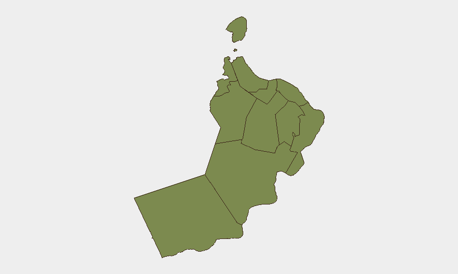
Al Wusta Governorate is the only sub-national region with elevated risk (31.8), but this reflects geographic exposure to maritime chokepoints and southern maritime transit corridors rather than internal instability. All other governorates, including Muscat (the capital and commercial hub), register at 1.8—essentially baseline risk. The critical vulnerability is not territorial but maritime: Oman's shoreline, particularly Musandam Governorate and waters adjacent to the Strait of Hormuz, face elevated exposure to regional maritime attacks and transit disruption driven by extra-territorial actors and competing claims over navigation authority.
How GeoBit Would Assist
Security teams with personnel or assets in Oman should employ Maritime & Aviation tracking to monitor vessel movements and incident patterns in the Strait of Hormuz and Gulf of Oman in real time. AOI Monitoring & Early Warning on defined maritime corridors and port approaches would provide persistent alerting of attacks, route closures, or regulatory changes. Routing & Network Analysis capabilities enable identification of alternative logistics and personnel-transit routes that circumvent high-risk maritime zones, while Intel Sweep (social media OSINT, multi-language feeds, and entity extraction) tracks Iranian and regional authorities' declarations on route authorization and fee structures affecting operational compliance.
7-Day Outlook
Vessel attacks are likely to continue or intensify over the near term given the apparent absence of coordinated regional enforcement and competing authority claims over transit routes. Expect ongoing regulatory friction between Iran, Oman, and international maritime bodies, with potential for additional temporary route closures or crew evacuation operations. Organizations with shipping operations or personnel transiting the Strait of Hormuz should anticipate further disruption and escalating compliance/fee uncertainty over the next week.
Highest-Risk Areas — Ranked
| # | State / Region | Risk |
|---|---|---|
| 1 | Al Wusta Governorate | 31.8 |
| 2 | Muscat Governorate | 1.8 |
| 3 | Al Buraymi Governorate | 1.8 |
| 4 | Ad Dhahirah Governorate | 1.8 |
| 5 | Musandam Governorate | 1.8 |
| 6 | Al Batinah North Governorate | 1.8 |
| 7 | Al Batinah South Governorate | 1.8 |
| 8 | Ad Dakhiliyah Governorate | 1.8 |
| 9 | Ash Sharqiyah North Governorate | 1.8 |
| 10 | Ash Sharqiyah South Governorate | 1.8 |
| 11 | Dhofar Governorate | 1.8 |
Sources
Previous Daily Briefs
A new Oman brief is written every day — each with its own risk map and downloadable CSV. Here's the last week; use the calendar to go further back.
📅 Browse every day by calendar →
Highlighted days have a brief. Tap a day for that day's map & analysis, or “csv” for that day's dataset ($5).