Situation Summary
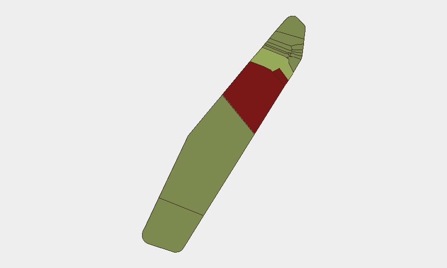
Palau remains a low-threat environment with no confirmed security incidents, civil unrest, crime spikes, or infrastructure disruptions reported in the past 24–48 hours. The nation ranks #203 globally (composite threat score 2), reflecting a stable baseline. However, sub-national risk concentration in Peleliu and Angaur—driven by historical conflict legacies, limited governance capacity, and maritime boundary sensitivities—warrants targeted awareness for organizations with operations in those states.
Key Developments
No discrete security, conflict, civil unrest, crime, or travel-disruption events have been confirmed in Palau within the last 24–48 hours. Live web research across news aggregators, social media (X/Twitter), travel advisories, and regional conflict trackers identified no new incidents, dated statements, or operational disruptions specific to Palau during this window.
Highest-Risk Areas
Peleliu (risk 92) and Angaur (risk 88) significantly outpace other states and account for the majority of Palau's residual risk profile. Both states are historically sensitive due to World War II legacy sites, limited civilian infrastructure, disputed maritime claims, and lower population density—factors that reduce government presence and create governance gaps. Koror (risk 45), the economic and administrative hub, carries moderate risk tied to port operations and higher population density; remaining states cluster below risk 35, indicating distributed but lower-order concerns. Organizations operating in Peleliu or Angaur should maintain heightened situational awareness and contingency protocols.
How GeoBit Would Assist
Security teams monitoring Palau should deploy AOI Monitoring & Early Warning on Peleliu and Angaur to detect emerging political, maritime, or incident signals before they affect operations. Intel Sweep and multi-language OSINT fusion across news, social media, and regional conflict feeds provide real-time corroboration and early warning of unrest, strikes, or infrastructure disruptions. Maritime & Aviation tracking, coupled with Routing & Network Analysis, enable rapid identification of port or airport disruptions and alternative supply/evacuation routes, critical for island-dependent logistics.
7-Day Outlook
Palau's security posture is expected to remain stable over the next week, absent unforeseen regional developments (e.g., typhoon season escalation, maritime incidents, or political friction in neighboring states). Routine monitoring of Peleliu and Angaur should continue; no specific triggers or warning indicators have emerged. Organizations should maintain standard duty-of-care protocols and refresh contingency plans quarterly.
Highest-Risk Areas — Ranked
| # | State / Region | Risk |
|---|---|---|
| 1 | Peleliu | 92 |
| 2 | Angaur | 88 |
| 3 | Koror | 45 |
| 4 | Melekeok | 35 |
| 5 | Airai | 32 |
| 6 | Ngatpang | 28 |
| 7 | Ngeremlengui | 26 |
| 8 | Ngaraard | 25 |
| 9 | Ngardmau | 24 |
| 10 | Aimeliik | 23 |
| 11 | Ngiwal | 22 |
| 12 | Ngchesar | 21 |
Previous Daily Briefs
A new Palau brief is written every day — each with its own risk map and downloadable CSV. Here's the last week; use the calendar to go further back.
📅 Browse every day by calendar →
Highlighted days have a brief. Tap a day for that day's map & analysis, or “csv” for that day's dataset ($5).
Atlas — our AI intelligence desk — emails them this snapshot personally. Nothing else, no list.