Situation Summary
Panama's overall security posture remains stable, with no major armed conflict, large-scale civil unrest, or terrorism verified in the last 24–48 hours. Current threat drivers are weather-related infrastructure disruption, ongoing organized-crime and anti-corruption enforcement operations, and latent protest/crime risk. The country ranks #58 globally (composite score 23), with Colón province significantly elevated above all other regions.
Key Developments
- Nationwide weather alerts (13–15 July 2026): Sinaproc declared "alerta verde" (green alert) in 19 districts across 10+ provinces and comarcas due to heavy rain, flooding, strong winds, and thunderstorms through 15 July, affecting transport and infrastructure.[5]
- Pacific coast tidal warning (14–15 July 2026): Sinaproc issued "mareas máximas" alert for all Pacific coastal areas through 19 July, with tides reaching 5.15 m peak expected 16 July, increasing coastal flooding and navigation risk.[5]
- Port of Balboa cargo-security operation (arrests 7 July, reported 14 July 2026): Australian Federal Police and Panamanian authorities announced arrest of 26 port workers following a two-year investigation into cocaine-contamination of refrigerated containers (>1 tonne) destined for Australia and Europe, confirming ongoing port-integrity vulnerability.[1]
- Multi-province anti-corruption raids (reported 9 July, ongoing): Fiscalía Anticorrupción and police conducted 22+ simultaneous raids across Panamá, Panamá Oeste, Colón, and Coclé provinces, detaining 16 people including 9 public officials in connection with a $40 million Dirección General de Ingresos loss, still in active news cycle.[2]
- Gang-related enforcement (David, Chiriquí, 9 July 2026): Police arrested a woman in the Cinco Esquinas sector for gang-related offense, reflecting sustained anti-gang policing in western Panama.[2]
- Episodic protest/blockade risk (14–15 July advisories): Updated travel advisories from Germany and Australia reiterate that while current conditions are calm, sporadic protests and road blockades remain possible on the Panamericana and in Panama City.[3][7]
Highest-Risk Areas
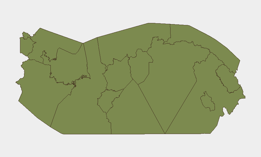
Colón province dominates the national risk profile with a composite score of 31.5—more than ten times that of the second-ranked region (Coclé, 2.9). This elevation reflects Colón's role as a major Caribbean port hub, historical gang and smuggling activity, and economic instability. Coclé, Los Santos, Panamá Province, Darién, and the autonomous comarcas (Guna Yala, Emberá-Wounaan, Ngäbe-Buglé, Naso Tjër Di) occupy a secondary tier (1.5–2.9) driven by border smuggling routes, limited state presence, and demographic vulnerability. Bocas del Toro and Chiriquí register equivalent risk (1.5), linked to narcotics transit and gang activity, though current enforcement activity suggests no acute destabilization.
How GeoBit Would Assist
Security teams should deploy AOI Monitoring & Early Warning on Colón's ports and key Caribbean entry points to detect anomalies in shipping, personnel movement, and supply-chain disruption tied to organized crime. Intel Sweep (global feeds, OSINT fusion, entity extraction) should track ongoing anti-corruption investigations and port-worker networks to anticipate follow-on enforcement or retaliation. Routing & Network Analysis can model alternative supply-chain and staff-travel corridors avoiding the Panamericana and coastal flood zones during the 19 July weather window.
7-Day Outlook
Severe weather will dominate operational risk through 19 July, with coastal flooding and road disruption likely to peak mid-week. Anti-corruption and organized-crime enforcement operations are expected to continue at current intensity. Absent major new political or security incident triggers, baseline protest risk remains elevated but episodic; however, close monitoring of Colón port activity and official statements is warranted given the scale of the cargo investigation.
Highest-Risk Areas — Ranked
| # | State / Region | Risk |
|---|---|---|
| 1 | Colón | 31.5 |
| 2 | Coclé | 2.9 |
| 3 | Los Santos | 2.2 |
| 4 | Panamá Province | 1.5 |
| 5 | Guna Yala | 1.5 |
| 6 | Darién | 1.5 |
| 7 | Emberá-Wounaan | 1.5 |
| 8 | Naso Tjër Di | 1.5 |
| 9 | Bocas del Toro | 1.5 |
| 10 | Ngäbe-Buglé | 1.5 |
| 11 | Chiriquí | 1.5 |
| 12 | Panamá Oeste | 1.5 |
Sources
Previous Daily Briefs
A new Panama brief is written every day — each with its own risk map and downloadable CSV. Here's the last week; use the calendar to go further back.
📅 Browse every day by calendar →
Highlighted days have a brief. Tap a day for that day's map & analysis, or “csv” for that day's dataset ($5).
Atlas — our AI intelligence desk — emails them this snapshot personally. Nothing else, no list.