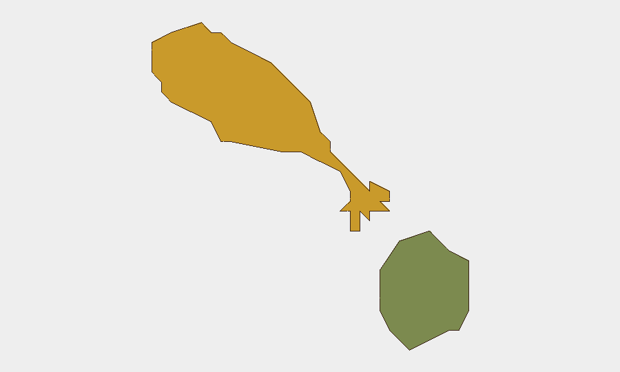
Situation Summary
Saint Kitts and Nevis remains a low-threat environment with no reported security incidents, civil unrest, or infrastructure disruptions in the past 24–48 hours. The country ranks #164 globally on composite threat score and maintains stable baseline conditions across both islands. A July 10 biometrics data-sharing agreement between the U.S. Department of Homeland Security and CARICOM IMPACS reflects regional security cooperation rather than response to domestic instability.
Key Developments
No discrete security incidents, protests, crime spikes, infrastructure failures, or travel disruptions were corroborated in Saint Kitts and Nevis during July 11–12, 2026. Targeted web research across news, regional alerts, and security feeds returned no location-specific reports matching standard security event criteria (civil unrest, violence, strikes, outages, curfews, or major crime events).
The only dated security-related development in the past 48 hours is diplomatic: on July 10, 2026, the Embassy of Saint Kitts and Nevis in Washington, D.C., participated in signing a Biometrics Data Sharing Partnership Memorandum of Cooperation with the U.S. Department of Homeland Security, covering CARICOM states with Citizenship by Investment programs. This is a bilateral/regional framework initiative, not a response to a domestic incident.
Generic weather forecasts and regional roundups list Saint Kitts and Nevis as part of broader Caribbean summaries but contain no security content specific to the islands.
Highest-Risk Areas
Saint Kitts (composite risk score 72) is the higher-risk island and drives the nation's overall threat profile, likely reflecting higher population density, concentration of commercial activity, and baseline urban crime patterns typical of Caribbean urban centers. Nevis (risk score 28) shows significantly lower risk, consistent with smaller population and more dispersed settlement. Neither island currently shows elevated acute threats; the differential reflects structural, not event-driven, risk distribution. Security teams should maintain standard duty-of-care protocols in Saint Kitts' main commercial and port areas while treating Nevis as lower-priority for immediate monitoring.
How GeoBit Would Assist
Security teams should employ GeoBit's AOI (Area of Interest) Monitoring & Early Warning capability to establish persistent watch on high-risk zones in Saint Kitts (ports, commercial districts, transport hubs) with automated alerting for protest activity, incidents, or infrastructure disruption. Intel Sweep and multi-language OSINT fusion (X/Twitter, Telegram, regional news feeds, YouTube) would provide real-time detection of emerging unrest, crime spikes, or political instability before mainstream reporting. GIS & Spatial Analysis combined with Routing & Network Analysis would support contingency planning for personnel movement and asset protection in the event of localized disruptions.
7-Day Outlook
No indicators suggest material threat escalation in the coming week. Standard baseline risk conditions are expected to persist across both islands. Security teams should maintain routine monitoring protocols while remaining alert to seasonal factors (hurricane preparedness in July–August) and any sudden political or economic developments at the regional CARICOM level that could indirectly affect the islands.
Highest-Risk Areas — Ranked
| # | State / Region | Risk |
|---|---|---|
| 1 | Saint Kitts | 72 |
| 2 | Nevis | 28 |
Sources
Previous Daily Briefs
A new Saint Kitts and Nevis brief is written every day — each with its own risk map and downloadable CSV. Here's the last week; use the calendar to go further back.
📅 Browse every day by calendar →
Highlighted days have a brief. Tap a day for that day's map & analysis, or “csv” for that day's dataset ($5).
Atlas — our AI intelligence desk — emails them this snapshot personally. Nothing else, no list.