Situation Summary
Saint Vincent and the Grenadines remains a low-threat environment with no confirmed security, crime, civil-unrest, or acute travel-risk incidents recorded in the last 24–48 hours. The nation ranks #192 globally on GeoBit's composite threat index (score 3), reflecting stable overall conditions. Baseline risks—petty crime, violent crime hotspots in urban parishes, and natural hazards (volcanic/seismic activity)—persist but show no acceleration or new triggering events as of 17 July 2026.
Key Developments
- No new incidents documented in the last 24–48 hours across all monitored threat categories (security, crime, civil unrest, political instability, infrastructure, travel risk) as of 15–17 July 2026.
- Baseline crime environment remains unchanged: Recent homicides and shootings in Glen and Golden Vale (10–14 July) fall outside the current 24–48 hour reporting window but reflect ongoing localized violent-crime patterns in Saint George parish typical of prior months.
- No protest activity, political statements, or demonstrations flagged in open-source reporting for the last two days.
- No infrastructure disruptions, transportation delays, or utility failures reported.
- Natural hazard status (La Soufrière volcano) remains within normal monitoring parameters; no new seismic or volcanic alerts issued.
Highest-Risk Areas
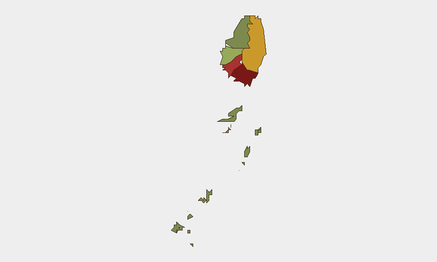
Saint George parish (risk score 92) and Saint Andrew (risk 78) drive the majority of in-country threat concentration, driven primarily by violent and property crime clustering in urban districts (Kingstown environs, Glen, Golden Vale). Charlotte (71) and Saint Patrick (58) show elevated but secondary risk; the Grenadines (12) and Saint David (34) present minimal threat. Corporate and expatriate personnel should maintain heightened situational awareness in Saint George and Saint Andrew, particularly in nighttime or isolated settings, while lower-risk rural and island areas permit standard baseline precautions.
How GeoBit Would Assist
Teams protecting personnel or assets in Saint Vincent should deploy AOI (Area-of-Interest) Monitoring & Early Warning on Kingstown and high-risk parishes to detect emergent protest, civil unrest, or surge in violent incidents in near real-time. OSINT Fusion & Corroboration (X/Twitter, local news, Telegram, YouTube) and multi-language search enable continuous scanning of local SVG media and social platforms for credible early signals of crime spikes, infrastructure failure, or political instability. GIS & Spatial Analysis supports secure facility siting and personnel routing away from documented crime hotspots in Saint George and Saint Andrew.
7-Day Outlook
Saint Vincent is forecast to remain in a stable, low-incident posture over the next 7 days absent major exogenous shocks (natural disaster, significant political event). Localized violent crime in urban Saint George and Saint Andrew will likely persist at baseline levels. Travel and operations should proceed under standard duty-of-care protocols with continued monitoring of local news and GeoBit alerts for any threshold breach.
Highest-Risk Areas — Ranked
| # | State / Region | Risk |
|---|---|---|
| 1 | Saint George | 92 |
| 2 | Saint Andrew | 78 |
| 3 | Charlotte | 71 |
| 4 | Saint Patrick | 58 |
| 5 | Saint David | 34 |
| 6 | Grenadines | 12 |
Sources
Previous Daily Briefs
A new Saint Vincent brief is written every day — each with its own risk map and downloadable CSV. Here's the last week; use the calendar to go further back.
📅 Browse every day by calendar →
Highlighted days have a brief. Tap a day for that day's map & analysis, or “csv” for that day's dataset ($5).
Atlas — our AI intelligence desk — emails them this snapshot personally. Nothing else, no list.