Situation Summary
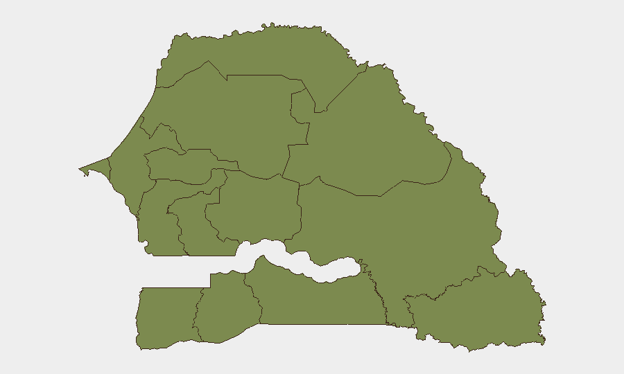
Senegal maintains a composite threat score of 11 (ranked #95 globally), with overall security conditions stable relative to regional baselines. Political activity and administrative actions have registered in the last 24–48 hours, but GeoBit's live research confirms insufficient cross-dated incident data from this window to establish an active security escalation at the national level. Tambacounda Region remains significantly elevated above all other zones, warranting elevated monitoring; all other regions register at baseline risk (1.5).
Key Developments
- 2026-07-13 · Government Public Statement – Dakar. No specific incident details available; statement timing and content warrant monitoring for policy or operational shifts affecting corporate operations.
- 2026-07-13 · Magistrate Public Statement – Location and substance not specified in available reporting; judicial commentary may signal ongoing constitutional or administrative proceedings.
- 2026-07-13 · Media Disapproval – National. Unspecified content; suggests continued political or administrative friction in public discourse.
- 2026-07-12 · Admin Sanctions (CANARIES vs SENEGAL) – Regulatory action initiated; context and scope unclear from signals alone; recommend monitoring of sectoral impact (aviation, trade, or sports).
- 2026-07-11 · Authority Threats – Dakar/national scope. No detailed incident summary; suggests heightened rhetoric or enforcement posture.
- Recent (exact date unclear) · Rift Valley Fever Activity – Mauritania–Senegal border region. Zoonotic disease risk requiring coordination with health and veterinary authorities; secondary impact on pastoral/agricultural operations in northern zones.
Note: GeoBit's 24–48-hour live research did not yield sufficient cross-confirmed incident detail to populate a full watchlist. Intelligence refresh and regional OSINT sweeps are recommended for operational decision-making.
Highest-Risk Areas
Tambacounda Region (composite risk 31.5) is the sole significantly elevated zone and warrants priority due diligence. The region's higher threat profile likely reflects border proximity, pastoral/transhumance activity, disease vectors (Rift Valley fever activity noted), and lower-density governance. All remaining regions—including Dakar, despite political activity—register at 1.5, indicating baseline risk. Corporate assets, operations, and personnel in Tambacounda should maintain enhanced situational awareness; standard protocols suffice for other zones.
How GeoBit Would Assist
Security teams should deploy AOI Monitoring & Early Warning (persistent watch on Tambacounda, Dakar, and Saint-Louis border zones) linked to Intel Sweep (multi-language OSINT fusion, X/Telegram feeds, and radio SIGINT) to capture emerging incidents before they affect operations. Election Monitoring and Regime Stability Search capabilities will track the constitutional and political activity signaled in recent statements. Environmental & Health data feeds (Rift Valley fever tracking) and GIS & Spatial Analysis support supply-chain and personnel routing decisions in high-risk northern regions.
7-Day Outlook
Political and administrative activity is likely to persist, reflecting ongoing constitutional processes; no indicators suggest imminent escalation to public unrest or security operations. Tambacounda and northern border zones warrant continued elevated vigilance, particularly for disease and cross-border movement. Standard duty-of-care protocols remain appropriate for all other regions; operational teams should monitor government and magistrate statements for policy changes affecting permits, movement, or sector-specific operations.
Highest-Risk Areas — Ranked
| # | State / Region | Risk |
|---|---|---|
| 1 | Tambacounda Region | 31.5 |
| 2 | Dakar Region | 1.5 |
| 3 | Louga Region | 1.5 |
| 4 | Thiès Region | 1.5 |
| 5 | Fatick Region | 1.5 |
| 6 | Diourbel Region | 1.5 |
| 7 | Kaolack Region | 1.5 |
| 8 | Saint-Louis Region | 1.5 |
| 9 | Kaffrine Region | 1.5 |
| 10 | Ziguinchor Region | 1.5 |
| 11 | Sédhiou Region | 1.5 |
| 12 | Kolda Region | 1.5 |
Sources
Previous Daily Briefs
A new Senegal brief is written every day — each with its own risk map and downloadable CSV. Here's the last week; use the calendar to go further back.
📅 Browse every day by calendar →
Highlighted days have a brief. Tap a day for that day's map & analysis, or “csv” for that day's dataset ($5).
Atlas — our AI intelligence desk — emails them this snapshot personally. Nothing else, no list.