Situation Summary
South Sudan remains at composite threat level #36 globally (score 55/100) with 212 tracked events as of 4 July 2026. Unity State dominates the risk profile with a score of 34.6—more than 7.5 times higher than any other state—indicating concentrated instability in oil-producing regions and pastoral conflict zones. Recent signals point to territorial occupation disputes and government investigative activity, though ground-truth confirmation of new incidents in the past 24–48 hours remains limited in available open sources. The trajectory suggests sustained fragmentation rather than imminent systemic collapse, but localized security deterioration in oil and pastoralist areas warrants close monitoring.
Key Developments
- 2 July 2026, South Sudan (location unspecified): Residents reported occupation of territory; investigative activity by South Sudan government authorities initiated. Specific location and casualty figures not yet confirmed in independent sources.
- 2 July 2026, South Sudan / Central African Republic border: Residents reported territorial occupation in cross-border context; underlying driver (pastoral displacement, resource dispute, or administrative boundary friction) requires clarification.
- Open-source limitation: No additional ground-truth incidents with confirmed date, location, and event type were corroborated in web research over the preceding 24–48 hours. Prior Sudan-related reporting (Port Sudan, El Obeid) falls outside South Sudan's geographic scope and should not be conflated with South Sudan developments.
*Note: Analysts are advised that sparse 24–48 hour incident confirmation does not indicate absence of threat; rather, it reflects reporting lag and limited open-source granularity in remote areas.*
Highest-Risk Areas
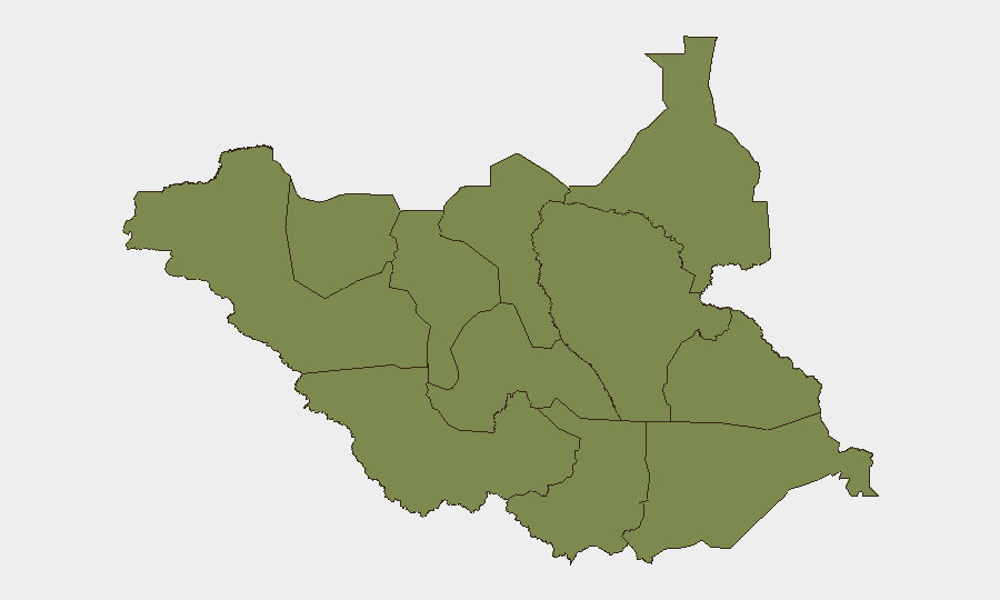
Unity State is the acute focal point, with a risk score of 34.6—substantially above the national composite of 55. This concentration reflects recurring pastoral conflict (cattle raiding, resource competition), oil-sector security incidents, and weak state capacity in remote areas. The remaining ten states cluster around 4.6, indicating either diffuse, lower-intensity risk or under-reporting in isolation. Northern Bahr el Ghazal, Upper Nile, Warrap, Jonglei, and the administrative areas (Ruweng, Greater Pibor) are secondary risk nodes where communal violence, militia activity, and IDP-related tension persist. Geographic exposure assessment should prioritize Unity State for staff, asset, and supply-chain security reviews; secondary vigilance is warranted in oil-zone corridor states and areas hosting large displaced populations.
How GeoBit Would Assist
Corporate security and risk teams can operationalize Area-of-Interest (AOI) Monitoring & Early Warning to set persistent watches over Unity State, oil infrastructure, and key transport routes, triggering alerts on new conflict, displacement, or administrative activity. Intel Sweep and multi-language OSINT fusion (X/Twitter, Telegram, local radio, YouTube) would surface ground-level incident reporting and sentiment shifts faster than formal press cycles. GIS & Spatial Analysis paired with Satellite & Imagery monitoring enables real-time assessment of displacement camps, roadblock placement, and force movement, informing duty-of-care decisions on staff transit and asset positioning.
7-Day Outlook
No major escalatory trigger is evident in the near term; however, the tight clustering of secondary states at low but uniform risk scores suggests fragmented, chronic instability rather than a single epicenter. Expect continued territorial disputes in pastoral zones and ongoing government investigative activity; Unity State remains the primary vector for impact to corporate operations. Seasonal factors (dry season, pastoralist migration) may intensify resource competition over the coming weeks. Duty-of-care posture should remain elevated, particularly for staff in or transiting oil-zone states.
Highest-Risk Areas — Ranked
| # | State / Region | Risk |
|---|---|---|
| 1 | Unity | 34.6 |
| 2 | Upper Nile | 4.6 |
| 3 | Northern Bahr el Ghazal | 4.6 |
| 4 | Western Bahr el Ghazal State | 4.6 |
| 5 | Ruweng Administrative Area | 4.6 |
| 6 | Warrap | 4.6 |
| 7 | Lakes | 4.6 |
| 8 | Jonglei | 4.6 |
| 9 | Greater Pibor Administrative Area | 4.6 |
| 10 | Western Equatoria | 4.6 |
| 11 | Central Equatoria | 4.6 |
| 12 | Eastern Equatoria | 4.6 |
Sources
Previous Daily Briefs
A new South Sudan brief is written every day — each with its own risk map and downloadable CSV. Here's the last week; use the calendar to go further back.
📅 Browse every day by calendar →
Highlighted days have a brief. Tap a day for that day's map & analysis, or “csv” for that day's dataset ($5).
Atlas — our AI intelligence desk — emails them this snapshot personally. Nothing else, no list.