Situation Summary
Sweden faces a fragmented but elevated near-term security picture driven by discrete operational incidents rather than systemic instability. Stockholm County dominates the composite risk score (31.3), reflecting multiple acute events—infrastructure fires, traffic collisions, and an armed-man police operation—concentrated in the past 48 hours. No coordinated threat campaign or protest movement is evident, but infrastructure vulnerability, maritime-safety gaps, and localized violent crime indicate persistent duty-of-care exposure for corporate and personnel operations.
Key Developments
- Norra länken, Stockholm (1–2 Aug): Cable fire closed a critical road tunnel, forcing traffic rerouting and congestion across central Stockholm's already-strained arterial network.
- Skansbron, Stockholm (1–2 Aug): Large fire and smoke beneath the central bridge disrupted traffic and emergency-response capacity in one of Sweden's densest urban zones.
- Off Tjörn, west coast (1–2 Aug): Mother and daughter remain missing after suspected leisure-boat collision with Norwegian cargo vessel; active maritime search and investigation ongoing with implications for west-coast pleasure-craft safety.
- Strandbaden, Höganäs, Skåne (2 Aug): Police conducted major operation around a villa area following report of armed man; preliminary weapons-offense classification; no injuries or detentions reported but localized disruption continuing.
- E6 near Rydebäck, Skåne (2 Aug): Vehicle collision caused major congestion on a primary regional motorway, illustrating traffic-artery bottleneck vulnerability.
- Trelleborg harbor, Skåne (2 Aug): Truck rolled and hung partly outside ferry railing while at sea; rescue and police response ongoing, highlighting maritime transport-safety risk.
- Road 509, Mark municipality, Västra Götaland (2 Aug): Head-on collision hospitalized four people; regional traffic disruption and elevated injury-risk environment noted.
- New migration-enforcement information duty (3 Aug): Six public authorities now required to notify police and security services of suspected illegal-residency cases; framework change takes effect today with potential for civil-society tensions and police interactions to intensify.
Highest-Risk Areas
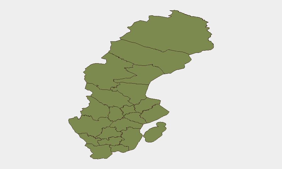
Stockholm County (risk 31.3) is the clear risk epicenter, accounting for the majority of the 16 tracked events and hosting two major infrastructure fires, multiple collisions, and the armed-man operation within 48 hours. Secondary risk is distributed across northern counties (Norrbotten, Västerbotten, Västernorrland) and scattered western/southern regions, all scoring 1.3 or below—indicating that Stockholm's concentration of population, transport density, and ongoing operational incidents is the dominant driver. The pattern reflects urban infrastructure vulnerability and localized acute events rather than geographic dispersion of threat.
How GeoBit Would Assist
Teams operating in Sweden should deploy AOI Monitoring & Early Warning on Stockholm County and major transport corridors (E6, road 509, ferry routes) to detect emerging infrastructure, collision, and maritime-safety trends in real time. Routing & Network Analysis would enable rerouting of personnel and cargo around the affected Norra länken and Skansbron zones and identify alternative motorway segments during congestion. Multi-language OSINT and sentiment analysis of Swedish and Nordic media feeds and Telegram channels would provide early signals of civil unrest or organized activity tied to the new migration-enforcement regime before escalation.
7-Day Outlook
Infrastructure incidents and traffic disruption are likely to persist as investigations into the fires and collisions continue and repairs commence; Stockholm's transport network will remain congested. The missing-persons search off Tjörn may extend operational complexity and emotional tension in coastal communities. Implementation of the new migration-enforcement information duty carries low-to-moderate risk of localized protest or civil-society friction over the next week, though no coordinated mobilization is evident to date.
Highest-Risk Areas — Ranked
| # | State / Region | Risk |
|---|---|---|
| 1 | Stockholm County | 31.3 |
| 2 | Norrbotten County | 1.6 |
| 3 | Jämtland County | 1.3 |
| 4 | Västerbotten County | 1.3 |
| 5 | Västernorrland County | 1.3 |
| 6 | Dalarna County | 1.3 |
| 7 | Gävleborg County | 1.3 |
| 8 | Skåne County | 1.3 |
| 9 | Blekinge County | 1.3 |
| 10 | Västra Götaland County | 1.3 |
| 11 | Halland County | 1.3 |
| 12 | Värmland County | 1.3 |
Sources
Previous Daily Briefs
A new Sweden brief is written every day — each with its own risk map and downloadable CSV. Here's the last week; use the calendar to go further back.
📅 Browse every day by calendar →
Highlighted days have a brief. Tap a day for that day's map & analysis, or “csv” for that day's dataset ($5).
Atlas — our AI intelligence desk — emails them this snapshot personally. Nothing else, no list.