Situation Summary
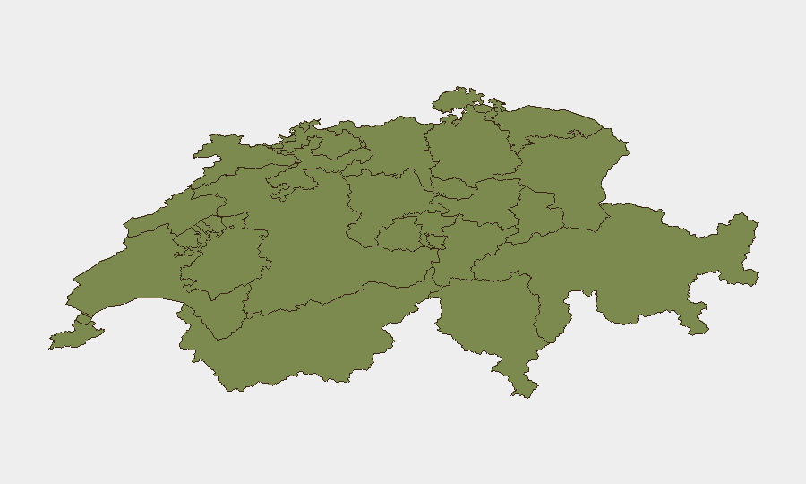
Switzerland maintains a low overall security threat environment (global composite score 14/100) with no major nationally significant incidents reported in the last 24–48 hours. However, sub-national risk concentration in Bern (31.3) and Ticino (22.5) reflects localized operational concerns requiring sector-specific monitoring. Current posture is stable, with threat trajectory remaining flat; routine traffic enforcement and infrastructure disruptions dominate the incident landscape.
Key Developments
- A1 motorway, St. Gallen–Neudorf to Meggenhus (24–25 July): Traffic accident caused significant congestion on this east–west transit corridor; temporary delays for commuters and freight logistics resolved within hours.
- A4 motorway, Flüelen–Sisikon, Uri/Schwyz border (24–25 July): Full bidirectional closure due to incident impact on north–south Alpine transit route; alternative routing required for commercial and passenger traffic.
- H21 mountain road, Orsières–Bourg-St-Bernard, Valais (24–25 July): Weather-related closure (snowfall) affected access to Grand-Saint-Bernard area; seasonal Alpine infrastructure vulnerability confirmed.
- Wey-Umzug parade, Lucerne city center (24–25 July): Approximately 45,000 attendees; event was peaceful but generated street closures and traffic restrictions until 17:00 local time; no security incidents reported.
- St. Gallen traffic enforcement (24–25 July): Police apprehended driver with extreme blood-alcohol level (9 per mille); reflects routine DUI enforcement rather than systemic instability.
- Ostermundigen, Bern (24–25 July): Police vehicle checks resulted in 5 formal charges and 12 fines across 239 vehicles; standard compliance operations with minor traffic friction.
- Event signals review (20–25 July): Analysis of 18 tracked events shows pattern of low-intensity public statements and administrative actions (Bern–student statement, migrant media engagement, U.S.–Geneva diplomatic signal); no escalation indicators or coordinated unrest detected.
Highest-Risk Areas
Bern's elevated composite risk (31.3) reflects administrative and political activity concentration, including government focal points and student-sector engagement; this is consistent with the canton's role as the national capital and does not indicate acute security deterioration. Ticino's secondary risk elevation (22.5) warrants monitoring for cross-border criminal or migration-related activity typical of southern Alpine transit zones. Geneva (13.7) maintains diplomatic-sector baseline risk. All remaining cantons cluster at minimal risk (1.3), indicating risk is highly geographically concentrated and not diffuse.
How GeoBit Would Assist
Sector teams would deploy AOI Monitoring & Early Warning on Bern (administrative nodes), Ticino (border-crossing infrastructure), and Geneva (diplomatic venues) to detect shifts in protest activity, migration flows, or cross-border incidents before operational impact. OSINT Fusion & Corroboration across multi-language feeds, Telegram/X, and government-linked advisories would provide real-time validation of routine incidents (traffic, weather) versus genuine security escalation. Routing & Network Analysis capabilities enable duty-of-care teams to pre-plan alternative transit routes for staff and assets transiting the A1, A4, and Alpine corridors, accounting for seasonal closures and incident-related disruptions.
7-Day Outlook
No material threat escalation is forecast for the next 7 days; Switzerland's stable baseline is expected to persist. Seasonal Alpine weather and routine traffic incidents will remain the primary operational constraint for logistics and travel; continued monitoring of Bern and Ticino for any shift from administrative to mobilized activity is prudent.
Highest-Risk Areas — Ranked
| # | State / Region | Risk |
|---|---|---|
| 1 | Bern | 31.3 |
| 2 | Ticino | 22.5 |
| 3 | Geneva | 13.7 |
| 4 | Zurich | 11.9 |
| 5 | Basel-City | 1.3 |
| 6 | Jura | 1.3 |
| 7 | Basel-Landschaft | 1.3 |
| 8 | Solothurn | 1.3 |
| 9 | Aargau | 1.3 |
| 10 | Lucerne | 1.3 |
| 11 | Vaud | 1.3 |
| 12 | Neuchâtel | 1.3 |
Sources
Previous Daily Briefs
A new Switzerland brief is written every day — each with its own risk map and downloadable CSV. Here's the last week; use the calendar to go further back.
📅 Browse every day by calendar →
Highlighted days have a brief. Tap a day for that day's map & analysis, or “csv” for that day's dataset ($5).
Atlas — our AI intelligence desk — emails them this snapshot personally. Nothing else, no list.