Situation Summary
Thailand's composite threat score (68, rank #26 globally) reflects persistent, localized security pressures rather than systemic instability. The past 48 hours have seen a marked spike in militant activity in the southern border provinces, with two coordinated IED attacks on police units injuring 11 officers across Yala and Pattani. Concurrently, tourism-dependent islands are experiencing criminal-network enforcement concerns, while Thai–Cambodian border tensions remain elevated but contained. The security environment is fragmented by region: Bangkok and the south face distinct threat vectors requiring differentiated monitoring.
Key Developments
- Thanto district, Yala province (19 June, 08:10 local): An IED detonated on a border patrol police unit's vehicle on the Ban Pulo Saniyae–Ban Sakai road, injuring six officers, two critically airlifted to Yala Hospital. Authorities cordoned the scene and initiated a perpetrator investigation.
- Mayo district, Pattani province (19 June, 11:30 local): A second bomb targeted a Pattani Police Special Operations unit near Ban Khuan Yi as officers returned from checkpoint deployment, injuring five officers transported to Mayo Hospital. Evidence collection is ongoing.
- Koh Samui & Koh Phangan, Surat Thani province (18–19 June): Tourism operators publicly demanded government action against "illegal networks" on both islands, citing reputational and security risks tied to organized crime. Industry pressure for sustained law-enforcement operations is rising.
- Thai–Cambodian border (18–19 June): Authorities characterize the border as "fragile but under control" with heightened military readiness and public messaging. No confirmed cross-border kinetic incidents reported in the past 48 hours, though political signaling remains elevated.
- Nationwide detentions & property operations (mid-June, referenced in current updates): Multiple arrests and detentions by police, military, and intelligence agencies continue nationwide; property seizure operations conducted 15–16 June remain under investigation with limited public disclosure of locations or targets.
Highest-Risk Areas
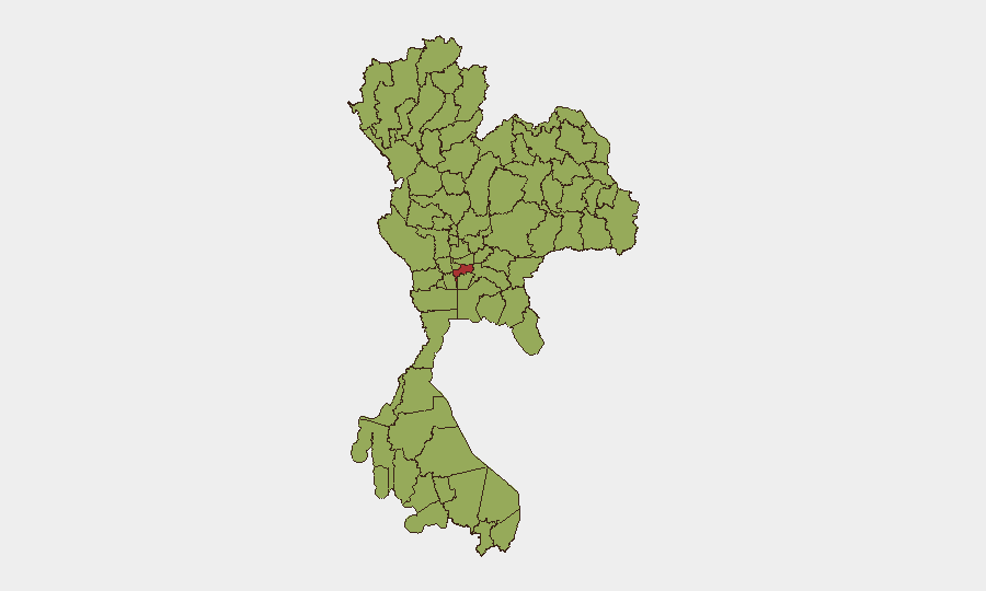
Bangkok (77.2) leads the composite ranking, driven by urban density, traffic/transit vulnerability, and historical protest/political flashpoints. The southern border provinces—Chiang Rai (59.7), Chiang Mai (59), Songkhla (58.2), and Phayao (58.2)—form a secondary cluster, concentrated in the north and deep south. The northern tier reflects ongoing drug-trafficking and cross-border insurgent activity; the Yala/Pattani corridor (not separately ranked but central to 19 June events) remains the most kinetically volatile, with organized militant cells conducting bombings against law enforcement. Tourism zones (Surat Thani, Krabi region) are rising in significance due to organized-crime expansion and investor concern.
How GeoBit Would Assist
Security teams should deploy AOI (area-of-interest) monitoring and early-warning tools on Yala, Pattani, and Songkhla provinces to detect militant activity patterns, including weapons caches and checkpoint operations. OSINT fusion and Telegram/social-media intelligence on criminal networks operating Koh Samui and Koh Phangan would enable early detection of organized-crime escalation and tourism-sector threats. Conflict event mapping and network-actor analysis pinpoint militant group structure and targeting cycles, allowing duty-of-care teams to synchronize personnel rotation and asset placement with heightened-risk windows.
7-Day Outlook
The two synchronized bombings on 19 June suggest either tactical coordination among militant cells or a deliberate uptick in operational tempo. Police and military are likely to increase checkpoint density and visible patrols, raising the risk of secondary incidents (ambushes, IED placement on alternate routes). Tourism-sector demand for law enforcement will amplify security operations on islands, potentially displacing criminal networks to less-monitored mainland routes and increasing volatility in transit corridors. Monitoring should be sustained across all southern provinces and Bangkok transit hubs through at least 25 June.
Highest-Risk Areas — Ranked
| # | State / Region | Risk |
|---|---|---|
| 1 | Bangkok | 77.2 |
| 2 | Chiang Rai Province | 59.7 |
| 3 | Chiang Mai Province | 59 |
| 4 | Songkhla Province | 58.2 |
| 5 | Phayao Province | 58.2 |
| 6 | Nong Khai Province | 57.5 |
| 7 | Chai Nat Province | 53.8 |
| 8 | Nakhon Pathom Province | 52.4 |
| 9 | Trat Province | 51.6 |
| 10 | Samut Prakan Province | 50.9 |
| 11 | Sa Kaeo Province | 49.4 |
| 12 | Yasothon Province | 49.4 |
Sources
Previous Daily Briefs
A new Thailand brief is written every day — each with its own risk map and downloadable CSV. Here's the last week; use the calendar to go further back.
📅 Browse every day by calendar →
Highlighted days have a brief. Tap a day for that day's map & analysis, or “csv” for that day's dataset ($5).