Situation Summary
Turkmenistan remains at a low baseline threat level with no confirmed security incidents in the last 24–48 hours. The country's highly restricted media environment and limited open-source reporting make near-real-time incident detection difficult, but available international wires, regional outlets, and travel advisories show no new developments as of 21 June 2026. Structural risks—including tight state controls on movement, assembly, and information flow—persist as chronic conditions but do not reflect acute instability.
Key Developments
No discrete security, conflict, civil-unrest, crime, infrastructure, or travel incidents have been corroborated by multiple independent sources for Turkmenistan in the last 24–48 hours. Monitoring of international news wires, Central Asian regional media, specialist security advisories, and social-media platforms (X/Twitter, Telegram) for 20–21 June 2026 has yielded no time-stamped reports of attacks, protests, border closures, airport disruptions, or major accidents. This absence reflects both the low current threat environment and the structural difficulty of detecting smaller-scale events in a country with minimal independent domestic media.
Highest-Risk Areas
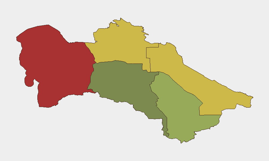
The Balkan Region (risk score 78) presents the highest sub-national threat profile, followed by Lebap (68) and Dashoguz (62) in the north and west. These three regions drive Turkmenistan's composite risk ranking and likely reflect a combination of factors: proximity to borders, limited state capacity for incident response, sparse international presence, and historical patterns of volatility. By contrast, Ashgabat City (risk 18) remains the lowest-risk zone, consistent with the capital's concentration of security services and international engagement. Corporate and duty-of-care teams with operations in the north or west should prioritize communications and contingency protocols for those areas.
How GeoBit Would Assist
Teams managing personnel or assets in Turkmenistan should deploy AOI (Area-of-Interest) Monitoring & Early Warning focused on Balkan, Lebap, and Dashoguz regions to detect emergent incidents in near-real time, paired with multi-language OSINT and X/Twitter/Telegram intelligence to compensate for sparse open media. Routing & Network Analysis can identify alternative travel corridors and safe zones within high-risk regions, while regime-stability and border-dispute search capabilities help identify structural shifts that might precede escalation. Regular Intel Sweeps across regional outlets and wires will flag any developments that break through the reporting gap.
7-Day Outlook
No significant changes to Turkmenistan's security posture are anticipated in the immediate seven days. Absent new triggering events (border incidents, political announcements, or economic shocks), the threat environment should remain consistent with the current low baseline. Monitoring intensity should remain steady, with heightened attention to the northern and western regions where risk scores are substantially elevated.
Highest-Risk Areas — Ranked
| # | State / Region | Risk |
|---|---|---|
| 1 | Balkan Region | 78 |
| 2 | Lebap Region | 68 |
| 3 | Dashoguz Region | 62 |
| 4 | Mary Region | 42 |
| 5 | Ahal Region | 35 |
| 6 | Ashgabat City | 18 |
Sources
Previous Daily Briefs
A new Turkmenistan brief is written every day — each with its own risk map and downloadable CSV. Here's the last week; use the calendar to go further back.
📅 Browse every day by calendar →
Highlighted days have a brief. Tap a day for that day's map & analysis, or “csv” for that day's dataset ($5).