Situation Summary
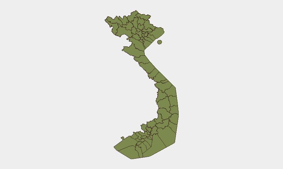
Vietnam remains a lower-tier global threat environment (rank #151, composite score 5) with 30 tracked security events. However, sub-national risk concentration is pronounced: Huế dominates the risk profile at 33.6, followed by Gia Lai Province (15.3) and Ho Chi Minh City (9.0), suggesting localized vulnerabilities rather than nationwide instability. Recent event signals (2–4 July) include mixed governance, business, and civil incidents; weather hazards in the East Sea may compound coastal and maritime exposure in the near term.
Key Developments
- Tropical depression, northern East Sea, 2 July: Vietnamese authorities issued warnings to coastal localities and maritime operators. A depression moving over the northern East Sea was assessed for potential strengthening into a tropical storm, prompting vessel accountability measures and tourist/resident advisories in island and coastal zones.
- Multi-incident security roundup, nationwide, 2 July: Vietnamese police reported several law-enforcement items including a weapons case in Quảng Trị Province, public-order detentions, and unlicensed product seizures in a national security-and-order news summary. Incident-level detail and precise dates beyond the roundup date remain unconfirmed in available reporting.
- Presidential and business public statements, 2 July: Multiple statements from presidential, business, and investor figures were issued; specific content and operational impact remain unclear from event signals alone and warrant follow-up.
- Governance demonstration/rally, 4 July: A governance-related public demonstration occurred; location and scale not yet detailed in available reporting.
- School physical assault, 2 July: A physical-assault incident was reported between school actors; specific location and injury status not confirmed in current reporting.
- Admin sanctions and investigation activity, 2 July: Vietnamese administrative and investigative actions were undertaken; scope and targets not yet clarified in available event data.
Highest-Risk Areas
Huế's disproportionate risk score (33.6) reflects a concentration of tracked incidents that substantially exceeds other major urban and provincial centers and warrants priority monitoring for corporate operations or personnel in the city. Gia Lai Province (15.3) and Ho Chi Minh City (9.0) occupy the second and third tiers; Gia Lai's elevation may reflect border-adjacent vulnerabilities or resource-sector activity, while Ho Chi Minh City's score reflects urban scale and density. The remaining ten provinces cluster at 3.6–6.3, suggesting a stable, fragmented risk baseline with limited inter-provincial contagion risk at present.
How GeoBit Would Assist
Teams with Vietnam exposure should deploy Area-of-Interest (AOI) Monitoring & Early Warning focused on Huế, Gia Lai, and Ho Chi Minh City to capture incident-level alerts before corporate exposure escalates. Intel Sweep and multi-language OSINT fusion (Vietnamese news, ANTV, local police reports, and Telegram channels) enable rapid event verification and detail extraction—critical for the current reporting gaps on school assaults, administrative actions, and governance rallies. Routing & Network Analysis and Maritime & Aviation tracking support contingency planning for personnel in coastal provinces given the active East Sea weather threat.
7-Day Outlook
The tropical-depression risk in the East Sea will likely persist or intensify through early July; corporate travel and supply-chain teams should monitor IMETS and Vietnamese port-authority advisories. Governance and civil unrest signals remain low-amplitude but warrant continued watch, particularly in Huế. Overall threat trajectory for Vietnam remains stable absent major political or economic shocks.
Highest-Risk Areas — Ranked
| # | State / Region | Risk |
|---|---|---|
| 1 | Huế | 33.6 |
| 2 | Gia Lai Province | 15.3 |
| 3 | Ho Chi Minh City | 9 |
| 4 | Trà Vinh Province | 6.3 |
| 5 | Ninh Bình Province | 5.4 |
| 6 | Ninh Thuận Province | 4.5 |
| 7 | Lai Châu Province | 3.6 |
| 8 | Lào Cai Province | 3.6 |
| 9 | Hà Giang Province | 3.6 |
| 10 | Tuyên Quang Province | 3.6 |
| 11 | Cao Bằng Province | 3.6 |
| 12 | Bắc Kạn Province | 3.6 |
Sources
Previous Daily Briefs
A new Vietnam brief is written every day — each with its own risk map and downloadable CSV. Here's the last week; use the calendar to go further back.
📅 Browse every day by calendar →
Highlighted days have a brief. Tap a day for that day's map & analysis, or “csv” for that day's dataset ($5).
Atlas — our AI intelligence desk — emails them this snapshot personally. Nothing else, no list.