Situation Summary
Zimbabwe remains a low-to-moderate security risk globally (rank #141, composite threat score 5.0) with 458 tracked threat events. No major new security incidents or unrest have been reliably documented in the last 24–48 hours via open sources; however, the concentration of risk in Harare and Midlands Province reflects ongoing political, economic, and administrative tensions. Duty-of-care teams should treat the absence of recent headline incidents as low acute risk, not zero risk—localised crime and civil friction remain persistent baseline concerns, particularly in the capital.
Key Developments
No widely confirmed security, crime, or civil-unrest incidents with verifiable timestamps in the last 24–48 hours (as of 13 July 2026) are currently visible in open reporting. Event signals tracked on 11–13 July include diplomatic public statements (British, Mozambique, and Zimbabwe statements; embassy messaging to Harare), a lawyer's public statement, and a conventional military force activity on 13 July, but none are linked to documented acute incidents or travel-affecting disruptions in specific locations. Corporate security teams should note that absence of reporting does not indicate absence of risk; cross-validation with embassy travel advisories, Zimbabwe Republic Police statements, and local media (The Herald, NewsDay, ZimLive) filtered by precise timestamps is recommended for operational decision-making.
Highest-Risk Areas
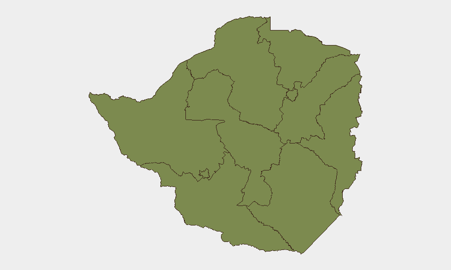
Harare (risk score 31.6) and Midlands Province (23.7) account for the overwhelming majority of tracked threat activity. Harare's elevated score reflects capital-city concentrations of political activity, administrative friction, civil unrest potential, and organised crime networks; the Midlands—Zimbabwe's industrial and agricultural heartland—shows secondary but significant risk, likely linked to labour, land, and resource-control tensions. All other provinces register composite scores of 1.6–3.2, indicating that risk is heavily spatialised rather than national. Personnel or assets in rural or peripheral regions face substantially lower threat profiles than those in or transiting through the capital or Midlands economic zones.
How GeoBit Would Assist
GeoBit's AOI Monitoring & Early Warning capability enables persistent, alert-triggered watch over Harare and Midlands hotspots, flagging emerging civil unrest or security incidents before mainstream reporting. Multi-language OSINT fusion (X/Twitter, Telegram, local news feeds) with temporal and sentiment analysis identifies early shifts in political rhetoric or civil tension. GIS & Spatial Analysis combined with election monitoring and regime-stability assessment tools provides forward warning of political friction points that may drive unrest or operational disruption, particularly relevant given Zimbabwe's 2027–2028 UNSC non-permanent seat bid and domestic political calendar.
7-Day Outlook
No acute security escalation is forecast for the next seven days based on current open reporting. Diplomatic activity and international positioning (UN cooperation pledges, regional statements) suggest a period of relative policy focus rather than internal crisis. However, underlying economic strain, xenophobic repatriation pressures from South Africa, and localised labour or resource disputes remain structural drivers; security teams should maintain baseline monitoring protocols and keep travel decisions flexible pending any fresh incident reporting or embassy alerts.
Highest-Risk Areas — Ranked
| # | State / Region | Risk |
|---|---|---|
| 1 | Harare | 31.6 |
| 2 | Midlands Province | 23.7 |
| 3 | Mashonaland East Province | 3.2 |
| 4 | Mashonaland West Province | 1.6 |
| 5 | Matabeleland South Province | 1.6 |
| 6 | Masvingo Province | 1.6 |
| 7 | Matabeleland North Province | 1.6 |
| 8 | Bulawayo Province | 1.6 |
| 9 | Mashonaland Central Province | 1.6 |
| 10 | Manicaland Province | 1.6 |
Sources
Previous Daily Briefs
A new Zimbabwe brief is written every day — each with its own risk map and downloadable CSV. Here's the last week; use the calendar to go further back.
📅 Browse every day by calendar →
Highlighted days have a brief. Tap a day for that day's map & analysis, or “csv” for that day's dataset ($5).
Atlas — our AI intelligence desk — emails them this snapshot personally. Nothing else, no list.