OpenGeoBit · Open to anyone

OpenGeoBit

Eleven GeoBit apps, open to anyone: Terrorism, Arms, Troops, the Aerospace Router, Country Risk, Supply Chain, Agriculture, Commodities, Health, Economy and Elections. Look around first. View only. Updated every month. Your name, email and phone open everything.

Look around firstView onlyUpdated every month
The eleven apps

Eleven apps our analysts use. Open to you.

Each one opens on its own address, straight away. Look around, search, filter and click into anything.

GeoBit TerrorismView only
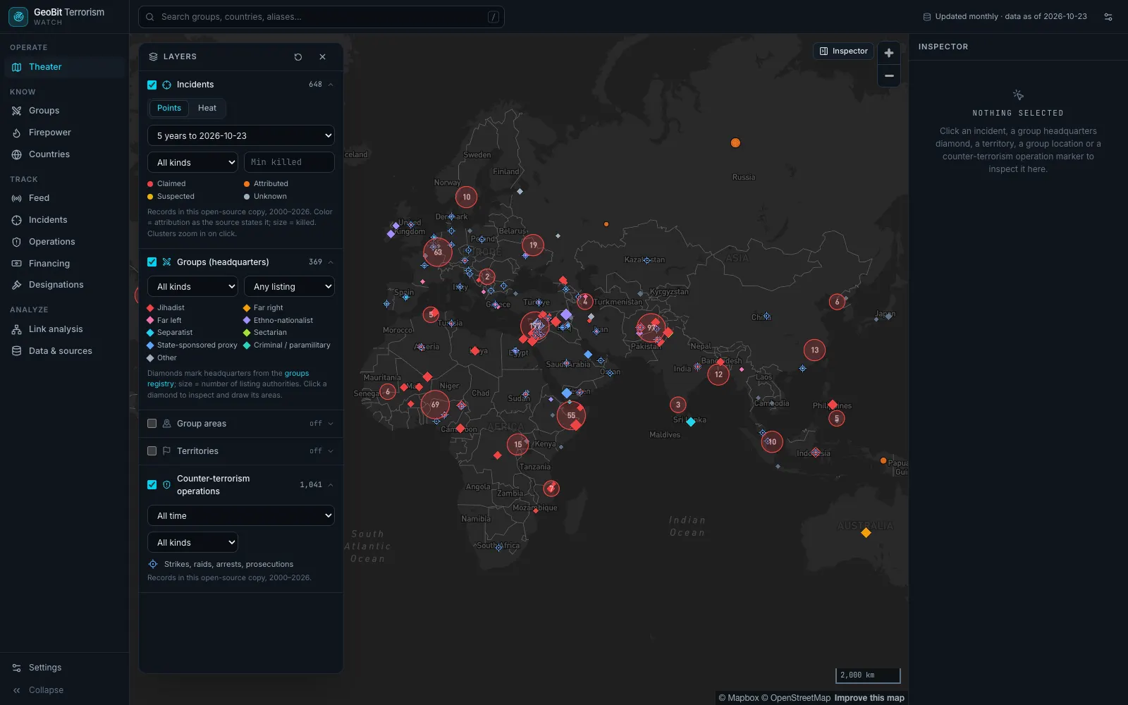
GeoBit Terrorism: the incidents map, with attacks, group headquarters and counter-terrorism operations across Europe, Africa and Asia
01 · GeoBit Terrorism

Attacks and the groups behind them, on one map.

What you can do
  • Filter attacks by country, group, kind and date, as points or as a heat map.
  • Click an attack for the date, the place, the target, the people killed and wounded, and the source.
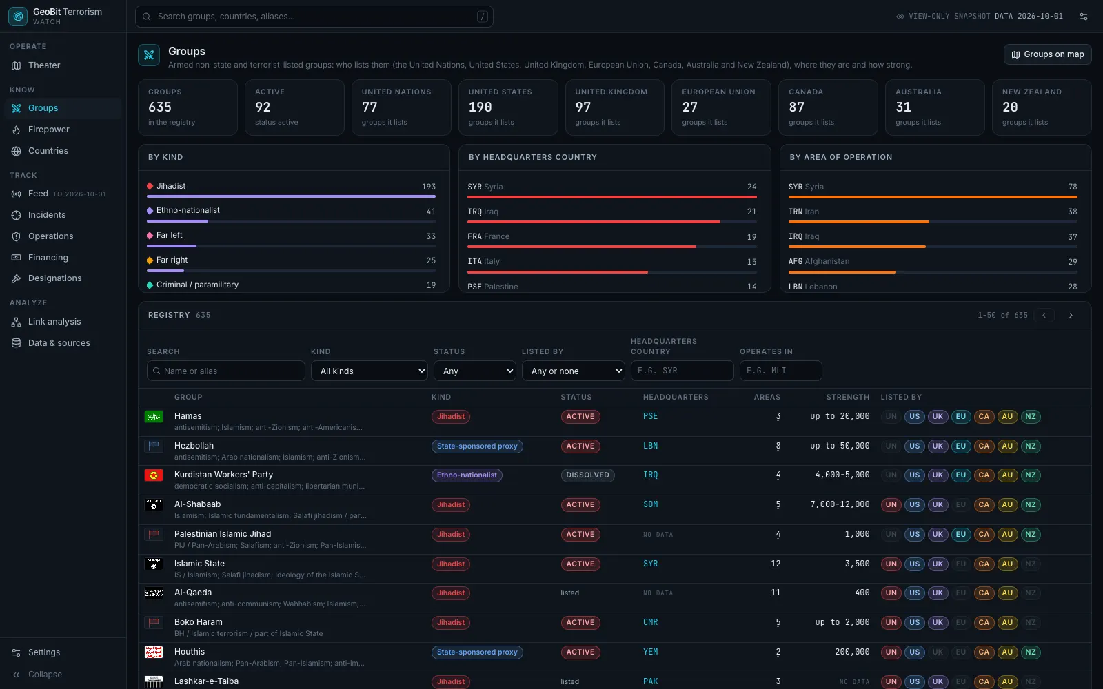
  • Open a group to see who lists it, where it operates and what it has done.
What is inside

Attacks reported around the world, each with its source and a confidence score, counter-terrorism operations, and a registry of armed groups and organizations, including those listed as terrorist by the United Nations, the United States, the United Kingdom, the European Union, Canada, Australia and New Zealand.

Open GeoBit Terrorism →terrorism.geobit.ai

Live data and alerts on your own areas come with a

GeoBit ArmsView only
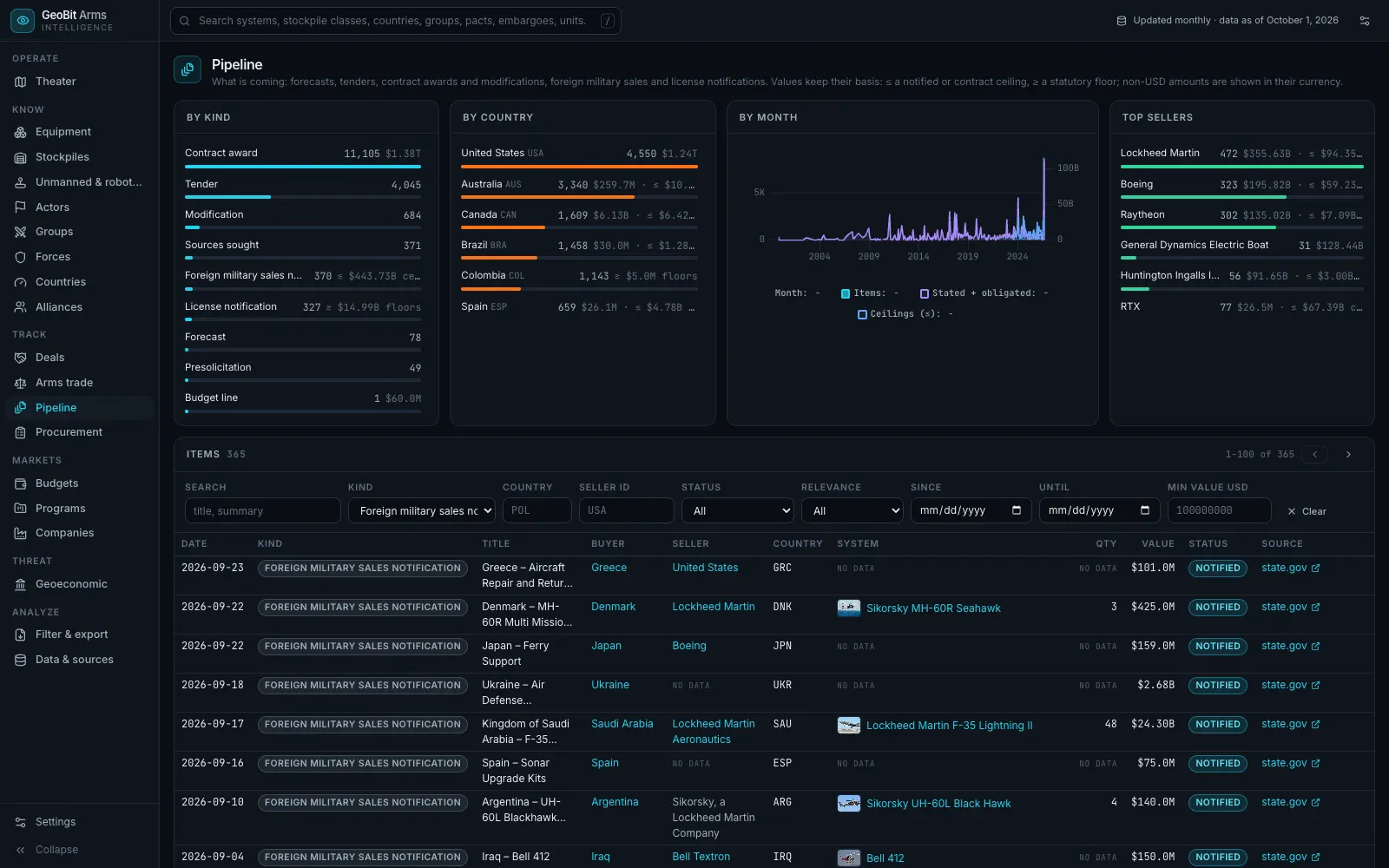
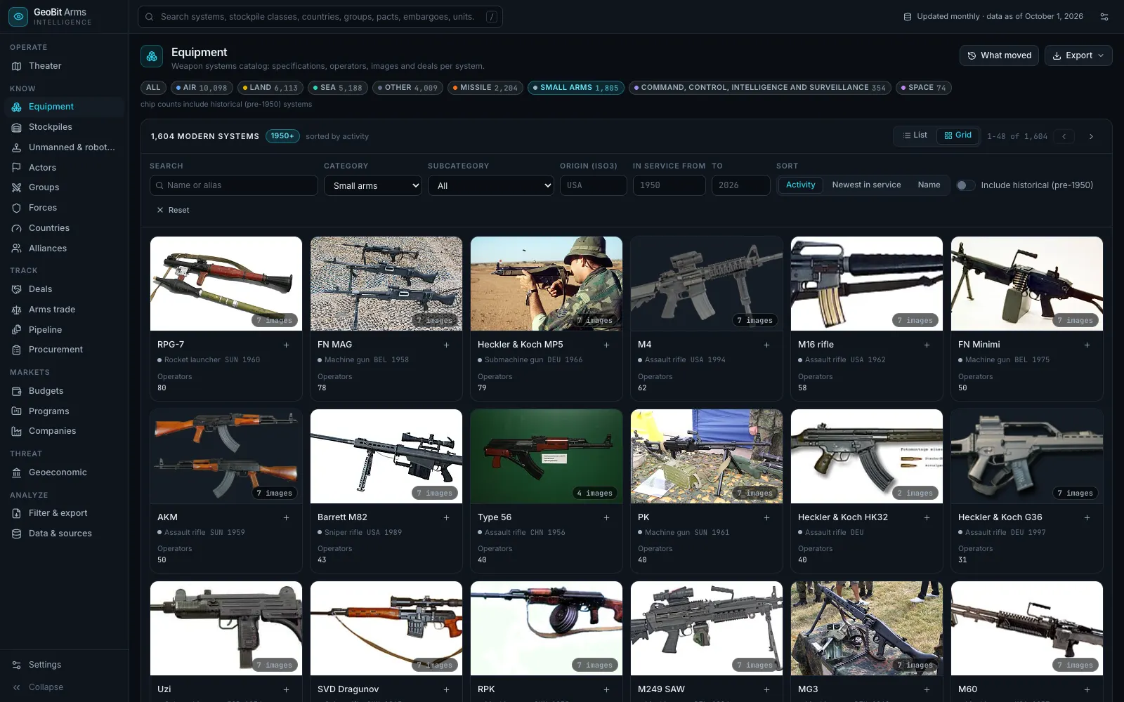
GeoBit Arms: the weapons catalog, showing small arms with their makers and the countries that use them
02 · GeoBit Arms

Weapons, who makes them and who buys them.

What you can do
  • Look up a weapon system: what it is, who makes it and which countries use it.
  • Filter the catalog by type, country of origin and years in service.
  • Browse the deals pipeline, including United States foreign military sales, by buyer, seller, date and value.
What is inside

A catalog of weapon systems across air, land, sea, missiles and small arms, with their makers and users, and a pipeline of deals: tenders, contract awards and the foreign military sales the United States government has announced, each with the buyer, the seller, the value and its source.

Open GeoBit Arms →arms.geobit.ai

Live data and alerts on your own areas come with a

GeoBit TroopsView only
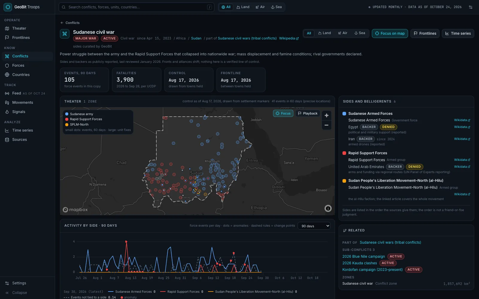
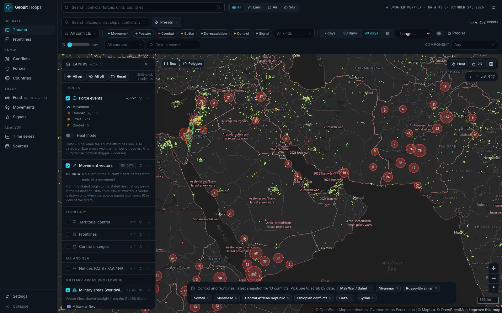
GeoBit Troops: the conflict map over the Middle East, with fighting reported in the last 90 days from Israel and Lebanon to Iran, Yemen and Pakistan
03 · GeoBit Troops

Where forces are and where the fighting is.

What you can do
  • See where fighting was reported, from the last week back to 1989.
  • Filter by kind: combat, strikes, movements, posture and more.
  • Open a conflict for its sides and their backers, or a country for its forces.
What is inside

Fighting and military activity from open conflict datasets and news reports, placed on the map, areas of control for the major conflicts, a profile for each conflict, and each country's forces: personnel, peacekeepers and forces abroad.

Open GeoBit Troops →troops.geobit.ai

Live data and alerts on your own areas come with a

GeoBit Aerospace RouterView only
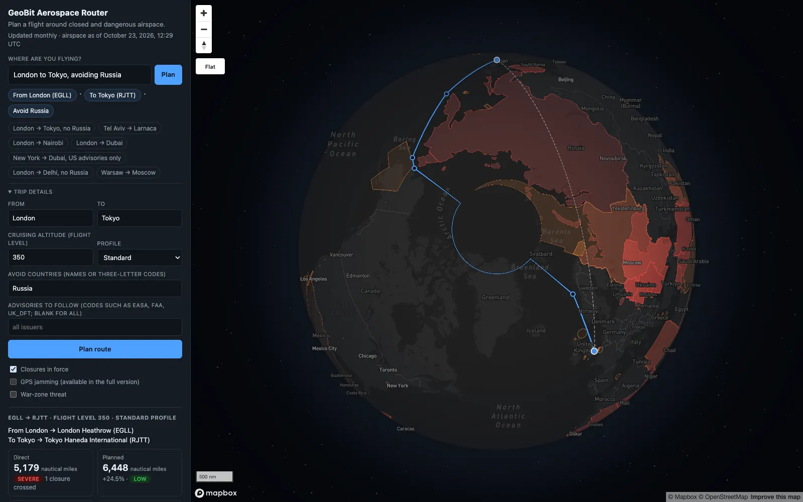
GeoBit Aerospace Router: a London to Tokyo flight planned around Russian airspace, with the direct route shown for comparison
04 · GeoBit Aerospace Router

Plan a flight around closed and dangerous airspace.

What you can do
  • Type a trip in plain words, like London to Tokyo avoiding Russia, or pick two airports and a cruising altitude.
  • See the extra distance against the direct route, and every country and flight region the route crosses.
  • Choose countries to avoid, and which authorities' warnings apply.
What is inside

Airspace prohibitions published by governments, conflict-zone bulletins, and volcanic ash and weather warnings, over every country and flight region. Reported jamming of navigation signals comes with the live version.

Live data and alerts on your own areas come with a

GeoBit Country RiskView only
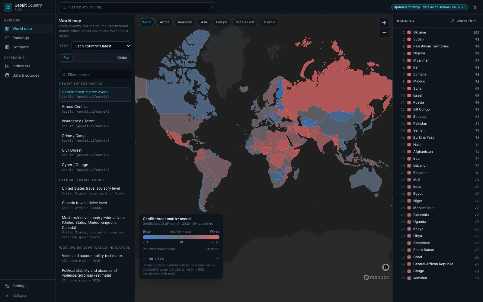
GeoBit Country Risk: the world map colored by the GeoBit threat matrix score, with every country ranked on the right
05 · GeoBit Country Risk

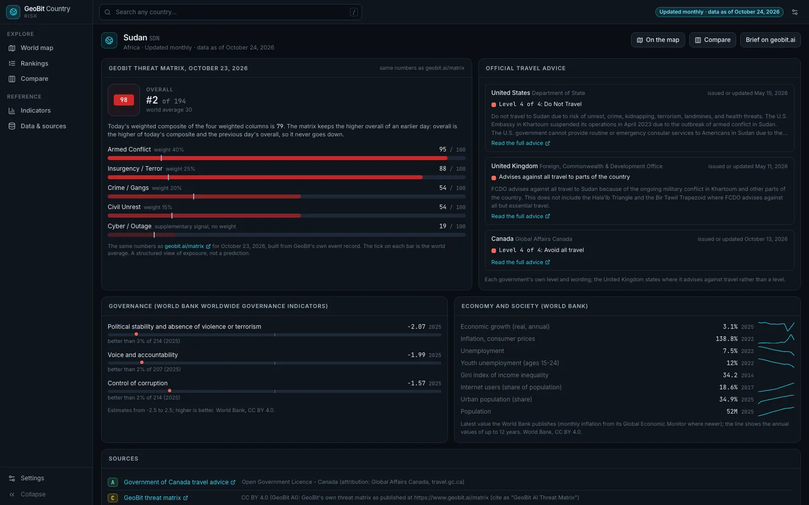
Every country scored, with official travel advice.

What you can do
  • Color the world map by the GeoBit threat score, a travel advice level or a World Bank series.
  • Rank every country, and open any one for its scores and official travel advice.
  • Compare countries side by side, and look up governance and economy indicators.
What is inside

Every country's score and rank from the GeoBit threat matrix (the same numbers as on this site), official travel advice from the United States, the United Kingdom and Canada, and World Bank governance and economy series.

Open GeoBit Country Risk →countryrisk.geobit.ai

Live data and alerts on your own areas come with a

GeoBit Supply ChainView only
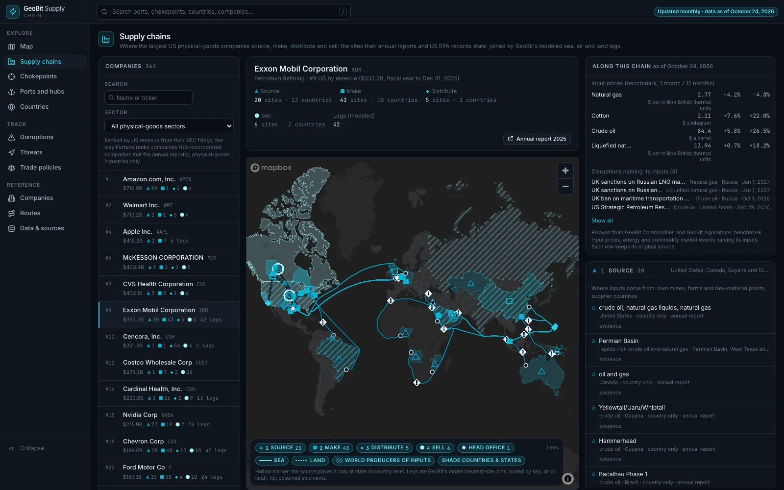
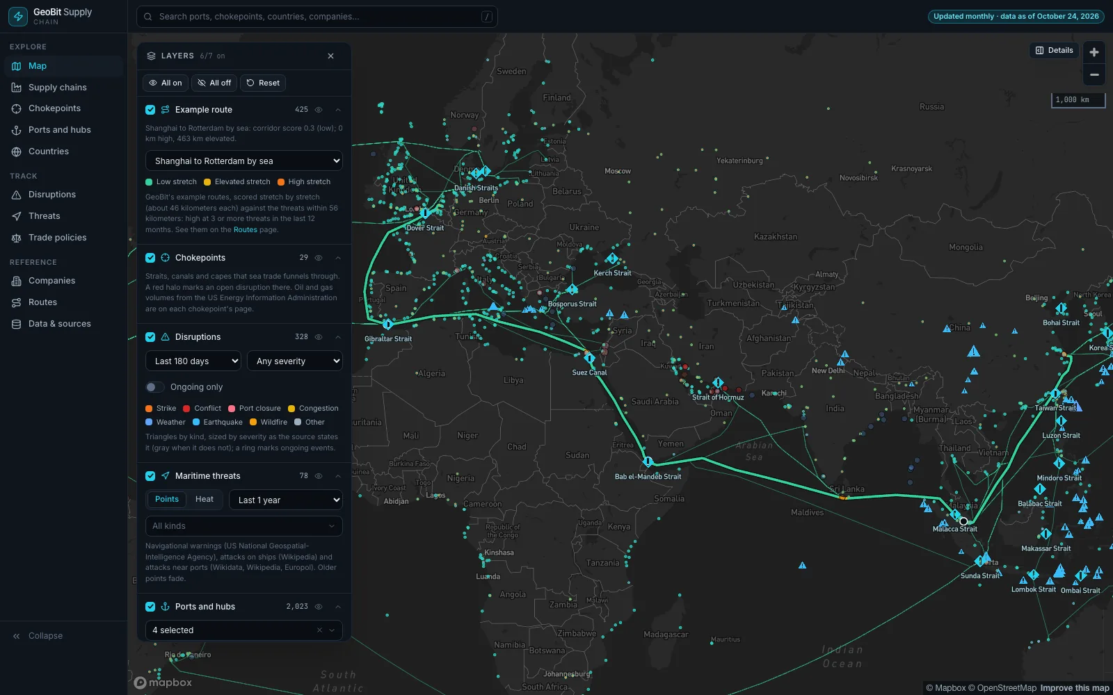
GeoBit Supply Chain: a map of ports, airports and terminals, the 29 maritime chokepoints and the sea lanes between major ports, with an example Shanghai to Rotterdam route scored stretch by stretch against recent disruptions and maritime threats
06 · GeoBit Supply Chain

Company supply chains and the chokepoints they cross.

What you can do
  • See where the largest US physical-goods companies source, make, distribute and sell, with the evidence from their annual reports.
  • Open any chokepoint, port, airport or country for its risk score, recent disruptions and threats, and US trade measures.
  • Follow example sea routes and the lanes between major ports, scored stretch by stretch against the threats and chokepoints along them.
What is inside

Company annual reports filed with the US Securities and Exchange Commission, government port and airport registers and OpenStreetMap, oil and gas volumes through the chokepoints from the US Energy Information Administration, natural-hazard alerts, US trade measures and World Bank indicators, with GeoBit's own routing and risk scores.

Live data and alerts on your own areas come with a

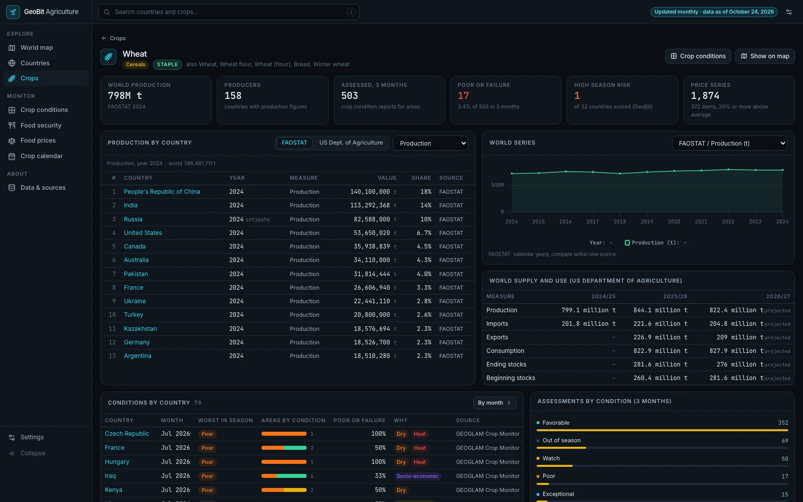
GeoBit AgricultureView only
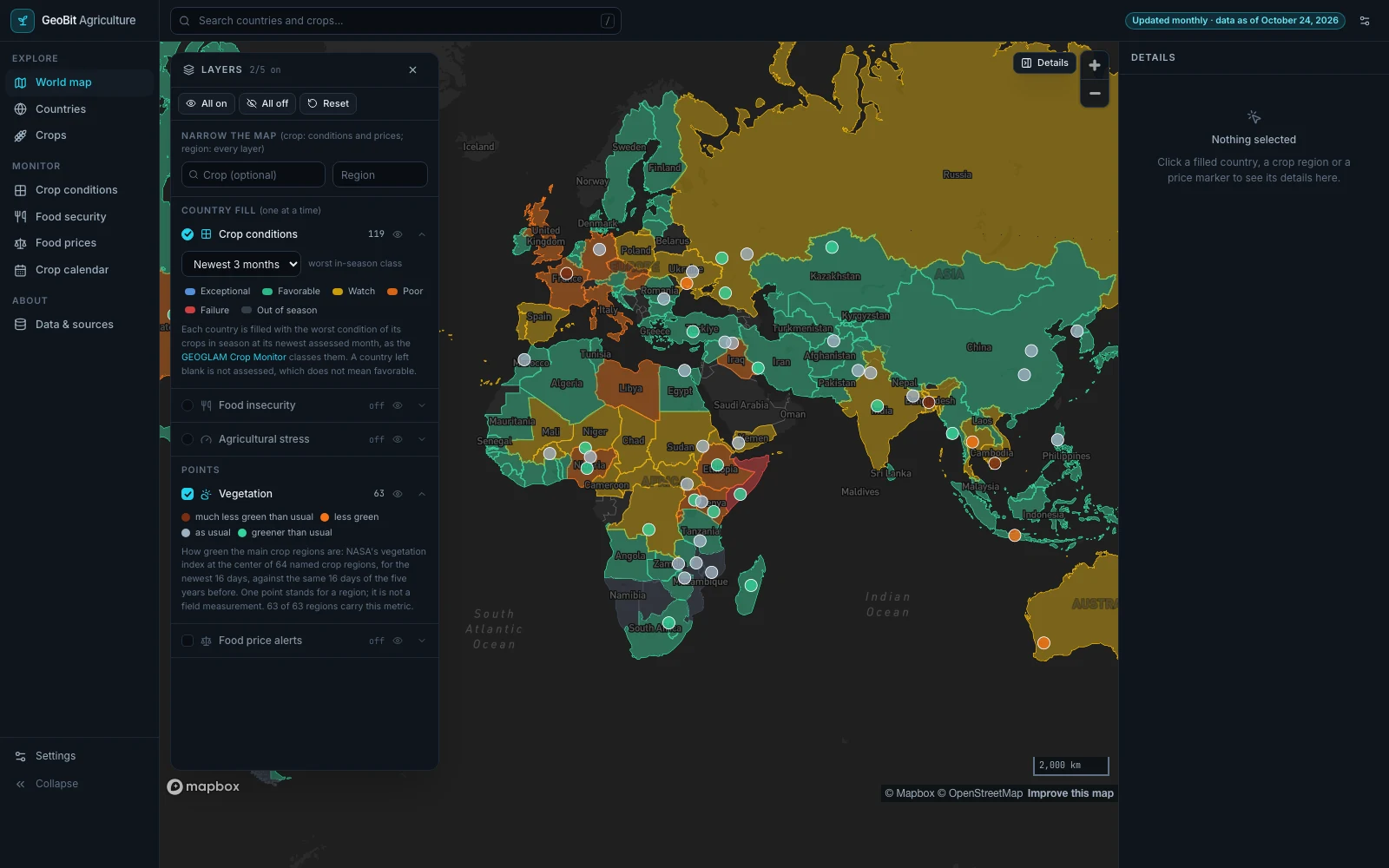
GeoBit Agriculture: the world map of crop conditions by country, with NASA's vegetation index at 63 crop regions
07 · GeoBit Agriculture

Crop conditions, hunger and food prices worldwide.

What you can do
  • See where crops are in poor condition, country by country and month by month, and why.
  • Compare countries on food insecurity, food price alerts and GeoBit's agricultural stress score.
  • Look up production, stocks, trade, and planting and harvest months for 46 crops.
What is inside

Satellite crop monitoring, food insecurity analyses, market food prices, production and supply statistics, and development indicators from the GEOGLAM Crop Monitor, NASA, the Integrated Food Security Phase Classification, the World Food Programme, FAOSTAT, the US Department of Agriculture and the World Bank.

Open GeoBit Agriculture →agriculture.geobit.ai

Live data and alerts on your own areas come with a

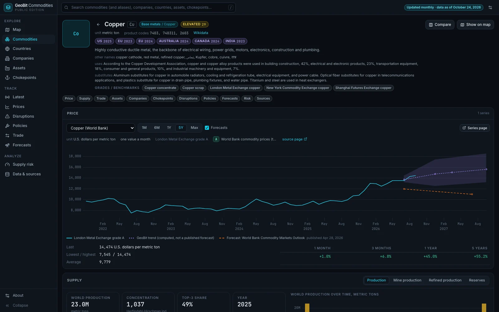
GeoBit CommoditiesView only
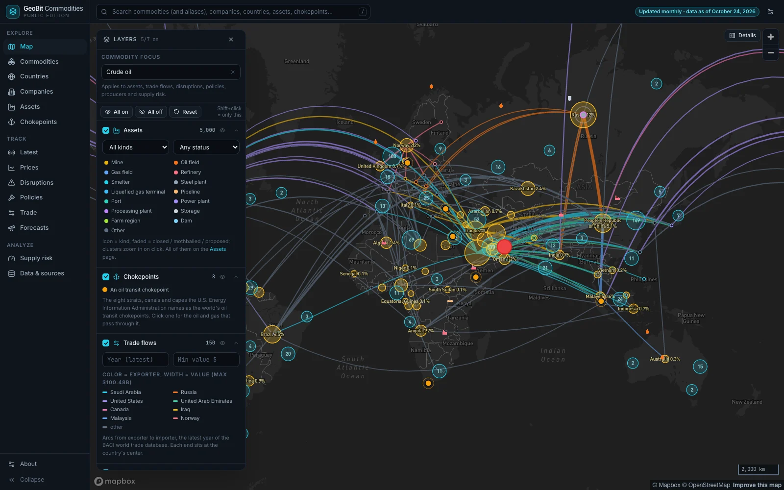
GeoBit Commodities: a world map of crude oil, with producing countries sized by their share of output, export arcs from the latest world trade data, oil fields and refineries, and the eight oil transit chokepoints
08 · GeoBit Commodities

Prices, producers, trade and supply risk, worldwide.

What you can do
  • See where a commodity is mined, refined, traded and shipped, on one map.
  • Compare benchmark prices with the forecasts the World Bank and US agencies publish.
  • Check each commodity's supply risk, and which countries depend on imports of it.
What is inside

World Bank and US government prices, statistics and outlooks, United Nations farm statistics, an open world trade database, official trade measures and sanctions lists, and open map data on mines, plants, ports and oil fields.

Open GeoBit Commodities →commodities.geobit.ai

Live data and alerts on your own areas come with a

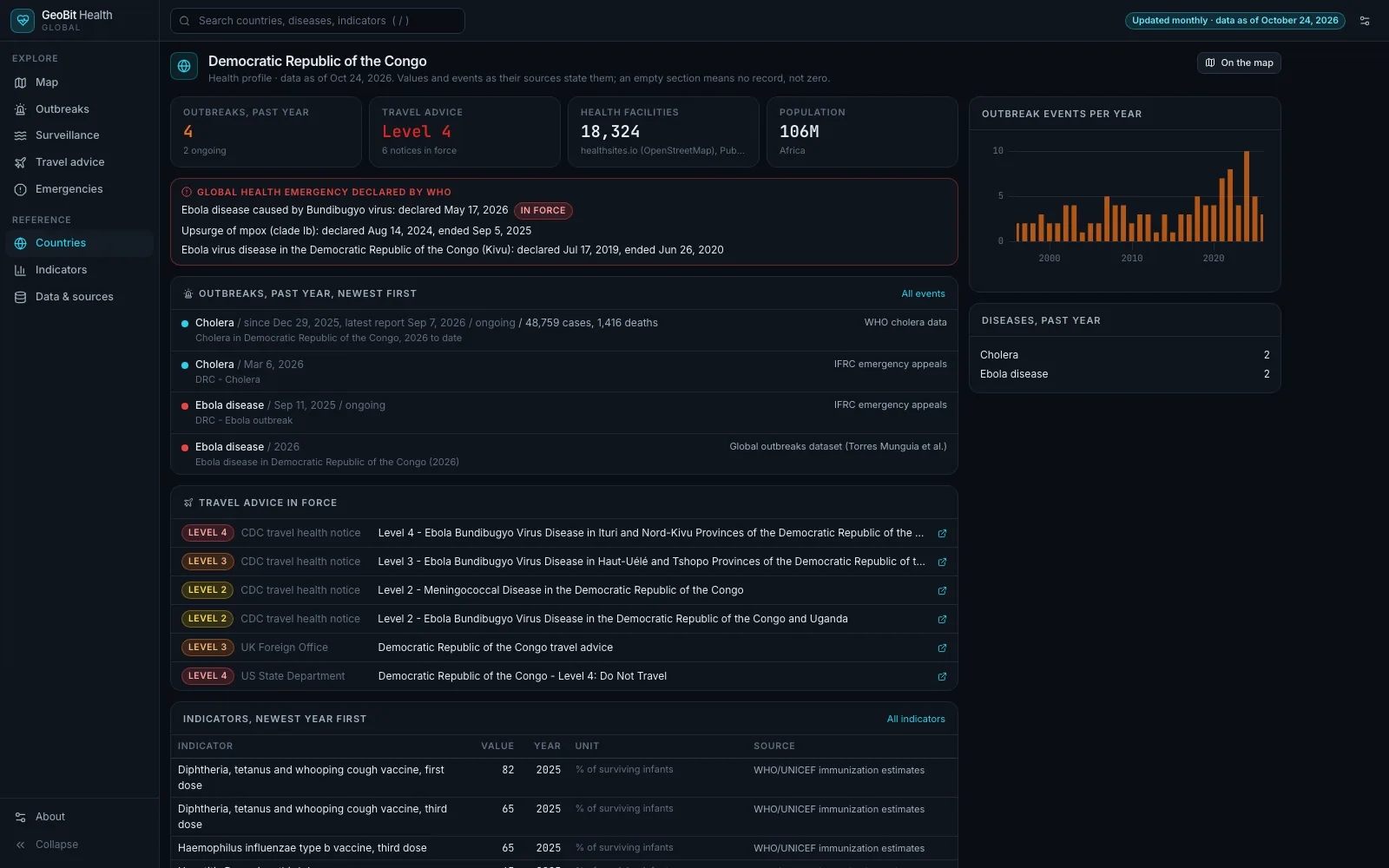
GeoBit HealthView only
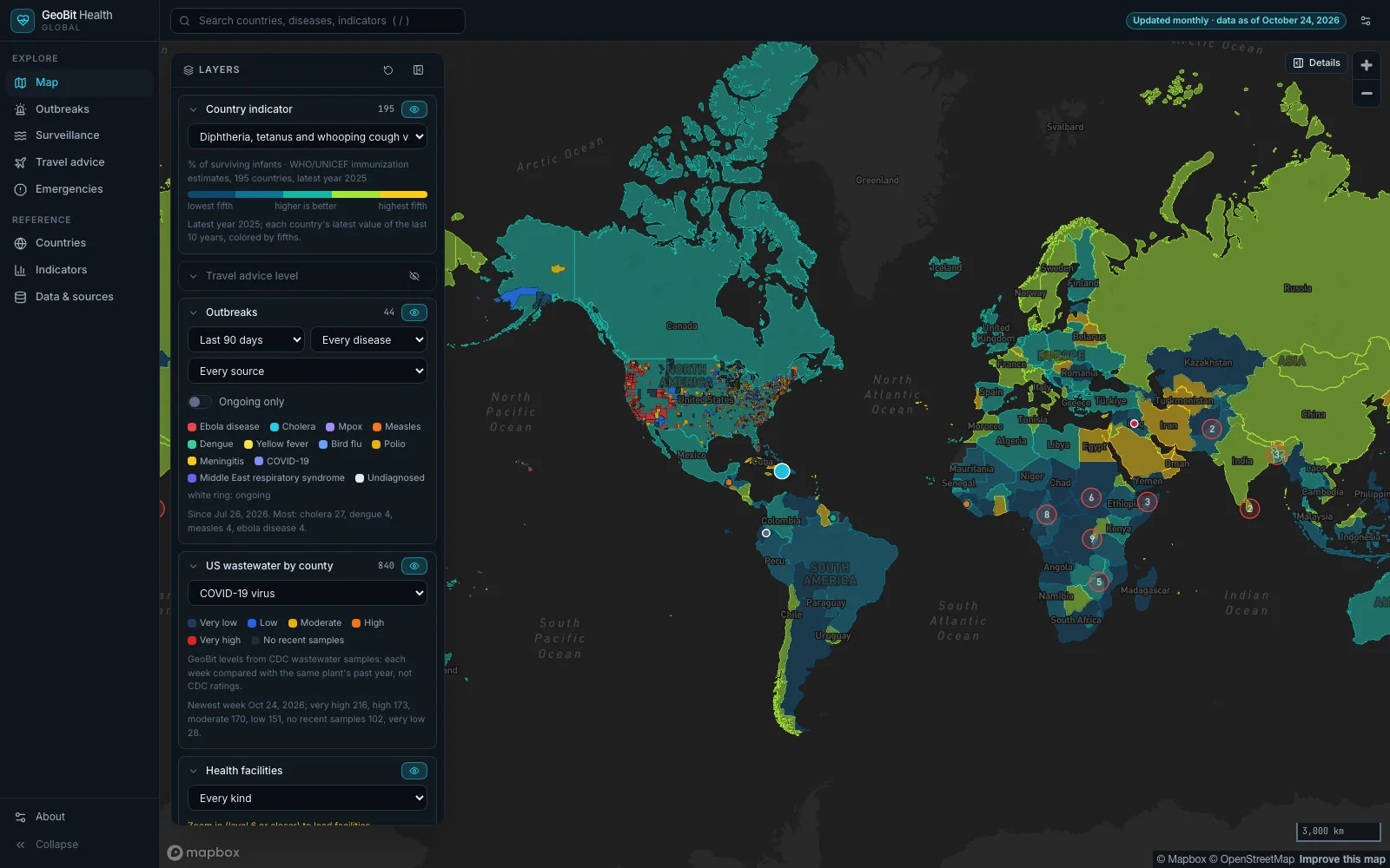
GeoBit Health: a world map colored by 2025 vaccination coverage, with outbreaks of the last 90 days and US wastewater levels by county
09 · GeoBit Health

Outbreaks, surveillance and health risk, newest first.

What you can do
  • See outbreaks reported in the last 90 days, newest first, with cases and deaths as each source states them.
  • Follow the newest weeks of surveillance: US wastewater by county, hospital admissions, and flu-like illness in the US and Europe.
  • Open any country's health profile: official US and UK travel advice, vaccination coverage and health indicators, each with its year.
What is inside

Openly licensed data from the US Centers for Disease Control and Prevention, the World Health Organization, the World Bank, UNICEF, the Red Cross and Red Crescent, the European Centre for Disease Prevention and Control, the US State Department, the UK Foreign Office, Our World in Data and OpenStreetMap health facilities.

Open GeoBit Health →health.geobit.ai

Live data and alerts on your own areas come with a

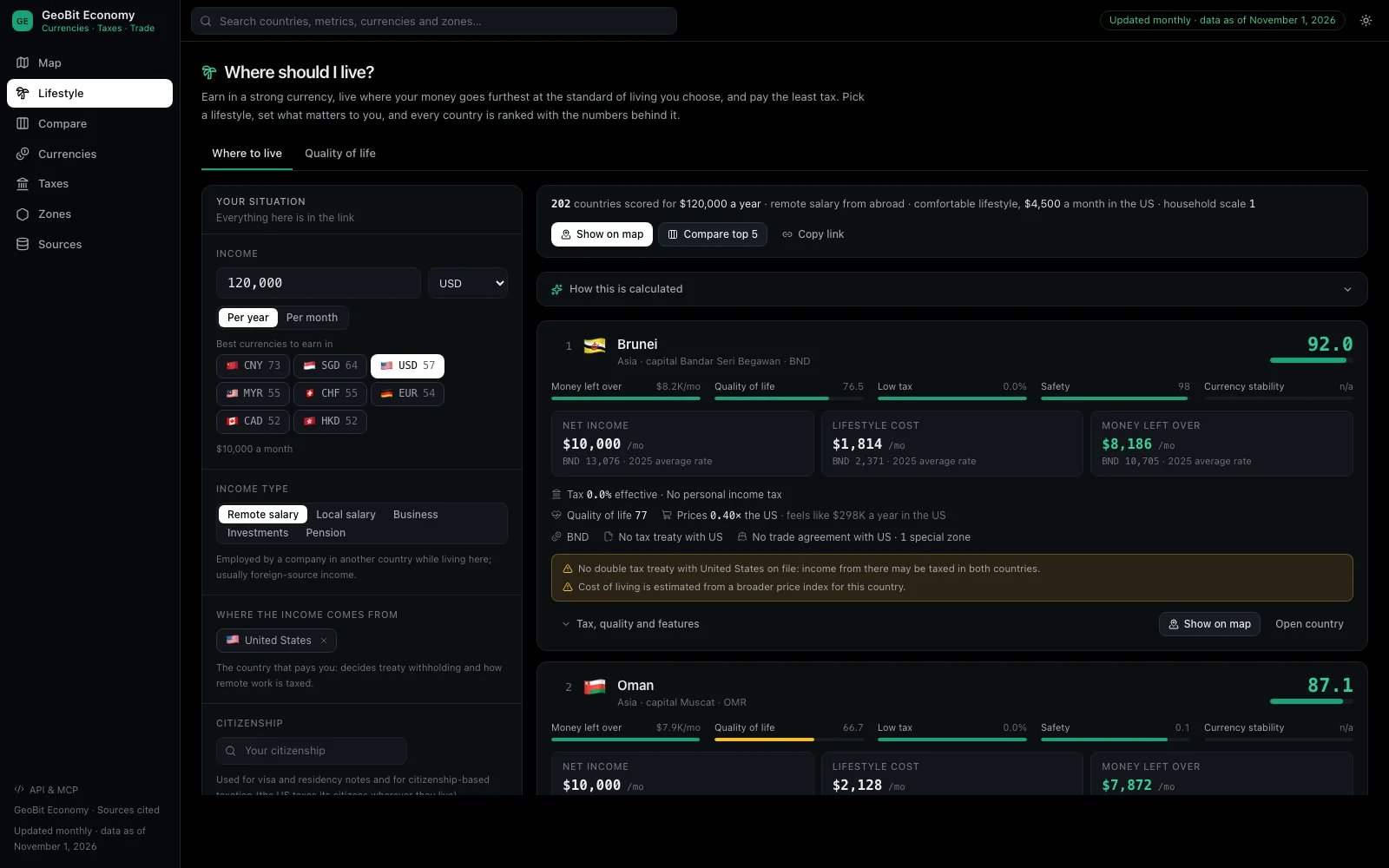
GeoBit EconomyView only
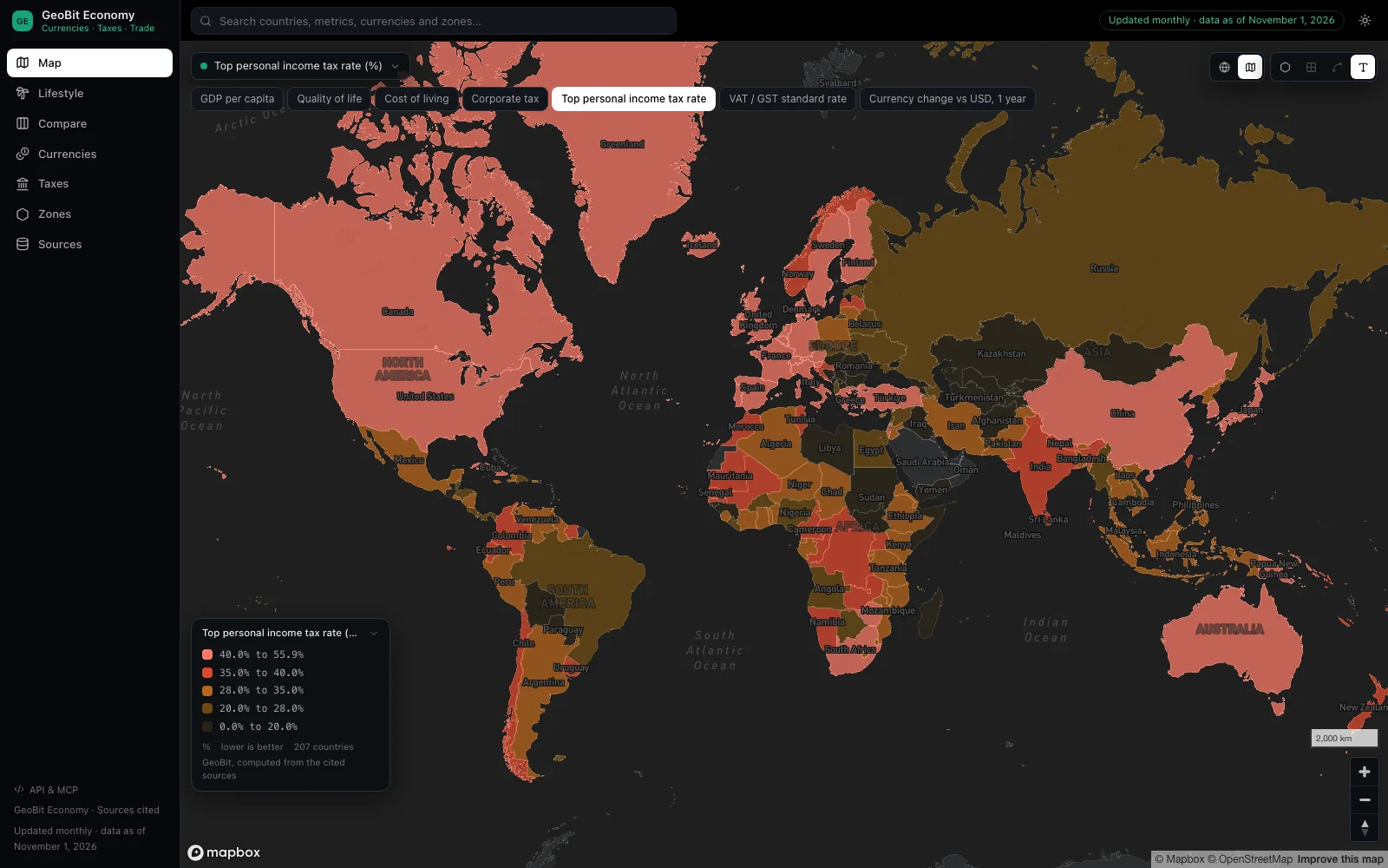
GeoBit Economy: a world map colored by each country's top personal income tax rate, with the metric picker and its legend
010 · GeoBit Economy

Every country's taxes, currencies and economy.

What you can do
  • Compare up to ten countries on taxes, prices, growth and governance, side by side.
  • See what an income is worth after tax and living costs in every country, and where it goes furthest.
  • Look up tax rates, treaties, special economic zones and exchange rates, each with its source.
What is inside

World Bank and OECD statistics, European Central Bank exchange rates, United Nations population data and GeoBit's tax research compiled from official government sources.

Live data and alerts on your own areas come with a

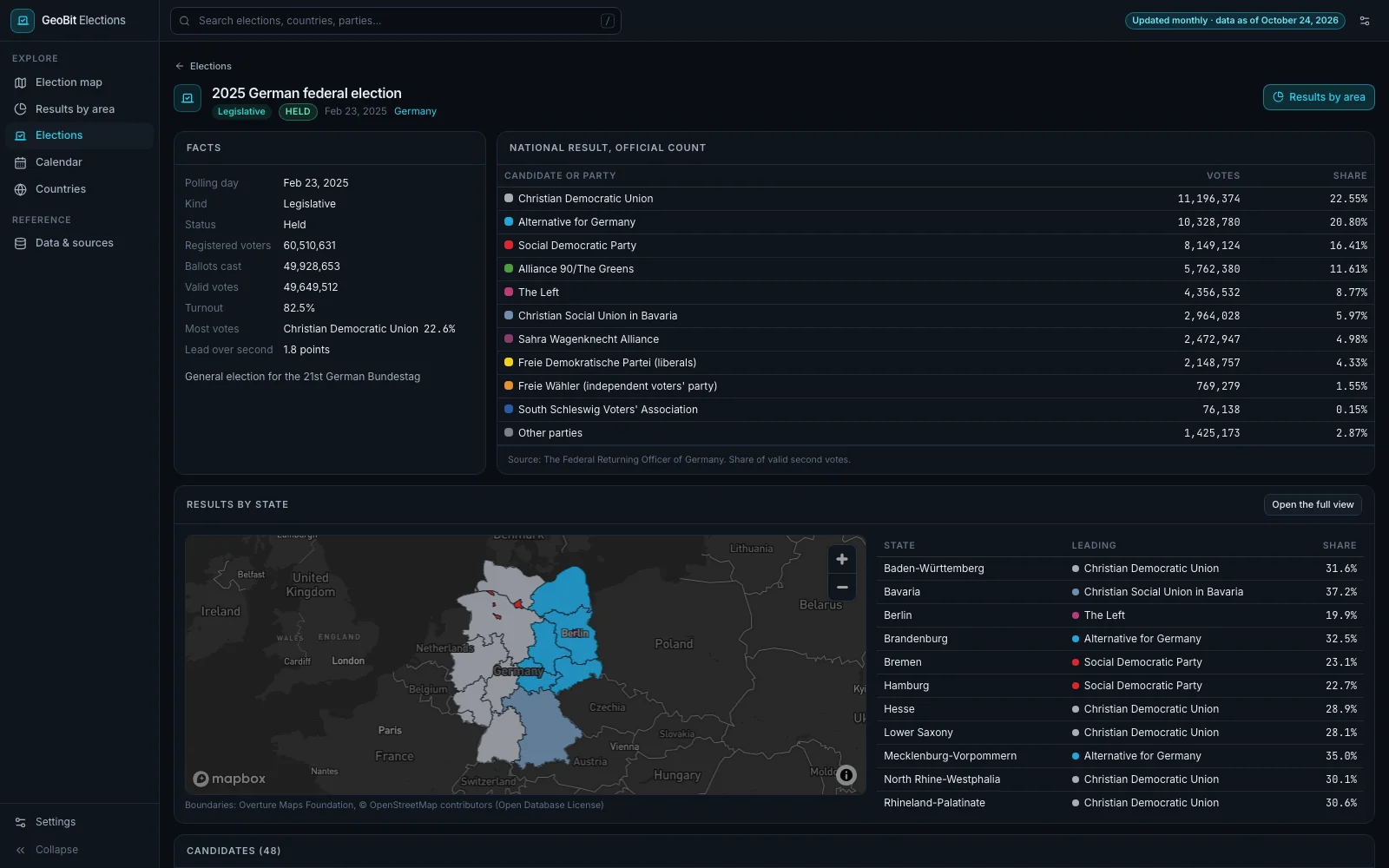
GeoBit ElectionsView only
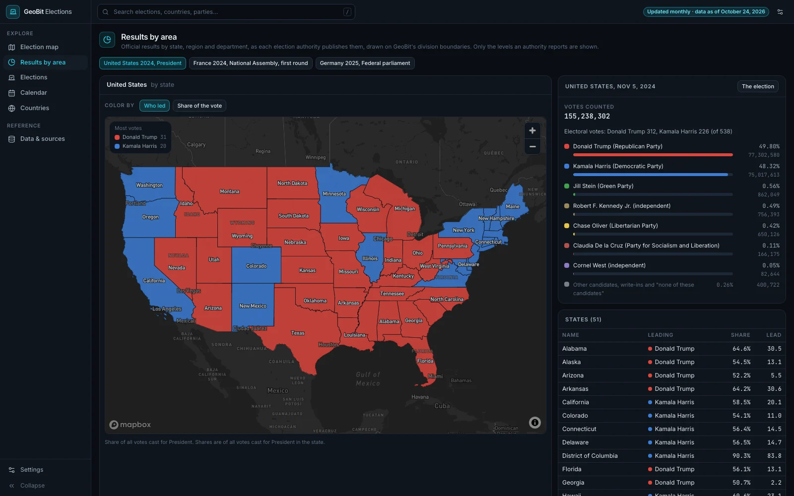
GeoBit Elections: the 2024 United States presidential election by state, each state colored by the candidate who led it, beside the national count and a table of every state's share and lead
011 · GeoBit Elections

Elections worldwide, with official results by area.

What you can do
  • See every national election and referendum on a world map, for the months ahead or the year behind.
  • Open official results by state, region and department for the United States, Germany and France, and go from a French region down to its departments.
  • Look up any country's next and last election, its past contests, and its economy and governance figures.
What is inside

Open election records from Wikidata, official counts from the election authorities of the United States, Germany and France, and World Bank economic and governance indicators.

Open GeoBit Elections →elections.geobit.ai

Live data and alerts on your own areas come with a

How it works

Open it. Look around.

01Look around firstOpen the address and the app is there, with nothing to install. After a few pages, your name, email and phone open everything.
02View onlyLook, search, filter and click into anything. Answers to your own questions come with an account.
03Updated every monthEach app shows a snapshot of its data, refreshed once a month.
04Live with an accountLive data, alerts on your own areas and answers to your questions come with a GeoBit account.
Go further

Want it live, on your own areas?

The open apps show a monthly snapshot. Here are three ways to get more.

01 · Your own accountStart here

Get a GeoBit account

The full GeoBit, live, on your own areas.

  • Live data, not a monthly snapshot
  • Alerts on the areas you draw
  • Answers to your questions, on the map
02 · Your own systems

Use the data in your own systems

The GeoBit API: events, area alerts and risk as JSON and GeoJSON, with a source on every record. Access is by waitlist.

Join the API waitlist →
03 · Our team

Have us run it for you

Our team watches the places that matter to you and sends you the output: alerts, briefs and maps.

Talk to us →
04 · Built for you

Have us build your intelligence system

Development engagements and full build-outs: our forward-deployed engineers build your intelligence system with your team, on GeoBit, around your data, your areas and your questions.

Forward-deployed engineers →

Have us run it, or build it with you.

Tell us what you want watched, or the intelligence system you want built. Someone from GeoBit will be in touch soon.

Questions

Short answers.

Do I need an account?
Not to look around. Open any app and start. After a few pages we ask for your name, email and phone, and your GeoBit account opens everything: every app, every map and profile, the full history, and one sign-in for all of GeoBit.
How fresh is the data?
Each app shows a snapshot of its data, refreshed once a month. For live data, alerts on your own areas and answers to your questions, get a GeoBit account.
Can I use it in my own systems?
The open apps are for viewing. To bring GeoBit data into your own systems, join the waitlist for the GeoBit API: events, area alerts and risk as JSON and GeoJSON, with a source on every record.
Can I get it for my own areas?
Yes. A GeoBit account gives you live data and alerts on the areas you draw. Or our team can watch your areas for you and send you the output: talk to us.
EnglishEspañolPortuguêsFrançaisالعربيةעברית日本語