Situation Summary
Algeria remains a low-threat environment globally (composite score 15), with no active armed conflict or mass-casualty terrorism reported. The country's security posture is stable, though concentrated risk exists in the capital region. A sustained pattern of wildfires across northern provinces over the past week has created secondary infrastructure and environmental pressures, but poses no direct political or conflict escalation at present.
Key Developments
GeoBit's live research over the last 24–48 hours has not identified verifiable, newly-dated security incidents, civil unrest, terrorism, or infrastructure attacks specific to Algeria within this window. Open sources contain:
- Diplomatic tension signals flagged 2026-07-28 regarding Western Sahara (two "Disapprove" events involving Algeria), consistent with long-standing territorial/recognition disputes but without new operational context in the last 48 hours.
- Public statement from Algeria recorded 2026-07-27, content not yet detailed in available summaries.
Background context (outside 24–48h window but operationally relevant): Wildfires across northern provinces—reported peaked around 24 July—have involved 23+ active fires, damage to electrical infrastructure, and civil protection operations in provinces including Guelma, Tizi Ouzou, and Boumerdes. Arson-related arrests have been reported over the past week in connection with fire incidents. A Sonatrach refinery incident at Arzew (Oran) occurred 9 July. These do not represent current 24–48h developments but reflect recent operational stressors.
Highest-Risk Areas
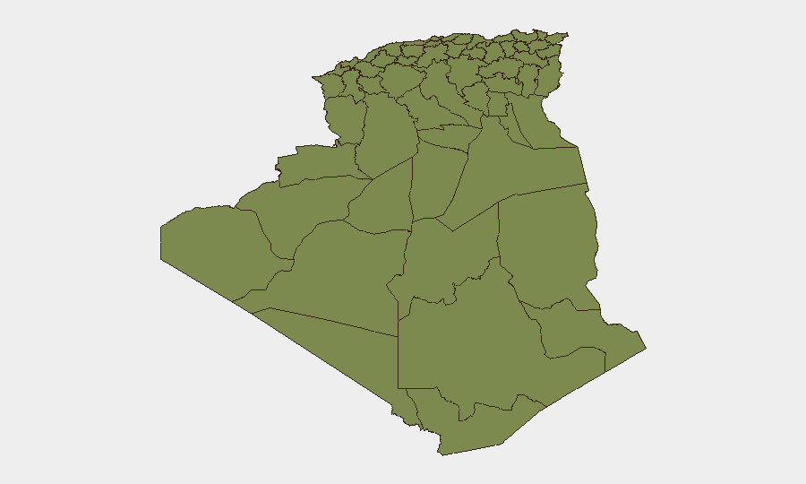
Algiers dominates the sub-national risk profile with a composite score of 31.3—approximately 24× higher than any other province. This reflects the capital's concentration of critical infrastructure, diplomatic presence, and population density, making it the primary area of concern for duty-of-care teams. All other provinces rank uniformly at 1.3, indicating risk in Algiers is geographically isolated rather than systemic. Corporate and diplomatic personnel in the capital should maintain heightened situational awareness and routine security protocols; operations in secondary cities and remote regions face minimal tracked threat.
How GeoBit Would Assist
Intel Sweep and multi-language OSINT would provide early warning of political tensions, infrastructure incidents, or cross-border activity affecting Algeria's stability. AOI Monitoring & Early Warning on Algiers, key infrastructure nodes (refineries, ports, power plants), and border regions would enable persistent watch and alert thresholds before incidents escalate. GIS & Spatial Analysis combined with Satellite & Imagery would track wildfire progression, infrastructure damage, and civil protection resource deployment to inform evacuation and supply-chain continuity decisions. Network & Actor Analysis would monitor diplomatic actors and regional state behavior tied to the Western Sahara dispute for any shift toward operational confrontation.
7-Day Outlook
Wildfire activity is expected to moderate as July transitions to August, reducing secondary infrastructure risk, though heat stress and drought conditions may persist in central and southern provinces. Western Sahara diplomatic signals should be monitored for escalation, but current posture suggests low probability of direct Algeria-involving kinetic activity in the near term. Overall security trajectory remains stable with localized environmental and diplomatic friction rather than acute threat.
Highest-Risk Areas — Ranked
| # | State / Region | Risk |
|---|---|---|
| 1 | Algiers | 31.3 |
| 2 | Bechar | 1.3 |
| 3 | Beni Abbes | 1.3 |
| 4 | Adrar | 1.3 |
| 5 | Bordj Badji Mokhtar | 1.3 |
| 6 | El Bayadh | 1.3 |
| 7 | Ghardaia | 1.3 |
| 8 | Saïda | 1.3 |
| 9 | Boumerdes | 1.3 |
| 10 | Tizi Ouzou | 1.3 |
| 11 | Chlef | 1.3 |
| 12 | Relizane | 1.3 |
Sources
Previous Daily Briefs
A new Algeria brief is written every day — each with its own risk map and downloadable CSV. Here's the last week; use the calendar to go further back.
📅 Browse every day by calendar →
Highlighted days have a brief. Tap a day for that day's map & analysis, or “csv” for that day's dataset ($5).
Atlas — our AI intelligence desk — emails them this snapshot personally. Nothing else, no list.